Real estate development due diligence remains one of the most data-intensive phases of the investment lifecycle. CBRE’s 2025 market outlook projects commercial real estate investment activity reaching $437 billion globally, yet site analysis workflows in many European markets still depend on fragmented public data sources, manual GIS assembly, and disconnected municipal databases that extend pre-development timelines by weeks or months. JLL’s European research estimates that developers spend 15 to 25 percent of pre-acquisition costs on environmental, zoning, and site feasibility studies that could be compressed through integrated spatial analytics. In Nordic markets specifically, the combination of strict environmental regulations, complex municipal planning processes, and detailed cadastral record systems creates an environment where technology that unifies spatial data into a single analysis layer delivers measurable competitive advantage for development firms evaluating land parcels and project feasibility.
Placepoint is a Norwegian proptech company based in Sandefjord that provides next-generation spatial analysis software for real estate professionals. The platform combines cadastral information, company registry data, municipal case records, environmental overlays (soil conditions, noise levels, daylight measurements), demographic statistics, price analytics, and 3D mapping of the entire Norwegian landscape into a unified analysis environment. Placepoint’s Property Relationship Management (PRM) system adds collaborative project management capabilities, enabling development teams to build shared data environments around specific parcels and projects. The company has demonstrated AI capabilities through a text-to-3D building generation tool developed at an Autodesk Forma hackathon, signaling an innovation trajectory that extends beyond traditional GIS analysis into generative design.
BestCRE assigns Placepoint a 9AI Score of 62/100, reflecting genuine innovation in spatial intelligence and strong CRE relevance for Norwegian development workflows, balanced by geographic limitations to a single country, absence of published pricing, limited market visibility outside Scandinavia, and minimal integration with international CRE software platforms.
This review is part of BestCRE’s systematic coverage of commercial real estate AI tools across 20 CRE sectors. For the full AI tools directory, see our Best CRE AI Tools hub.
What Placepoint Does and How It Works
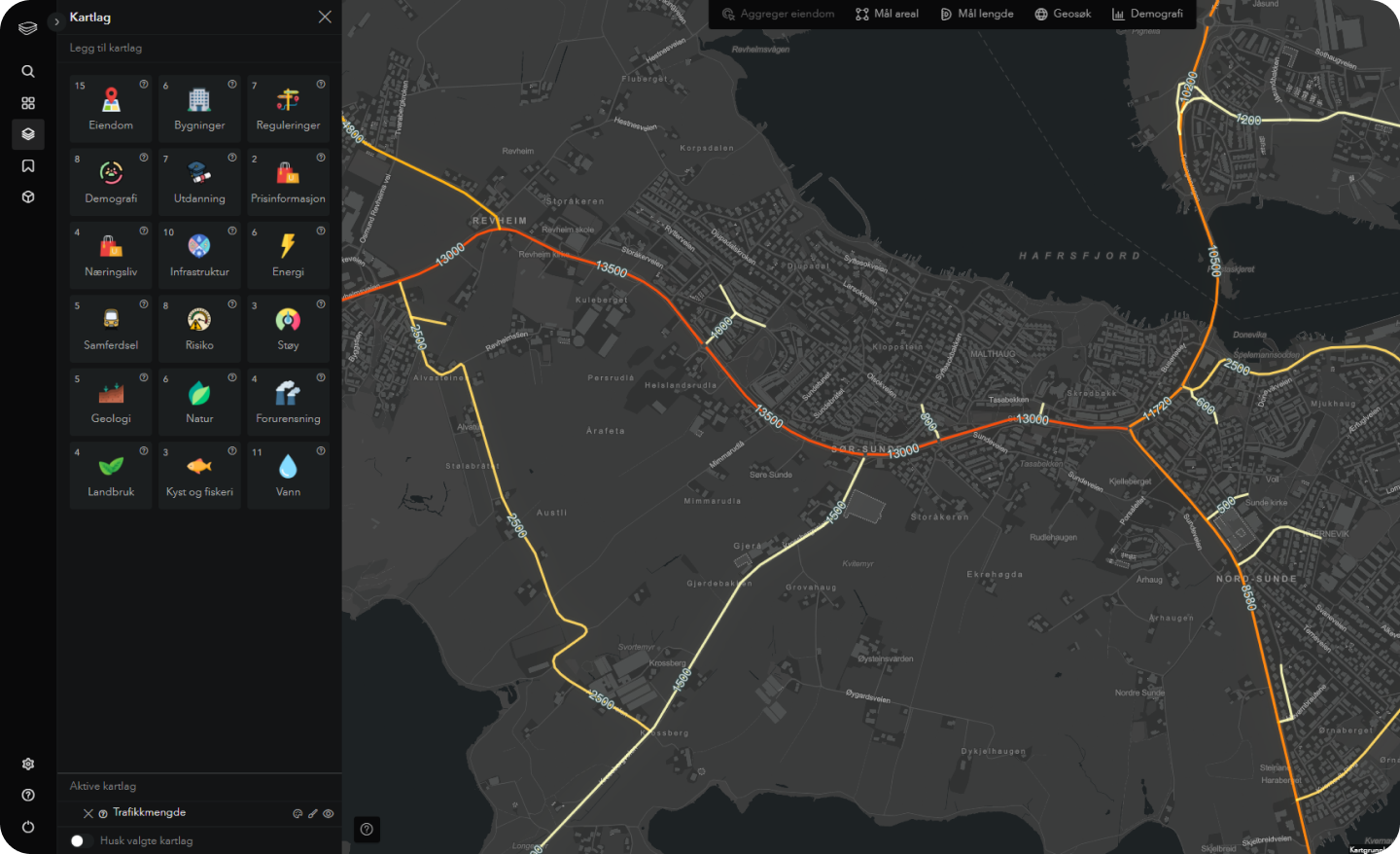
Placepoint operates as a comprehensive spatial intelligence platform that aggregates Norway’s public real estate data infrastructure into a single analysis interface designed for development feasibility, site selection, and investment screening. The platform ingests cadastral records from the Norwegian Mapping Authority, ownership and corporate structure data from the Bronnoysund Register Centre, municipal planning documents and case histories, environmental datasets covering soil composition, flood risk zones, noise contours, and agricultural land classifications, along with demographic and socioeconomic statistics at the district level. Users access this data through an interactive map interface that supports layered analysis, enabling a developer to evaluate a specific parcel against dozens of relevant data dimensions simultaneously.
The 3D mapping capability covers all of Norway, allowing users to visualize existing building stock, terrain elevation, and surrounding context in three dimensions. Daylight analysis tools calculate solar exposure for proposed developments, which is particularly relevant in Norwegian markets where sunlight hours vary dramatically by season and latitude. Travel time analysis measures accessibility across multiple transportation modes, helping developers and investors assess connectivity to employment centers, schools, and commercial amenities. The municipal case insight system tracks planning applications, zoning decisions, and regulatory activity at the parcel level, providing early intelligence on regulatory trajectories that affect development potential.
The Property Relationship Management (PRM) module extends Placepoint beyond pure analytics into collaborative project management. Development teams can create shared workspaces around specific land parcels, aggregating research, regulatory documents, financial models, and stakeholder communications in a single environment. This collaborative layer addresses the reality that Norwegian development projects typically involve multiple municipal approvals, environmental assessments, and stakeholder consultations that generate substantial documentation. The text-to-3D building generation capability, demonstrated at the Autodesk Forma hackathon, represents Placepoint’s most forward-looking feature: users describe building parameters in natural language and the AI generates corresponding 3D models within the Forma extension ecosystem. While still emerging, this capability signals a product direction that could transform early-stage feasibility visualization from a specialized architectural task into an accessible development screening step. The ideal practitioner profile includes Norwegian property developers evaluating land acquisition opportunities, municipal planning consultants conducting site feasibility studies, real estate investors assessing Norwegian portfolio exposure, and architectural firms performing preliminary site analysis before committing to full design engagement.
9AI Framework: Dimension-by-Dimension Analysis
CRE Relevance: 8/10
Placepoint is purpose-built for real estate development analysis, addressing the specific workflow of evaluating land parcels and development feasibility in the Norwegian market. The platform combines cadastral data, zoning intelligence, environmental overlays, and 3D visualization in a way that directly mirrors how development teams conduct site analysis. Every feature maps to a concrete step in the pre-acquisition or pre-development process: ownership verification, environmental constraint identification, daylight assessment, accessibility evaluation, and regulatory history review. The platform’s PRM system extends relevance into project coordination, addressing the collaborative nature of development workflows. The CRE relevance score is held back slightly by the exclusively Norwegian geographic scope, which limits applicability for international investors or firms operating across multiple markets. In practice: Norwegian development teams can replace fragmented manual workflows with a unified spatial analysis environment that compresses site evaluation from days to hours.
Data Quality and Sources: 8/10
Placepoint’s data quality benefits from Norway’s exceptionally well-maintained public data infrastructure. Norwegian cadastral records, maintained by the Kartverket (Norwegian Mapping Authority), are among the most complete and accurate in Europe. The platform aggregates data from authoritative government sources including the Bronnoysund Register Centre for corporate ownership, municipal planning databases for regulatory activity, and environmental agencies for soil, noise, and flood risk data. The 3D mapping layer covers the entire country, providing consistent spatial context that developers can rely on for preliminary feasibility work. Price statistics and demographic data are sourced from official Norwegian statistical agencies. The primary data quality limitation is that all sources are Norwegian, meaning the platform cannot serve cross-border analysis or provide comparative international benchmarks. In practice: the data foundation reflects the high quality of Norwegian public records, making Placepoint outputs reliable for site selection and feasibility screening within the country’s borders.
Ease of Adoption: 6/10
Placepoint’s adoption path is straightforward for Norwegian real estate professionals familiar with the country’s planning and regulatory landscape. The map-based interface is intuitive for users comfortable with GIS-style tools, and the layered analysis approach allows new users to start with basic property lookups before exploring advanced features like 3D modeling and daylight analysis. However, the platform appears to be primarily Norwegian-language, which creates an immediate barrier for international users or firms with non-Norwegian team members. The depth of Norwegian-specific data and regulatory context, while a strength for local users, means the learning curve is steeper for professionals who lack familiarity with Norwegian municipal planning processes and land registration systems. Documentation and onboarding resources are limited compared to larger international platforms. In practice: Norwegian development professionals can adopt Placepoint quickly given existing familiarity with the country’s data infrastructure, while international users will find the platform inaccessible without Norwegian market expertise.
Output Accuracy: 7/10
Output accuracy is strong for Placepoint’s core spatial analysis capabilities, grounded in authoritative Norwegian government data sources. Cadastral boundaries, ownership records, and municipal planning data reflect official registrations that are legally definitive in Norwegian real estate transactions. The 3D mapping layer provides accurate terrain and building visualization based on national survey data. Daylight analysis calculations apply established solar geometry models to the specific latitude and terrain context of each site, producing results that inform architectural planning decisions. Environmental overlay accuracy depends on the currency and resolution of underlying government datasets, which are generally well-maintained in Norway. The text-to-3D AI generation capability is newer and less proven, with accuracy likely varying based on prompt specificity and building complexity. In practice: spatial analysis outputs are reliable for development screening and preliminary feasibility work, though users should validate critical regulatory and environmental findings against primary municipal sources before committing capital.
Integration and Workflow Fit: 5/10
Integration capabilities are limited compared to larger international platforms. Placepoint does not publicly market API access, connectors to property management systems like Yardi or MRI, or integrations with financial modeling tools like Argus Enterprise. The Autodesk Forma hackathon collaboration suggests technical capability and willingness to integrate with architectural design platforms, but this appears to be an emerging capability rather than a production integration. The PRM system provides internal collaboration features but does not appear to connect with external CRM, project management, or document management platforms. Data export capabilities are not prominently documented. For firms that need to move Placepoint analysis results into underwriting models, investor reporting systems, or portfolio management databases, manual data transfer is the likely workflow. In practice: Placepoint functions as a standalone spatial analysis environment with limited connectivity to the broader CRE technology stack, suitable for firms that can accept manual handoffs between analysis and execution systems.
Pricing Transparency: 4/10
Placepoint does not publish pricing information on its website. There is no visible pricing page, no published tier structure, and no self-serve trial or freemium access path. The only route to understanding costs is through direct contact with the company. This is common among Nordic proptech startups targeting a relatively small professional market, where personalized sales conversations are the norm. However, the absence of any pricing guidance creates friction for firms evaluating multiple tools and attempting to build technology budgets. Without published benchmarks, prospective users cannot determine whether Placepoint fits within their technology spending parameters before investing time in a sales conversation. In practice: organizations interested in Placepoint should expect to engage directly with the company’s sales team and should request clear pricing structures, including any per-user, per-project, or data access fees, before committing to evaluation.
Support and Reliability: 5/10
Support infrastructure details are limited in publicly available information. Placepoint appears to be a small team based in Sandefjord, Norway, which implies hands-on founder-led support but limited capacity for enterprise-scale support operations. The company participates in Norwegian real estate industry events and maintains an active LinkedIn presence, suggesting engagement with its user community. However, formal support documentation, knowledge bases, training programs, and published service level agreements are not prominently visible. For a tool serving a specialized Norwegian market, the small team size may be appropriate given the user base, but it represents a risk for firms that require guaranteed response times and structured support escalation paths. In practice: users should expect responsive but informal support from a small team, with the advantages of direct access to product developers and the limitations of a startup-scale support operation.
Innovation and Roadmap: 8/10
Innovation is Placepoint’s standout dimension. The text-to-3D building generation capability demonstrated at the Autodesk Forma hackathon represents a genuinely forward-looking application of large language models to architectural visualization. The team built a working implementation that generates 3D building models from text prompts and integrates them seamlessly into Autodesk Forma’s extension ecosystem, all developed from scratch in two days. This signals strong technical capability and a product direction that could transform early-stage development feasibility from static analysis into interactive generative design. The combination of comprehensive spatial data with AI-driven 3D generation creates a unique value proposition that larger platforms have not yet matched at the site-specific level. The 3D mapping of all of Norway, combined with daylight analysis and environmental overlays, already represents a more sophisticated spatial intelligence offering than many international competitors provide for any single market. In practice: Placepoint demonstrates innovation velocity that exceeds its current market scale, with AI capabilities that could position it as a category leader in spatial development intelligence if successfully productized beyond the hackathon stage.
Market Reputation: 5/10
Placepoint’s market reputation is concentrated within the Norwegian real estate development community. The company has relationships with Norwegian developers such as Nordbohus and participates in industry events like Eiendomsutviklingsdagene (Real Estate Development Days) organized by Estate Media. LinkedIn activity shows engagement with Norwegian real estate professionals and positive reception from early adopters. However, Placepoint lacks the international visibility, published client counts, venture funding announcements, or industry analyst coverage that would signal broader market validation. The company does not appear to have raised significant institutional venture capital or achieved the scale of recognition needed to establish reputation beyond Scandinavia. For Norwegian firms, the local industry presence and event participation provide adequate credibility signals. For international investors evaluating Norwegian real estate technology, Placepoint’s limited global visibility may require additional due diligence. In practice: Placepoint is recognized within its home market as an innovative spatial analysis tool, but has not yet achieved the scale or visibility to carry reputation weight in international CRE technology evaluations.
Who Should Use Placepoint
Placepoint is best suited for Norwegian property developers evaluating land acquisition opportunities and conducting pre-development feasibility analysis. Municipal planning consultants who need rapid access to layered spatial data, regulatory history, and environmental constraints for Norwegian parcels will find the platform directly aligned with their workflows. Real estate investors with significant Norwegian portfolio exposure benefit from the demographic, pricing, and market forecast capabilities that enable comparative analysis across counties and municipalities. Architectural firms performing preliminary site analysis in Norway can leverage the 3D mapping and daylight analysis tools to assess development potential before committing to full design engagement. The PRM module serves development teams that manage multi-stakeholder projects requiring centralized documentation and collaborative decision-making around specific land parcels.
Who Should Not Use Placepoint
Placepoint is not appropriate for any firm operating outside the Norwegian real estate market, as all data sources, regulatory frameworks, and spatial intelligence are country-specific. International investors seeking cross-border analysis tools, firms focused on U.S. or broader European markets, and organizations requiring multi-country coverage should evaluate global platforms instead. Firms needing deep integration with standard CRE software (Yardi, MRI, Argus, CoStar) will find no established connectivity. Organizations requiring published pricing for budget planning or procurement processes may find the sales-driven engagement model a barrier. Teams without Norwegian language capability or familiarity with Norwegian planning regulations will face significant adoption friction.
Pricing and ROI Analysis
Placepoint does not publish pricing information. The ROI case for Norwegian development firms centers on time compression in the pre-acquisition phase. Traditional site analysis in Norway requires assembling data from multiple government databases, environmental agencies, and municipal planning departments, a process that can consume several days per parcel. Placepoint consolidates these sources into a single query, potentially compressing site evaluation from days to hours and enabling development teams to screen more opportunities within the same time frame. For firms evaluating ten or more parcels annually, the labor savings from eliminating manual data assembly could justify subscription costs, though without published pricing, this calculation requires direct engagement with the Placepoint team.
Integration and CRE Tech Stack Fit
Placepoint functions primarily as a standalone spatial analysis platform with limited published connectivity to external systems. The Autodesk Forma hackathon collaboration demonstrates technical capability for integration with architectural design tools, but this appears to be an emerging rather than production-ready capability. The PRM module provides internal collaboration features but does not appear to connect with external CRM, project management, or financial modeling platforms. For Norwegian development firms that maintain separate systems for financial modeling, investor reporting, and project management, Placepoint operates as a specialized analysis layer with manual data transfer to downstream systems. Firms should evaluate whether the depth of spatial intelligence justifies operating an additional standalone tool alongside their existing technology stack.
Competitive Landscape
Within the Norwegian market, Placepoint competes with general GIS tools (QGIS, ArcGIS), municipal planning databases accessed directly, and emerging spatial intelligence platforms like Aino. Internationally, platforms such as Esri’s ArcGIS for Real Estate and PriceHubble (which does not cover Norway) address similar spatial analysis needs across broader geographies. Placepoint differentiates through its depth of Norwegian-specific data integration, combining cadastral records, municipal case histories, environmental overlays, and 3D national mapping in a way that generic GIS tools cannot match without extensive custom configuration. The text-to-3D AI capability is a genuine differentiator that neither local nor international competitors currently offer at the site-specific development analysis level. The competitive risk is that larger platforms with more resources could build comparable Norwegian data integrations, potentially compressing Placepoint’s differentiation window.
The Bottom Line
Placepoint is a specialized spatial intelligence tool that delivers genuine value for Norwegian real estate development workflows. The platform’s depth of local data integration, 3D national mapping, and emerging AI capabilities exceed what generic GIS tools or manual data assembly can provide. The 9AI Score of 62/100 reflects the tension between strong innovation and CRE relevance within its market and the practical limitations of single-country scope, opaque pricing, limited integrations, and early-stage market presence. For Norwegian developers and investors, Placepoint merits evaluation as a purpose-built analysis layer that compresses pre-development due diligence. For international firms, the platform’s value is limited to Norwegian market exposure and serves as an example of the localized spatial intelligence tools emerging across European markets.
About BestCRE
BestCRE.com is the definitive authority on commercial real estate AI, analysis, and investment intelligence. Our 9AI Framework provides institutional-quality, independent assessments of every significant AI tool serving the CRE industry. For coverage across all 20 CRE sectors, visit the BestCRE Sector Hub.
Frequently Asked Questions
What is Placepoint and how does it serve commercial real estate?
Placepoint is a Norwegian proptech platform that provides spatial analysis software for real estate development professionals. Based in Sandefjord, Norway, the platform aggregates cadastral records, company registry data, municipal planning histories, environmental overlays, demographic statistics, and 3D mapping of the entire Norwegian landscape into a unified analysis environment. For CRE professionals, Placepoint addresses the pre-development feasibility phase by enabling rapid site evaluation against dozens of data dimensions simultaneously, replacing the traditional process of assembling information from multiple disconnected government databases. The platform also includes a Property Relationship Management (PRM) system for collaborative project management around specific parcels.
How does Placepoint compare to standard GIS tools like ArcGIS?
Placepoint differentiates from general GIS platforms through its pre-built integration of Norwegian-specific data sources. ArcGIS provides a powerful analytical framework but requires users to source, configure, and maintain data connections independently, which can take weeks of setup for a comprehensive Norwegian site analysis workflow. Placepoint delivers this integration out of the box, with cadastral records, municipal case histories, environmental overlays, and demographic data already connected and queryable through a single interface. Additionally, Placepoint’s 3D mapping of all of Norway and its emerging text-to-3D AI building generation represent capabilities that ArcGIS does not offer natively. The tradeoff is flexibility: ArcGIS supports global analysis across any geography, while Placepoint is limited to Norway.
What types of CRE firms benefit most from Placepoint?
Norwegian property development companies evaluating multiple land acquisition opportunities annually derive the most value from Placepoint. Firms that regularly conduct pre-development feasibility studies, requiring assessment of zoning constraints, environmental conditions, daylight exposure, and accessibility metrics, can compress evaluation timelines from days to hours per parcel. Municipal planning consultants who advise on development potential and regulatory feasibility benefit from the platform’s integrated municipal case insight system. Real estate investors with concentrated Norwegian portfolio exposure use the demographic and market forecast tools for portfolio-level analysis. The platform’s PRM module specifically serves development teams managing complex multi-stakeholder approval processes typical of Norwegian municipal planning.
Is Placepoint available outside Norway?
Placepoint is currently available only for the Norwegian market. All data sources, regulatory frameworks, and spatial intelligence layers are specific to Norway’s public data infrastructure, including Kartverket (Norwegian Mapping Authority) cadastral records, Bronnoysund Register Centre corporate data, and Norwegian municipal planning databases. The platform’s 3D mapping covers all of Norway but does not extend to other countries. For firms seeking similar spatial intelligence capabilities in other European markets, platforms like PriceHubble (11 European countries) or Esri’s ArcGIS (global coverage with local data packages) provide broader geographic scope, though with less depth of Norwegian-specific integration than Placepoint offers within its home market.
Where is Placepoint headed in 2026 and beyond?
Placepoint’s most significant development trajectory is the integration of AI-driven 3D building generation into its spatial analysis platform. The text-to-3D capability demonstrated at the Autodesk Forma hackathon, where the team built a working implementation that generates 3D buildings from natural language prompts in just two days, signals a product direction that could transform early-stage feasibility visualization. If successfully productized, this capability would enable developers to generate preliminary massing studies and building visualizations directly from site analysis data without engaging architectural teams for initial screening. The company’s participation in Norwegian real estate industry events and growing user adoption among Norwegian developers suggest continued focus on deepening the platform’s value within its home market rather than immediate geographic expansion.
Related Reviews
Explore more CRE AI tool reviews in the Best CRE AI Tools directory, or browse analysis across all 20 CRE sectors.