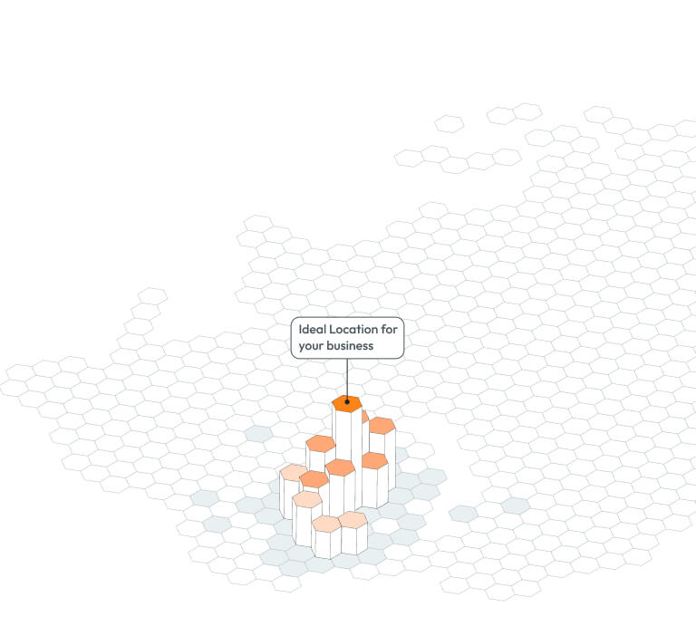
Targomo is a location intelligence company used by retail, restaurant, fitness, real estate and other teams that evaluate physical locations. In a commercial real estate workflow, it sits between raw geospatial data and the investment or leasing decision. Users can assess catchment areas, travel times, footfall, demographics, nearby amenities and competitive context without assembling every dataset and map separately. The clearest fit is a multi location operator deciding where to open, close or prioritize sites, although investors, developers and real estate marketplaces can also use its accessibility analysis.
The main application, TargomoLOOP, provides a configurable mapping and analysis environment for site selection and network planning. GeoAI adds models intended to identify location factors associated with business performance and predict sales metrics for candidate sites. TargomoAPI exposes routing, travel time, point of interest and isochrone capabilities for companies that want to place location intelligence inside their own applications or internal systems. This combination gives buyers a choice between a ready interface, predictive analysis and developer infrastructure.
For CRE buyers, the important distinction is that Targomo is CRE adjacent rather than a complete real estate intelligence system. It can explain how accessible a property is, who may reach it and what surrounds it. It does not replace lease comparables, ownership records, property financials, pipeline tracking or transaction management. Analysis: its value therefore depends on whether location potential is a central underwriting variable. It is more consequential for a restaurant expansion team than for an office investment analyst focused primarily on rent rolls and capital structure.
Targomo became part of CASAFARI, connecting its location data expertise with a broader property technology platform. That ownership could widen the product’s real estate context, but buyers should evaluate the current integration rather than purchase against a future roadmap. The vendor publishes meaningful product descriptions, API documentation and named customer evidence, yet it does not publish standard pricing or enough model validation detail for an investor to accept forecasts without independent testing. BestCRE views Targomo as a credible specialist for geographic demand and accessibility analysis, with less coverage of the property and transaction data required for comprehensive CRE underwriting.
What Targomo Does and How It Works
TargomoLOOP lets analysts place existing or proposed locations on a map, define relevant geographic areas and compare sites using selected data layers. Its travel time analysis can represent reach by modes such as driving, walking, cycling or public transport, subject to geographic availability and configuration. Isochrones provide a more realistic view of catchment than a fixed radius because they account for the transport network. Teams can then examine population, footfall, amenities, competitors and other indicators within those reachable areas. The vendor says the platform draws on more than 250 datasets, although coverage, provenance, refresh frequency and licensing can differ by market and should be checked during procurement.
GeoAI addresses the forecasting stage. A customer can combine its own performance data with location variables to determine which characteristics correlate with successful sites, then generate predictions for candidates. This can help an expansion team rank a long list before commissioning detailed fieldwork or negotiating leases. The forecast is not an independent guarantee of revenue. Its usefulness depends on the quality and representativeness of the customer’s historical locations, the selected explanatory variables, market stability and the treatment of operational differences between stores. Analysis: buyers should request holdout testing, error distributions and performance by market, rather than relying on a single accuracy headline or an attractive map.
TargomoAPI supplies building blocks for organizations that need location functions embedded in another product. Developers can request routes, travel times, points of interest and reachable areas, then combine the responses with property records, customer data or a proprietary user interface. This is useful for listing marketplaces, internal acquisition tools and applications that need personalized location results at scale. The API also creates implementation obligations: the buyer must manage data mapping, user permissions, monitoring and any downstream logic. Targomo therefore supports both analysts who want a packaged workspace and technical teams that want configurable geospatial services. It is not a substitute for a system of record, and a successful deployment still requires defined decision rules, data governance and accountable review.
9AI Framework: Dimension by Dimension Analysis
CRE Relevance: 7/10
Targomo earns 7 for CRE relevance because site selection, catchment analysis, accessibility and property potential are direct concerns for occupiers, developers and some investors. Its strongest CRE application is evaluating whether a location can reach the right customers and how it compares with an existing network. Those capabilities are particularly relevant to retail, restaurants, fitness, healthcare and other consumer facing uses. The limitation is scope. Targomo does not present itself as a complete source for leases, sales comparables, ownership, debt, rent rolls or asset management. A brokerage or acquisitions team would normally pair it with property and transaction systems. Analysis: this is a meaningful CRE decision layer, but not a broad CRE operating platform. The score reflects strong relevance to location driven property decisions and weaker relevance to financial underwriting, transaction execution and ongoing building operations.
Data Quality and Sources: 8/10
Targomo earns 8 for data quality. The platform brings together footfall, demographic, amenity, transport and point of interest information, and the vendor states that TargomoLOOP is powered by more than 250 datasets. That breadth can materially reduce the work required to source and normalize location variables. International coverage is also a practical advantage for operators comparing several countries. Breadth alone does not establish fitness for a specific decision. Dataset provenance, geographic granularity, update schedules, sampling methods and historical depth may vary, while some measures can be modeled rather than directly observed. The vendor does not publish a universal data dictionary covering every country and variable. Analysis: buyers should score representative addresses against known local conditions, inspect missing values and confirm whether important sources can be used in investment documentation. The rating recognizes substantial geographic breadth while reserving room for market specific validation.
Ease of Adoption: 8/10
Targomo earns 8 for ease of adoption because TargomoLOOP packages sophisticated spatial analysis inside a visual interface intended for daily business users. Mapping candidate sites, viewing catchments and comparing configured indicators should be more accessible than building the same workflow from geographic databases and desktop GIS software. Public customer comments also identify the interface as intuitive, although vendor selected testimonials are not a substitute for an independent usability study. Adoption still requires decisions about datasets, scoring logic, user roles and the meaning of each metric. GeoAI additionally needs suitable historical performance data and careful model validation. The API route requires development resources and should be treated as a software project rather than a plug in. Analysis: an analyst team can likely reach useful outputs quickly in the packaged product, but enterprise standardization across markets will require governance, training and consistent definitions.
Output Accuracy: 7/10
Targomo earns 7 for output accuracy. Routing, travel time and isochrone outputs are grounded in established geospatial methods, but real world accuracy depends on transport networks, mode assumptions, time settings and local data quality. Footfall and demographic estimates also carry sampling and modeling limitations that can become material when nearby sites have similar scores. GeoAI forecasts introduce another layer of uncertainty because predictions depend on the customer’s historical data, chosen variables and the stability of relationships across markets and formats. Targomo markets accurate forecasting, but it does not publish enough standardized, independent validation to establish one expected error rate for every customer. Analysis: outputs are suitable for screening, comparison and decision support when tested locally. Buyers should not treat them as definitive forecasts. A pilot should compare predictions with actual results, report errors by site type and preserve human review for unusual locations.
Integration and Workflow Fit: 9/10
Targomo earns 9 for integration because it offers both an end user platform and a dedicated API for geospatial applications. TargomoAPI covers core functions such as routing, travel times, points of interest and isochrones, allowing technical teams to place location analysis inside listing portals, acquisition tools, customer applications or internal dashboards. The API approach is more flexible than relying solely on exports from a closed mapping interface. Targomo’s relationship with CASAFARI also creates a plausible path toward richer property context, although buyers should verify which connections are available now. The vendor does not publish a comprehensive list of packaged connectors to every major CRE system, customer relationship platform or data warehouse. Analysis: the architecture appears integration friendly, but actual effort will depend on identity management, data rights, field matching and workflow design. The score rewards the unusually useful developer option while recognizing that an API is capability, not completed integration.
Pricing Transparency: 3/10
Targomo earns 3 for pricing transparency because the vendor does not publish standard subscription prices, API rates, implementation fees or minimum commitments. Prospective customers are directed toward a demonstration or sales conversation. Custom pricing can be reasonable for a platform whose cost may vary by countries, users, datasets, request volume and forecasting scope, but it makes early comparison difficult. Buyers cannot determine from public information whether a pilot, one market deployment or limited API workload fits their budget. They should request a detailed proposal separating software access, premium data, implementation, training, model development, API consumption and renewal increases. Analysis: procurement should also establish what happens when usage or geographic coverage expands. The low score does not imply that Targomo is expensive. It reflects the absence of public price points and the resulting effort required to understand total cost before entering a sales process.
Support and Reliability: 7/10
Targomo earns 7 for support. The company publishes a knowledge base for TargomoLOOP, documentation for TargomoAPI and contact paths for product inquiries. Its positioning also emphasizes expert assistance, which matters because location models require more than software access. Customers may need help choosing datasets, defining catchments, interpreting footfall, preparing internal performance data and validating forecasts. Public information does not establish standard response times, support tiers, service credits, implementation staffing or coverage by region. It is also unclear which services are included in subscription pricing and which require a separate engagement. Analysis: the available resources suggest a credible support structure, but enterprise buyers should put operational commitments into the contract. References should be asked about onboarding quality, issue resolution and help adapting models when a market or store format changes. The score reflects visible enablement resources without assuming unpublished service levels.
Innovation and Roadmap: 8/10
Targomo earns 8 for innovation because it combines interactive location analysis, multimodal accessibility, broad contextual data, predictive modeling and developer services within one product family. The strongest element is not any individual map layer. It is the ability to connect a customer’s operating outcomes with geographic features and apply the resulting model to prospective sites. That can move a team from descriptive mapping toward repeatable location forecasting. TargomoAPI also lets customers turn the underlying spatial functions into their own products and workflows. These capabilities are not unique, as several location intelligence vendors offer footfall analysis, catchments and predictive site scoring. The GeoAI label should therefore be judged by demonstrated model performance rather than terminology. Analysis: Targomo shows meaningful product depth and an adaptable technical foundation, but it is advancing within an established category rather than creating an entirely new one.
Market Reputation: 7/10
Targomo earns 7 for market reputation. The vendor identifies established brands using its products and publishes customer stories involving location planning and expansion. Its acquisition by CASAFARI provides strategic backing and links Targomo with a broader property technology business. The website also presents named executives from customer organizations, offering more credibility than anonymous testimonials. However, the vendor does not publish enough information to independently establish customer retention, recurring revenue, implementation success rates or market share. Public customer evidence appears strongest among multi location consumer businesses rather than across every CRE segment. Analysis: Targomo has credible proof that serious operators use the platform, but it does not have the category dominance or extensive independent benchmarking associated with the largest property data providers. Buyers should request references that match their country, asset type, portfolio scale and intended forecasting workflow.
Who Should Use Targomo
Targomo best suits expansion, strategy and real estate teams at retailers, restaurant groups, fitness operators, healthcare providers and other businesses with networks of physical sites. These buyers repeatedly ask whether a proposed location reaches the right population, faces excessive competition or complements the existing estate. The visual platform can give business analysts a common framework for screening candidates and explaining recommendations. It is especially relevant when a team operates across several markets and wants consistent accessibility and catchment methods without constructing a geographic technology stack internally.
The product can also suit developers, landlords, investment teams and property marketplaces when accessibility and consumer demand are important parts of the thesis. A developer assessing neighborhood services, an investor comparing retail assets or a marketplace adding travel time search could each use different parts of the platform. Technical organizations are particularly good candidates for TargomoAPI because they can combine spatial functions with proprietary property, tenant or customer data. Analysis: the strongest buyer has repeated location decisions, clean historical performance data and a staff member accountable for validating how geographic indicators affect commercial outcomes.
Who Should Not Use Targomo
Targomo is a weaker fit for buyers seeking a single source of comprehensive CRE records. It does not replace transaction comparables, lease intelligence, ownership research, debt data, rent roll analysis, asset accounting or brokerage workflow management. Office and industrial teams whose decisions depend mainly on tenancy, building specifications and financial structure may find location intelligence useful but secondary. A company making only occasional site decisions may also struggle to justify the setup and data work required for a recurring platform.
Teams without reliable outcome data should be cautious about buying primarily for revenue prediction. GeoAI can only learn useful relationships when the underlying performance history, store attributes and location variables are sufficiently consistent. Buyers that require an immediately published price will also find the evaluation frustrating because standard pricing is not public. Analysis: organizations unwilling to run a controlled pilot, examine forecast errors and maintain decision governance should choose a simpler mapping product or purchase project based analysis from a specialist consultant.
Pricing and ROI Analysis
Targomo does not publish standard prices for TargomoLOOP, GeoAI or TargomoAPI. It also does not publicly specify minimum contract value, included users, API allowances, implementation charges or premium dataset fees. Buyers should request separate pricing for platform licenses, geographic coverage, data modules, forecasting work, integration, training and ongoing support. The proposal should define overage rates, renewal terms and the cost of adding countries or business units. Because data rights can affect both price and permitted use, procurement should confirm whether outputs may be stored, shared with advisers and incorporated into investment records.
Analysis: simple ROI math should begin with avoidable research cost and better site decisions, not an assumed revenue uplift. If a team evaluates 120 candidates annually and Targomo saves three analyst hours per candidate, it saves 360 hours. Multiplying those hours by the buyer’s fully loaded hourly cost provides a conservative annual efficiency value. The buyer can then add an internally approved estimate for reduced external data purchases or avoided field studies. Forecast benefits should be counted only after a pilot demonstrates measurable improvement over the existing method. Compare that validated annual value with the complete first year cost, including implementation and internal labor, then repeat the calculation using the expected renewal cost.
Integration and CRE Tech Stack Fit
Targomo can occupy the geospatial analysis layer within a CRE technology stack. TargomoLOOP gives analysts a direct workspace, while TargomoAPI can send routing, travel time, point of interest and isochrone results into a property portal, site pipeline, data warehouse or custom underwriting application. A practical architecture would retain property identifiers and financial records in existing systems, then attach Targomo outputs to each candidate or asset. Buyers should confirm export formats, authentication, request limits, data retention rights and geographic coverage during technical diligence.
The CASAFARI ownership connection may eventually deepen links between location intelligence and property information, but current functionality should be verified in a demonstration and contract. The vendor does not publish a complete catalog of ready made connectors for major CRE platforms. Analysis: integration will be easiest for teams with API engineering capacity and stable property identifiers. Less technical organizations should budget for configuration, data mapping and governance, particularly if predictions combine internal sales with external location variables.
Competitive Landscape
Placer.ai is the clearest alternative when observed visitation patterns, trade areas and competitive movement are the primary requirement, particularly in the United States. BestCRE scored Placer.ai at 81 in this category. Targomo offers a broader developer story around travel time, routing and isochrones, plus an international site planning orientation. Buyers should compare geographic coverage, data provenance and validation at the exact properties under consideration rather than assuming that either vendor’s footfall measure is interchangeable.
Buxton is a relevant choice for retailers, restaurants and healthcare operators seeking customer analytics, site selection and consulting around network strategy. Locate.ai focuses on retail location decisions and predictive expansion workflows, while Placepoint and Plaace provide other approaches to site discovery and location analysis. Product availability and depth vary by geography, so buyers should confirm current market coverage directly. Targomo may be preferable when configurable accessibility analysis and an API are central requirements. A competitor may be preferable when it offers stronger local consumer data, a closer category model or more hands on advisory services.
Traditional CRE platforms such as CoStar, scored 81 by BestCRE, address property and transaction intelligence more directly. They are complements as often as substitutes. Analysis: a serious procurement should test Targomo against one specialist location platform and the buyer’s existing property data workflow. The winning product should improve decisions on a blinded set of known sites, not merely produce the most polished presentation.
The Bottom Line
Buy Targomo when location accessibility, catchment composition and network planning materially affect recurring site decisions. It is particularly persuasive for multi location operators and technical teams that want both a usable analyst interface and programmable geospatial services. Require a pilot using actual successful and unsuccessful sites, and judge GeoAI on holdout errors rather than headline claims. Confirm every critical dataset by country before committing.
Do not buy it as a replacement for a CRE property database or underwriting platform. Targomo explains geographic context, not the complete legal, physical and financial condition of an asset. Analysis: its best role is as a specialized decision layer connected to internal performance and property records. If the pilot improves ranking quality or reduces research effort enough to exceed the full subscription and implementation cost, proceed. If accessibility is only a minor factor, a narrower mapping tool or project based study is likely more economical.
About BestCRE
BestCRE.com is the definitive authority on commercial real estate AI, analysis, and investment intelligence. Every article advances the platform’s mission to help CRE professionals identify, evaluate, and adopt the best tools and strategies in the industry. We benchmark platforms using the 9AI Framework so CRE leaders can compare tools with clear evidence. Explore the category map at 20 CRE sectors for deeper coverage across the CRE stack.
Frequently Asked Questions
What is Targomo?
Targomo is a location intelligence platform for organizations that make decisions about physical sites. Retail, restaurant, fitness, healthcare, real estate and marketplace teams can use it to examine accessibility, travel times, footfall, demographics, nearby amenities and competitive context. Its principal products include TargomoLOOP for visual site and network analysis, GeoAI for location based forecasting, and TargomoAPI for adding geospatial functions to other applications. In CRE, the platform is most useful for screening locations and evaluating market context. It is not a comprehensive source for leases, sales comparables, ownership, debt or property financials. Targomo is part of CASAFARI, a property technology company.
How does Targomo compare with Placer.ai?
Targomo and Placer.ai both support location decisions, but their emphasis differs. Placer.ai is widely associated with visitation analytics, trade areas and competitive movement patterns, especially for properties and brands in the United States. Targomo combines contextual datasets with multimodal travel times, routing, isochrones, site analysis, predictive modeling and an API intended for custom geospatial applications. Targomo may fit better when international planning, accessibility or developer integration is central. Placer.ai may fit better when detailed observed visitation analysis is the main purchasing objective. Analysis: buyers should run the same known locations through both products and compare coverage, stability, explanatory power and forecast performance. Neither vendor’s metrics should be accepted without checking methodology and local accuracy.
How much does Targomo cost?
Targomo does not publish standard pricing for TargomoLOOP, GeoAI or TargomoAPI. A buyer must contact the company for a proposal. Pricing may depend on factors such as users, countries, datasets, forecast scope, API usage and implementation requirements, but the vendor does not publish a standard formula. Request a line item quote that separates licenses, data modules, model development, onboarding, training, integration, support and usage charges. Also ask about minimum commitments, overages, renewal increases and rights to retain derived outputs. Analysis: calculate value first from analyst hours saved and external research replaced. Add forecast value only after a controlled pilot shows that Targomo improves decisions against the organization’s current method.
Who should use Targomo for real estate decisions?
Targomo is best suited to real estate and expansion teams that evaluate many consumer facing locations. Retailers, restaurant groups, fitness operators, healthcare networks and similar businesses can use it to compare catchments, accessibility, footfall, demographics, amenities and competitors. Developers and investors may also benefit when consumer demand and transport access are important to an asset’s performance. Marketplaces and technically mature companies can use TargomoAPI to add travel time or reachability features to their own products. It is less suitable for teams primarily seeking lease comparables, ownership records, property financials or transaction workflow. Analysis: the ideal customer has recurring site decisions, reliable historical performance data and someone responsible for testing model outputs before they enter investment or leasing decisions.
How could Targomo change after the CASAFARI acquisition?
CASAFARI’s acquisition of Targomo creates a logical opportunity to combine location intelligence with broader property data and workflows. That could give users richer context when moving from market screening to individual property evaluation. However, specific future integrations, release dates and commercial terms are not published, so buyers should not assume that every potential connection exists. In Q4 2026, procurement should distinguish currently available functions from roadmap items and ask for demonstrations of any claimed CASAFARI integration. Analysis: the most valuable direction would connect accessibility, demand and forecasting outputs to verified property records through consistent identifiers. Until that is demonstrably available, Targomo should be evaluated on its present mapping, data, modeling and API capabilities rather than the strategic promise of combined platforms.
Related Reviews
Compare Targomo with other tools BestCRE has scored in the same category: CompStak, Google Gemini, Cherre. Explore more CRE AI tool reviews in our Best CRE AI Tools directory. For sector-specific analysis and market intelligence, visit our 20 CRE Sectors hub.