Category: CRE Permitting & Zoning

  • Conflation Labs Review: AI-powered research assistant that translates complex municipal zoning codes into plain English

    Conflation Labs Review: AI-powered research assistant that translates complex municipal zoning codes into plain English

    BestCRE 9AI Score

    59/100 · Watch

    Conflation Labs ranks #415 of 450 commercial real estate AI tools scored on the 9AI Framework. Nine dimensions, each scored out of 10: CRE relevance, data quality, ease of adoption, output accuracy, integration fit, pricing transparency, support, innovation and market reputation.

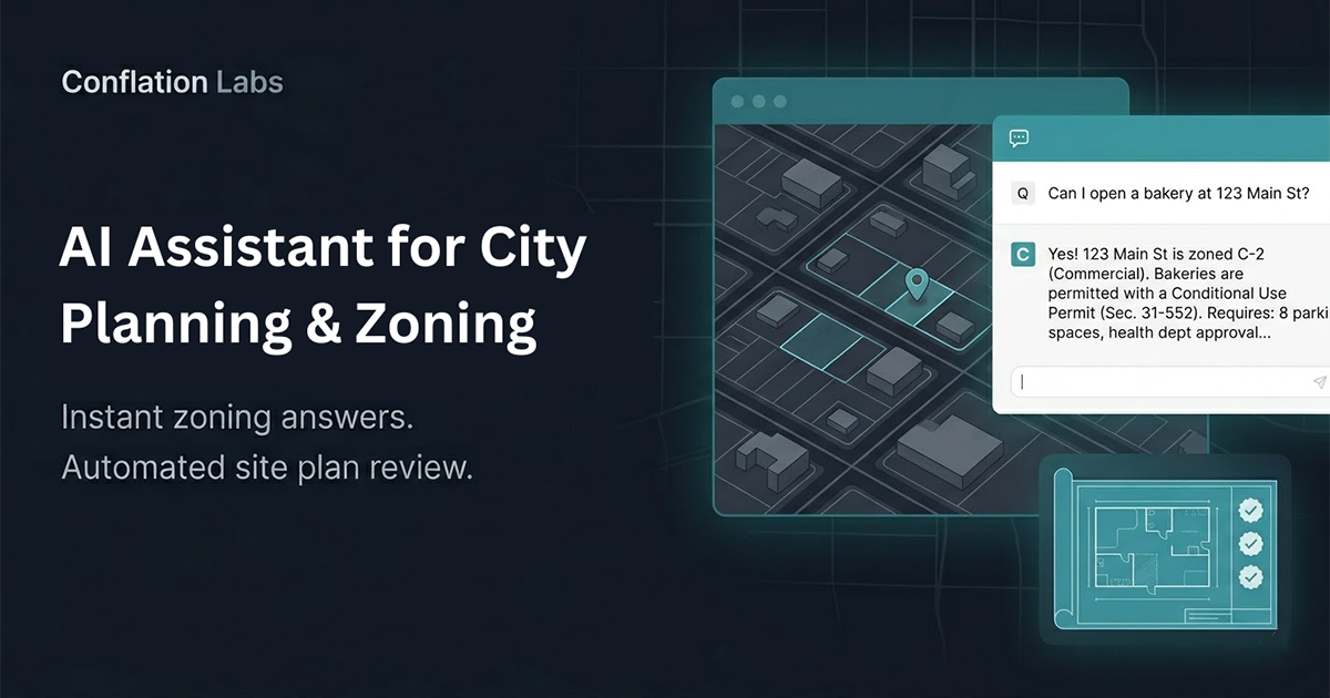
    Conflation Labs is a CRE-Native, Tier 2 software provider that uses artificial intelligence to read municipal zoning codes and answer user questions in plain English.

    As of August 2026, the commercial real estate industry continues to struggle with the fragmented, highly localized nature of zoning ordinances. Analysts and developers spend hundreds of hours parsing PDF documents and municipal websites to determine site viability, setbacks, and allowable uses. Conflation Labs enters this specific niche by offering a natural language interface for zoning queries, aiming to replace manual document review. Our analysis indicates that while the premise addresses a genuine pain point for acquisition teams, the execution relies heavily on the underlying language model’s ability to interpret dense legal text without hallucinating. BestCRE evaluates this tool through the lens of a principal or analyst who requires high-stakes accuracy. A missed overlay district or misinterpreted parking ratio can kill a deal or result in severe financial penalties. The platform is currently positioned in the market with a paid subscription model following a free trial, though exact enterprise pricing tiers are not published. As a Tier 2 vendor, Conflation Labs competes against more established permitting platforms but differentiates itself by focusing strictly on the code-reading and interpretation phase rather than workflow management or permit expediting. This review breaks down its capabilities, limitations, and overall utility for institutional and mid-market commercial real estate operators seeking to accelerate their site selection and due diligence processes.

    What Conflation Labs does and how it works

    Conflation Labs functions as a specialized search and synthesis engine for municipal zoning codes. Users input a specific property address or jurisdiction, and the platform retrieves the relevant zoning ordinances, overlay maps, and municipal guidelines. Instead of forcing the user to read through hundreds of pages of municipal PDFs, the software provides a chat-like interface where analysts can ask direct questions. For example, a user can type, “What is the maximum floor area ratio for a mixed-use development on this parcel?” or “Are there any setback requirements for a drive-thru restaurant in this specific zone?” The AI processes the query against the ingested municipal data and returns an answer in plain English.

    Our analysis shows that the core mechanic relies on natural language processing to map the user’s intent to the specific legal definitions within the local code. The system highlights the source text it used to generate the answer, which is a critical feature for commercial real estate professionals who must verify every claim before presenting it to an investment committee. If the tool states that a parcel allows for a 50-foot building height, it provides a direct citation to the exact section and paragraph of the municipal code. This traceability is intended to mitigate the risk of AI hallucinations, though users must still manually check the cited text to ensure the model did not misinterpret exemptions or conditional use clauses.

    Beyond single-parcel queries, the platform allows users to run comparative analyses across multiple jurisdictions. An acquisition team looking for light industrial sites can theoretically use the tool to compare warehouse parking requirements across five different suburban municipalities simultaneously. However, because Conflation Labs focuses entirely on reading and answering questions about existing codes, it does not generate architectural massing models, nor does it track the status of live permit applications. It is strictly a text-based research assistant designed to compress the time spent in the initial zoning feasibility phase of a project.

    9AI Framework: the score, dimension by dimension

    Dimension Score
    CRE Relevance 8/10
    Data Quality and Sources 7/10
    Ease of Adoption 8/10
    Output Accuracy 6/10
    Integration and Workflow Fit 4/10
    Pricing Transparency 4/10
    Support and Reliability 5/10
    Innovation and Roadmap 6/10
    Market Reputation 5/10
    Composite 9AI Score 59/100

    CRE Relevance: 8/10

    Conflation Labs is entirely dedicated to commercial real estate, specifically targeting the zoning and feasibility stages of development and acquisition. Unlike generic language models, this tool is classified as a CRE-Native platform, meaning its architecture is built around the specific terminology and structure of municipal land use codes. It directly addresses the tedious process of zoning research, which is a universal bottleneck for developers, brokers, and site selection consultants. However, because it is a Tier 2 application focused solely on text interpretation rather than full-cycle development management, its relevance is highly concentrated on front-end due diligence rather than asset management or operations. In practice: Acquisition analysts will use this daily during site selection, but property managers and leasing brokers will find little utility in the platform.

    Data Quality and Sources: 7/10

    The platform’s effectiveness is entirely dependent on the recency and completeness of the municipal codes it ingests. Zoning ordinances change frequently through city council amendments, variances, and updated comprehensive plans. Our analysis indicates that while Conflation Labs pulls directly from published municipal databases, the latency between a city passing an ordinance and the tool updating its corpus is an unknown variable. The data is inherently unstructured and varies wildly in format from one county to the next, making standardized data extraction difficult. The tool attempts to normalize this data, but users must remain vigilant about the “as of” date for any code it references. In practice: Users must independently verify that the AI is referencing the most recently amended version of the local zoning code before finalizing any site feasibility studies.

    Ease of Adoption: 8/10

    By utilizing a plain English question-and-answer interface, Conflation Labs removes the steep learning curve typically associated with specialized commercial real estate software. There are no complex dashboards to configure or extensive onboarding modules required to start querying zoning codes. Analysts who are already familiar with consumer-grade AI chatbots will immediately understand how to interact with the platform. The primary adoption hurdle is not technical, but rather behavioral: training senior partners and investment committees to trust the outputs generated by an AI assistant. The inclusion of a free trial allows teams to test the interface with zero financial commitment, further lowering the barrier to entry. In practice: A junior analyst can begin pulling zoning summaries within ten minutes of creating an account, requiring almost no formal software training.

    Output Accuracy: 6/10

    Translating dense, legally binding zoning text into plain English introduces significant risk. Municipal codes are filled with cross-references, conditional exceptions, and grandfather clauses that can easily confuse natural language processing models. While Conflation Labs provides citations to the original text, our analysis suggests that the AI may occasionally miss nuanced overlay districts or misinterpret the hierarchy of conflicting ordinances. The accuracy is sufficient for initial site screening, but it is not infallible enough to replace a formal zoning report from a qualified land use attorney. Users must treat the outputs as a highly educated starting point rather than a definitive legal conclusion. In practice: Analysts must click through every single citation provided by the AI to manually confirm that the plain English summary accurately reflects the legal text.

    Integration and Workflow Fit: 4/10

    As a specialized zoning research tool, Conflation Labs operates primarily as a standalone web application. There is no published evidence in our research that it offers native API integrations with major commercial real estate platforms like Argus, Yardi, or Salesforce. Users interact with the tool in an isolated environment, meaning that any data or summaries generated must be manually copied and pasted into external investment memos or underwriting spreadsheets. For enterprise teams looking to build automated, end-to-end data pipelines for site selection, this lack of connectivity presents a structural limitation. It functions as an isolated research terminal rather than a connected node in a broader tech stack. In practice: Analysts will run queries in a separate browser tab and manually export the findings into their firm’s standardized Word or Excel templates.

    Pricing Transparency: 4/10

    The vendor’s website indicates a model consisting of a paid subscription following a free trial. However, exact pricing tiers, seat licenses, and enterprise contract minimums are not published publicly. According to the 9AI Framework rules, a vendor that does not publish pricing cannot exceed a score of 5 in this category. This lack of transparency forces prospective buyers into a sales funnel simply to determine if the software fits their operating budget. While the free trial offers a risk-free evaluation period, the opaque nature of the subsequent paid tiers makes it difficult for procurement teams to forecast long-term software expenditures or calculate immediate return on investment prior to engagement. In practice: Buyers must complete the free trial and engage directly with a sales representative to uncover the actual cost of deployment.

    Support and Reliability: 5/10

    Conflation Labs is classified as a Tier 2, unproven startup in the commercial real estate technology space. Per the 9AI Framework, an unproven startup cannot exceed a score of 6 in this dimension. Information regarding dedicated customer success managers, service level agreements, or guaranteed response times is not published. Early-stage companies often struggle to scale their support infrastructure as their user base grows, leading to potential bottlenecks when users encounter bugs or require assistance with complex queries. While the simplicity of the tool may reduce the overall volume of support tickets, enterprise clients typically demand rigorous support guarantees that are currently unverified for this vendor. In practice: Users should expect standard email-based support and should not rely on the vendor for immediate, mission-critical technical assistance during active deal negotiations.

    Innovation and Roadmap: 6/10

    The core proposition of using AI to read zoning codes is highly relevant today, but the underlying technology is rapidly becoming commoditized. As foundational language models improve, the moat for specialized text-reading applications shrinks. Conflation Labs will need to innovate beyond simple question-and-answer mechanics to maintain its market position. Our analysis suggests that future iterations must incorporate geospatial mapping, automated massing generation, or integration with live municipal permit tracking to remain competitive. Currently, the roadmap is not published, leaving buyers to guess whether the platform will evolve into a comprehensive feasibility suite or remain a narrow, single-function research utility. In practice: Buyers are purchasing the tool for its current text-parsing capabilities, with no clear guarantee of future feature expansions or advanced geospatial integrations.

    Market Reputation: 5/10

    As a Tier 2 startup, Conflation Labs lacks the extensive track record and widespread industry adoption of older, more established software providers. Under the 9AI Framework rules, an unproven startup is capped at a score of 6 for market reputation. The company is currently building its brand within the niche of AI zoning analysis, but it has not yet accumulated a critical mass of published case studies or institutional endorsements. It competes in a crowded field alongside vendors like LandScout AI and Archistar AI, which have already secured higher visibility in the market. Trust is paramount when dealing with legal zoning codes, and Conflation Labs is still in the process of earning that trust from major developers. In practice: Institutional buyers will likely require a prolonged pilot program to independently validate the tool’s reputation for accuracy before committing to a firm-wide rollout.

    Who should use Conflation Labs

    Conflation Labs is purpose-built for professionals who spend a disproportionate amount of their week reading municipal codes. The tool is highly effective for teams that need to rapidly filter out unviable sites before committing capital to formal legal review.

    Acquisition analysts at mid-sized development firms who need to quickly verify allowable uses and setbacks across multiple municipalities.

    Site selection consultants working on behalf of retail or industrial tenants to identify parcels that meet specific zoning criteria.

    Land brokers who want to provide prospective buyers with immediate, plain-English summaries of a parcel’s development potential to accelerate transactions.

    Urban planners and architects conducting preliminary feasibility studies before drafting initial site plans or massing models.

    Who should look elsewhere

    Organizations that require full-service permit expediting, architectural design generation, or guaranteed legal opinions will find this tool insufficient for their needs. It is a research assistant, not a replacement for specialized legal or engineering professionals.

    Property managers and leasing agents, as zoning feasibility has minimal impact on the daily operations of stabilized assets.

    Institutional investment committees seeking legally binding zoning reports or formal land use opinions for final underwriting approval.

    Firms looking for an all-in-one platform that generates 3D architectural massing models or tracks live construction permits.

    Pricing and ROI

    Pricing for Conflation Labs is not published on their public-facing website. The research confirms that the vendor operates on a paid subscription model following a free trial, allowing users to test the platform before committing. Because exact enterprise tiers, per-seat costs, and minimum contract lengths are hidden behind a sales wall, procurement teams cannot accurately benchmark the software against competitors like Shovels.ai or PermitFlow without direct engagement.

    Our analysis indicates that the return on investment math for a tool of this nature is straightforward, despite the opaque pricing structure. If an acquisition analyst earns $100,000 annually, which equates to roughly $50 per hour, and currently spends ten hours per week manually reading municipal zoning PDFs, the firm is spending $500 weekly on basic zoning research. If Conflation Labs can reduce that research time by 80 percent through its plain English question-and-answer interface, it saves the firm $400 per week, or over $20,000 annually per analyst. To achieve a positive return on investment, the undisclosed annual subscription cost must simply fall below the value of the analyst hours saved. Buyers must also factor in the administrative time still required to manually verify the AI’s citations, ensuring that the efficiency gains are not offset by the cost of correcting inaccurate legal interpretations.

    Integration and CRE tech stack fit

    Conflation Labs functions as an isolated application within the commercial real estate tech stack. There is no published documentation suggesting that it offers native APIs or pre-built connectors to industry-standard platforms such as Yardi, MRI, Argus, or Salesforce. For teams focused on building highly integrated, automated data pipelines, this lack of connectivity is a notable drawback. Users must conduct their zoning research within the Conflation Labs interface and then manually export or copy the plain English summaries into their firm’s underwriting models, investment memos, or relationship management records. While this siloed approach is common among early-stage, Tier 2 research utilities, it limits the tool’s ability to automatically pass data downstream to architectural or financial forecasting software. The platform is best viewed as a standalone research terminal, similar to a specialized search engine, rather than a foundational layer of a firm’s enterprise architecture. Firms adopting this tool will need to establish strict internal protocols for how the AI-generated zoning data is formatted, verified, and manually entered into their primary systems of record to maintain data integrity across the organization.

    Competitive landscape

    The market for artificial intelligence in zoning and permitting software is becoming increasingly crowded, and Conflation Labs faces stiff competition from vendors that offer broader feature sets. LandScout AI, which holds a BestCRE Score of 87, and Archistar AI, with a BestCRE Score of 81, represent the upper echelon of this category. Both competitors go beyond simply reading text; they incorporate geospatial data and automated 3D massing models, allowing users to visualize the zoning code on a specific parcel. For teams that need visual outputs, these higher-scoring platforms present a more comprehensive solution.

    In the permitting and contractor intelligence space, Shovels.ai, scoring 80, and PermitFlow, scoring 76, offer workflow management and historical permit data tracking, which Conflation Labs does not attempt to provide. GreenLite, scoring 71, and ReZone, scoring 70, are closer direct competitors in terms of zoning analysis, but they also offer more established track records. Conflation Labs differentiates itself strictly through its focused, plain English question-and-answer interface, prioritizing simplicity over complex feature bloat. However, because it lacks the visual and workflow capabilities of its peers, buyers must decide if a pure text-analysis tool justifies a dedicated subscription, or if they are better served by a platform like LandScout AI that handles both the reading of the code and the visual application of its rules.

    The bottom line

    Conflation Labs offers a sharp, highly focused solution to one of commercial real estate’s most tedious problems: reading and interpreting municipal zoning codes. Its plain English interface makes it incredibly easy to use, and the citation feature provides necessary transparency for high-stakes due diligence. However, as an unproven Tier 2 startup with unpublished pricing and no integration capabilities, it carries inherent adoption risks. The tool is not a replacement for land use attorneys or comprehensive platforms like LandScout AI that offer geospatial visualizations. Decision makers should utilize the free trial to test the AI’s accuracy against known zoning codes in their target markets. If the tool consistently saves your analysts hours of manual reading without hallucinating legal nuances, it is worth the investment as a standalone research utility. If your firm requires automated massing models or integrated workflow management, pass on Conflation Labs and look to higher-scoring alternatives.

    Frequently asked questions

    Does Conflation Labs generate 3D architectural massing models?

    No. Conflation Labs is strictly a text-based research tool that uses AI to read zoning codes and answer questions in plain English. It does not provide geospatial mapping, visual site plans, or automated 3D massing models like some of its higher-rated competitors in the market.

    How much does a Conflation Labs subscription cost?

    Pricing is not published on the vendor’s website. The company offers a paid subscription model that requires users to transition from a free trial. Prospective buyers must engage directly with the sales team to determine enterprise pricing tiers, seat licenses, and contract minimums.

    Can this software replace my land use attorney?

    Absolutely not. While the AI provides plain English summaries and citations to specific municipal codes, it is not infallible. Users must manually verify the outputs, as AI can misinterpret complex legal nuances, grandfather clauses, or overlay districts. It is a research assistant, not a legal authority.

    Does Conflation Labs integrate with Argus or Yardi?

    There is no published evidence that the platform offers native integrations or APIs for major commercial real estate software like Argus, Yardi, or Salesforce. It operates as a standalone web application, requiring users to manually export and transfer data into their existing underwriting models.

    Is a free trial available for new users?

    Yes, the research confirms that Conflation Labs offers a free trial. This allows acquisition teams and analysts to test the natural language interface and verify the accuracy of the AI’s zoning citations before committing to a paid enterprise subscription.

    How does it compare to LandScout AI?

    LandScout AI scored an 87 on the BestCRE framework, significantly higher than Conflation Labs. While Conflation Labs focuses purely on text-based question-and-answer mechanics, LandScout AI offers a more comprehensive suite that includes geospatial data and visual massing models, making it better suited for complex site planning.

    Related Reviews

    Compare Conflation Labs with other Permitting & Zoning tools BestCRE has scored: Symbium (78/100), Zoneomics (78/100), TurboPermit (76/100) and Camino (68/100). Browse every review in CRE Permitting & Zoning, the full Best CRE AI Tools directory, or the 20 CRE Sectors hub.

  • Camino Review: Cloud based permitting and zoning software built for local government jurisdictions

    Camino Review: Cloud based permitting and zoning software built for local government jurisdictions

    BestCRE 9AI Score

    68/100 · Niche

    Camino ranks #286 of 450 commercial real estate AI tools scored on the 9AI Framework. Nine dimensions, each scored out of 10: CRE relevance, data quality, ease of adoption, output accuracy, integration fit, pricing transparency, support, innovation and market reputation.

    Camino, now operating as Clariti Launch, is a cloud-based permitting and licensing platform designed primarily for local government jurisdictions to digitize their application workflows. According to the BestCRE master database, its primary use case revolves around providing digital permitting and workflows for municipalities, rather than serving as an internal analytics tool for private commercial real estate developers. Acquired by Clariti Software, the platform has gained traction among city and county planning departments looking to replace paper-based submissions and legacy spreadsheet tracking with a centralized online portal. For a commercial real estate principal or development analyst, encountering Camino typically happens from the outside looking in, as an applicant navigating a city’s customized permit guide to determine zoning feasibility, fee estimates, and submittal requirements for a new project.

    While peers like PermitFlow or GreenLite focus on accelerating the builder’s side of the equation, Camino exists to solve the administrative bottlenecks within the government itself. It integrates local geographic information system data and zoning rules into a visual logic engine, allowing cities to create interactive guides for developers. When a commercial real estate firm evaluates the permitting technology landscape in August 2026, understanding Camino is less about purchasing a software license and more about recognizing the infrastructure powering the jurisdictions where they intend to build. Based on our analysis, the platform represents a modernization of civic technology, shifting the burden of initial compliance checks from city planners to an automated, public-facing interface.

    What Camino does and how it works

    At its core, Camino functions as a digital bridge between a municipality’s complex zoning code and the commercial real estate developer applying for a permit. The software utilizes a visual, no-code rule engine that allows city planners to map out conditional logic based on local ordinances. When a developer or architect accesses a city’s Camino-powered portal, they input their project location and basic parameters. The system then queries the jurisdiction’s integrated geographic information system data to identify parcel-specific constraints, such as flood zones, historic districts, or specific commercial overlays, automatically flagging potential hazard areas or additional required approvals.

    Once the initial project parameters are established, Camino generates a customized Permit Guide. This guide acts as an interactive checklist, detailing the exact documents, architectural plans, and supplementary forms required for a complete submission. By digitizing this pre-application phase, the platform prevents incomplete applications from entering the city’s queue, which is a primary cause of processing delays. The system also calculates estimated permit fees and projected review timelines based on the municipality’s current fee schedule and historical processing data, giving developers a clearer financial and temporal picture before they officially submit their applications.

    Beyond the initial application, Camino facilitates the ongoing administrative workflow for city staff. It includes modules for digital plan review, inter-departmental routing, and virtual inspections via live video. While a commercial real estate firm will not deploy this software internally, their project managers will interface with Camino’s applicant dashboard to track review statuses, respond to municipal comments, and schedule necessary site inspections. Based on our analysis, the mechanics are entirely focused on standardizing the intake and processing of land use and construction permits for the governing body.

    9AI Framework: the score, dimension by dimension

    Dimension Score
    CRE Relevance 6/10
    Data Quality and Sources 8/10
    Ease of Adoption 6/10
    Output Accuracy 8/10
    Integration and Workflow Fit 7/10
    Pricing Transparency 4/10
    Support and Reliability 8/10
    Innovation and Roadmap 6/10
    Market Reputation 8/10
    Composite 9AI Score 68/100

    CRE Relevance: 6/10

    Camino occupies a unique position in the commercial real estate technology ecosystem because it is fundamentally designed for the public sector rather than private enterprise. Its relevance to a commercial developer is strictly functional; it dictates how efficiently they can secure entitlements and building permits in specific municipalities. Unlike platforms built to analyze portfolio acquisitions or optimize property management, this software focuses entirely on civic compliance and workflow digitization. Developers cannot purchase it to manage their internal pipelines, but they must understand its mechanics to navigate local bureaucracies effectively. The tool scores lower here simply because the primary user is the government, not the commercial real estate principal. In practice: Commercial real estate teams will use this platform as a mandatory external portal when applying for permits in adopting jurisdictions, rather than an internal strategic asset.

    Data Quality and Sources: 8/10

    The integrity of the information within Camino relies entirely on the host municipality’s existing geographic information system and zoning databases. The software does not generate its own proprietary market data or utilize predictive models; instead, it acts as a structured conduit for official city records. When a jurisdiction implements the platform, they map their specific ordinances, fee schedules, and parcel data into the system’s rule engine. Consequently, the output is highly authoritative, reflecting the exact legal and regulatory realities of the local government. However, based on our analysis, if a city’s underlying parcel data is outdated or poorly maintained, the platform will surface those inaccuracies. In practice: Developers can trust the zoning constraints and fee estimates generated by the system, provided the local government actively maintains its underlying geographic and regulatory databases.

    Ease of Adoption: 6/10

    For the commercial real estate professional interacting with the platform as an applicant, the user experience is highly intuitive and requires zero training. The public-facing Permit Guide is designed specifically to simplify complex zoning codes into a straightforward, question-and-answer format. However, for the actual buyer, the municipal planning department, implementation requires a significant administrative lift. City staff must dedicate substantial time to mapping their intricate zoning logic, fee structures, and approval workflows into the system’s rule builder. While the vendor promotes a no-code environment, translating decades of municipal ordinances into conditional digital logic is inherently complicated. In practice: While developers will find the public portals exceptionally easy to navigate, the jurisdictions purchasing the software face a steep initial setup phase to digitize their legacy processes.

    Output Accuracy: 8/10

    Because Camino operates on deterministic logic rather than generative artificial intelligence, its outputs are highly precise and predictable. The software relies on strict if-then rules established by city planners, ensuring that the customized submittal checklists and fee estimates exactly match the municipal code. There is no risk of the system hallucinating a zoning variance or misinterpreting a setback requirement, as it only processes the specific parameters programmed by the jurisdiction. This rigid adherence to established rules eliminates the guesswork typically associated with initial permit applications. Based on our analysis, the accuracy is absolute, limited only by human error during the municipality’s initial configuration of the rule engine. In practice: Commercial real estate analysts can rely on the platform’s initial feasibility checks and document requirements as definitive, legally binding guidance from the local government.

    Integration and Workflow Fit: 7/10

    The platform is engineered to connect with the complex, often antiquated software stacks utilized by local governments. It offers comprehensive application programming interfaces intended to sync with municipal enterprise resource planning systems, financial software for payment processing, and legacy document management databases. For the commercial real estate firm, however, integration is non-existent. Developers cannot connect a city’s Camino portal to their internal project management tools or their proprietary financial models. The data remains siloed within the government’s ecosystem, requiring developers to manually transfer permit statuses and fee schedules into their own tracking systems. In practice: The software integrates well within a city hall’s digital infrastructure, but offers no connectivity to the private commercial real estate developer’s internal technology stack.

    Pricing Transparency: 4/10

    As is typical with enterprise government software, Camino does not publish its pricing tiers publicly. The BestCRE master database confirms it is a paid platform, but exact costs are negotiated directly with municipalities based on population size, module selection, and implementation complexity. Because the target audience is the public sector, commercial real estate developers will never pay a licensing fee for this software. Instead, developers interact with it for free as a public service, though they remain responsible for the standard municipal permit fees calculated by the system. A vendor that does not publish pricing cannot exceed a score of five in this dimension. In practice: Commercial real estate principals will not incur direct software costs for this tool, as the financial burden of licensing and implementation falls entirely on the local government.

    Support and Reliability: 8/10

    Operating under the Clariti Software umbrella, the platform benefits from the backing of an established entity in the government technology sector. The company maintains a dedicated support infrastructure tailored to the needs of municipal workers, offering training certifications, technical troubleshooting, and implementation guidance. For the commercial real estate applicant, direct support from the vendor is generally unavailable; if a developer encounters an issue with a permit application, they must contact the city’s planning department, which then acts as an intermediary with the software provider. Based on our analysis, the system boasts high uptime, which is critical for maintaining public access to government services. In practice: While municipal buyers receive dedicated enterprise support, commercial real estate users must route any technical or procedural issues through their local city planners.

    Innovation and Roadmap: 6/10

    The development trajectory for this platform is focused heavily on expanding features for government administrators rather than commercial applicants. Recent updates have prioritized virtual inspection capabilities via live video and enhanced geographic information system mapping integrations. While competitors in the private sector are rapidly adopting generative models for automated architectural plan review, Camino remains focused on solidifying its core workflow automation and rule-based logic. Based on our analysis, the roadmap indicates a steady, conservative approach to feature expansion, prioritizing stability and compliance over experimental technology. This aligns with the risk-averse nature of municipal procurement but leaves the platform feeling somewhat utilitarian compared to private-sector proptech. In practice: Future updates will likely streamline the municipal review process further, but developers should not expect advanced predictive analytics or generative design features.

    Market Reputation: 8/10

    The platform has established a solid foothold among mid-sized to large municipalities across North America, including notable deployments in cities like Tampa and Albany,. Within the government technology sector, it is highly regarded for its ability to demystify the permitting process for constituents. However, among commercial real estate professionals, brand awareness is relatively low. Developers tend to view the software simply as an extension of the local government’s website rather than an independent technology brand. Its reputation is essentially tied to the efficiency of the specific city using it; a poorly configured portal will reflect badly on the municipality, not necessarily the software vendor. In practice: The tool is respected among municipal planners for modernizing civic workflows, even if commercial real estate developers rarely recognize it by name.

    Who should use Camino

    Because Camino is strictly a business-to-government software solution, the direct buyers are entirely within the public sector. Commercial real estate professionals will only interact with the platform as end-users navigating a municipality’s digital infrastructure. The ideal profiles for purchasing and implementing this system include:

    Municipal Planning Departments: City and county governments seeking to digitize their paper-based permitting processes and reduce administrative bottlenecks.

    Local Building Inspectorates: Jurisdictions wanting to implement virtual inspections and mobile field tools for their staff.

    Civic IT Directors: Technology leaders in local government tasked with modernizing public-facing portals and integrating disparate municipal databases.

    Who should look elsewhere

    Commercial real estate entities cannot purchase or deploy this software for their own internal operations. It is not designed to manage private development pipelines or conduct independent site selection analysis. The following profiles should look elsewhere for their technology needs:

    Commercial Real Estate Developers: Firms looking for internal project management or permit tracking software to oversee their multi-jurisdictional portfolios.

    Acquisition Analysts: Professionals seeking predictive zoning analytics or automated feasibility studies for potential land purchases.

    Architecture and Engineering Firms: Teams needing automated code compliance checking or generative design tools for their building plans.

    Pricing and ROI

    Camino does not publish its pricing publicly, which is standard practice for enterprise software sold to government entities. According to the BestCRE master database, it operates on a paid model. Costs are typically negotiated directly with the purchasing municipality and are scaled based on the jurisdiction’s population size, the specific modules selected, such as the Permit Guide, virtual inspections, or full workflow routing, and the complexity of the initial implementation. Because this is a civic technology platform, commercial real estate developers, architects, and property owners do not pay any licensing fees to use the software. They simply access the public-facing portal provided by the city.

    For the municipal buyer, based on our analysis, the return on investment math centers on administrative efficiency and labor reallocation. If a mid-sized city processes five thousand commercial and residential permits annually, and the software reduces the initial intake and triage time by just thirty minutes per application, the jurisdiction reclaims two thousand five hundred hours of staff time each year. At an average fully loaded municipal planner rate of sixty dollars per hour, this equates to one hundred fifty thousand dollars in recovered productivity annually. For the commercial real estate developer interacting with the system, the return on investment is measured in holding costs saved; shaving two weeks off a permit approval timeline via an automated portal directly reduces the interest carried on a construction loan.

    Integration and CRE tech stack fit

    When evaluating how Camino fits into a commercial real estate technology stack, the reality is that it does not integrate at all. The platform is intentionally walled off within the municipal government’s secure infrastructure. For city IT departments, the software offers comprehensive application programming interfaces designed to connect with existing civic enterprise resource planning systems, geographic information system servers, and municipal payment gateways. This ensures that a permit fee paid by a developer flows directly into the city’s general ledger.

    However, for the commercial real estate principal or development analyst, the system exists entirely outside their internal ecosystem. You cannot link a city’s Camino portal to your firm’s proprietary trackers. When a project manager submits an application through the platform, they must manually update their internal project management software with the current status, review comments, and approval dates. While peers like PermitFlow attempt to bridge this gap by offering a centralized dashboard for developers across multiple jurisdictions, Camino remains a localized, government-owned node. Based on our analysis, commercial real estate teams must treat it as an external regulatory hurdle rather than an integrated component of their own operational technology stack.

    Competitive landscape

    The competitive landscape for Camino must be viewed through two distinct lenses: the government technology sector where it actually competes, and the commercial real estate technology sector where developers seek permitting solutions. Within the municipal procurement space, Camino (now Clariti Launch) competes directly with legacy civic software providers that pitch comprehensive digital transformation to city halls. Camino distinguishes itself in this arena with its highly visual, no-code rule engine and its specific focus on creating an intuitive, public-facing Permit Guide.

    Conversely, commercial real estate developers looking for software to accelerate their own permitting processes will evaluate an entirely different set of tools. Platforms like PermitFlow (Scored 76) and GreenLite (Scored 71) are built specifically for the builder, acting as tech-enabled expediters that manage applications across multiple different municipalities simultaneously. If a developer wants to analyze zoning feasibility before purchasing land, they would look to tools like LandScout AI (Scored 87) or Archistar AI (Scored 81), which provide independent, predictive zoning analytics rather than relying on a city’s static portal. Finally, tools like Shovels.ai (Scored 80) scrape building permit data nationally to provide market intelligence for contractors and investors. Ultimately, based on our analysis, Camino is the infrastructure that these private-sector tools must navigate, rather than a direct competitor for a commercial real estate firm’s software budget.

    The bottom line

    Commercial real estate principals should not evaluate Camino as a potential software acquisition for their firm, but rather as a critical piece of civic infrastructure they must master. If a jurisdiction where you are developing adopts this platform, your entitlement timelines will likely become more predictable, and your initial application submissions will face stricter, automated scrutiny. The software succeeds brilliantly at its actual mandate: digitizing the municipal permitting desk and forcing applicants to submit complete, compliant documentation before a city planner ever touches the file. However, because it offers zero integration with private-sector project management tools and provides no multi-jurisdictional tracking capabilities, it solves the government’s operational problem rather than the developer’s. Treat the emergence of this software in your target markets as a positive indicator of civic modernization, but rely on dedicated private-sector platforms like PermitFlow or internal tracking systems to actually manage your firm’s entitlement pipeline.

    Frequently asked questions

    Can commercial real estate developers purchase Camino for internal permit tracking?

    No. The software is built exclusively for municipal governments to manage their public-facing permitting and zoning workflows. Developers cannot license it for internal portfolio management, but will use it as an external portal when applying for permits in adopting cities.

    Does Camino integrate with Procore or other construction management tools?

    It does not integrate with private-sector construction management software. The platform is designed to connect with municipal enterprise resource planning and geographic information systems. Developers must manually transfer permit statuses and documents from the city’s portal into their own internal systems.

    How much does Camino cost for a commercial real estate firm?

    There is no cost for commercial real estate firms to use the platform. The software is purchased and licensed by the local government jurisdiction. Applicants simply access the public portal for free, though they remain responsible for standard municipal permit fees.

    Does Camino use artificial intelligence to review architectural plans?

    The platform does not use generative artificial intelligence for plan review. It relies on a deterministic, no-code rule engine configured by city planners to map local zoning ordinances. This ensures strict compliance with municipal codes without the risk of automated hallucinations.

    What is the difference between Camino and PermitFlow?

    Camino is business-to-government software used by cities to process incoming applications. PermitFlow is a business-to-business platform used by developers to manage and expedite their outgoing applications across multiple different municipalities. They serve opposite sides of the commercial real estate permitting transaction.

    Can Camino help identify off-market land acquisitions?

    No. The platform is strictly a workflow and application portal for processing permits on parcels you already control or intend to develop. For proactive site selection and predictive zoning analytics, developers should evaluate dedicated platforms like LandScout AI or Archistar AI.

    Related Reviews

    Compare Camino with other Permitting & Zoning tools BestCRE has scored: Symbium (78/100), Zoneomics (78/100), TurboPermit (76/100) and Conflation Labs (59/100). Browse every review in CRE Permitting & Zoning, the full Best CRE AI Tools directory, or the 20 CRE Sectors hub.

  • Archistar AI Review: AI-driven building permit assessment and compliance checks for commercial real estate developers

    Archistar AI Review: AI-driven building permit assessment and compliance checks for commercial real estate developers

    BestCRE 9AI Score

    81/100 · Contender

    Archistar AI ranks #44 of 450 commercial real estate AI tools scored on the 9AI Framework. Nine dimensions, each scored out of 10: CRE relevance, data quality, ease of adoption, output accuracy, integration fit, pricing transparency, support, innovation and market reputation.

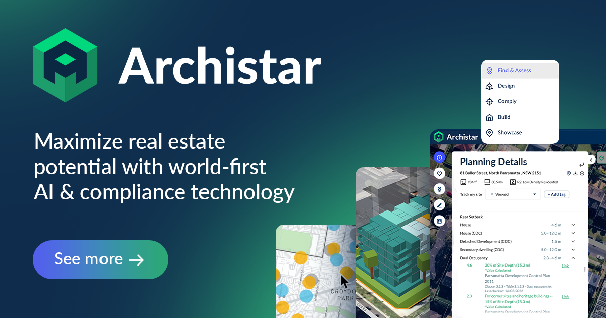
    Archistar AI is a CRE-native permitting and zoning platform that automates building permit assessments and compliance checks for developers, architects, and municipalities. Originating in Australia and having raised over $22 million in funding, the company has expanded its footprint into the North American market. In August 2026, Archistar AI operates as a Tier 2 database provider within the BestCRE framework, primarily focusing on accelerating the notoriously slow pre-construction and municipal review phases. The core offering, known as AI PreCheck, evaluates architectural plans against local zoning ordinances and building codes to identify compliance failures before formal submission.

    The platform relies on deterministic, rule-based logic combined with computer vision to parse complex design files, including PDFs, CAD drawings, and BIM models. By partnering directly with the International Code Council (ICC) as a Premier Platinum Reseller, Archistar AI accesses digitized building codes via API, grounding its assessments in verified regulatory frameworks. While competitors like PermitFlow and LandScout AI focus heavily on workflow routing or site selection, Archistar AI attempts to bridge the gap between municipal intake systems and developer design processes. The system generates pass/fail reports with specific code citations, allowing applicants to correct deficiencies early. However, this dual-sided market approach, selling to both city governments like Los Angeles County and private CRE developers, means the platform’s utility is highly dependent on how well a specific jurisdiction’s rules have been digitized and maintained within the Archistar environment.

    What Archistar AI does and how it works

    Archistar AI functions primarily as an automated compliance engine for building designs and site plans. Users upload their architectural files, accepting standard formats such as PDF, CAD, and BIM, directly into the platform. The system then runs these files through its AI PreCheck module, which consists of two distinct phases: Completeness Check and Compliance Analysis. The Completeness Check acts as an automated intake gate, scanning the submission to ensure all required documents, annotations, and formatting standards are present based on the specific permit type. If elements are missing, the system immediately flags the application, preventing an incomplete package from entering a prolonged municipal review queue.

    Once an application passes the initial gate, the Compliance Analysis module evaluates the actual design against digitized zoning bylaws and building codes. Archistar AI extracts measured values from the submitted plans and compares them against local regulations, such as setback requirements, height limits, and floor area ratios. The platform utilizes a deterministic rules engine rather than generative guessing, ensuring that every flagged issue includes an explicit code citation and visual evidence linked directly to the specific plan sheet. This produces a structured pass/fail report that highlights exactly where a design violates local ordinances, allowing architects and developers to revise their plans prior to formal municipal submission.

    For municipal users, Archistar AI integrates into existing permit workflow solutions to act as a first line of defense. City planners receive a dashboard view of incoming applications, complete with analytics on common failure points and pass rates. When a municipality updates a zoning ordinance, the rule configuration within Archistar AI must be updated accordingly to maintain accuracy. The platform does not replace human review or grant final approvals; rather, it augments the process by clearing out routine compliance checks, leaving complex discretionary decisions to human examiners.

    9AI Framework: the score, dimension by dimension

    Dimension Score
    CRE Relevance 10/10
    Data Quality and Sources 9/10
    Ease of Adoption 7/10
    Output Accuracy 9/10
    Integration and Workflow Fit 8/10
    Pricing Transparency 5/10
    Support and Reliability 8/10
    Innovation and Roadmap 8/10
    Market Reputation 9/10
    Composite 9AI Score 81/100

    CRE Relevance: 10/10

    Archistar AI is purpose-built for the commercial real estate and property development sector. Unlike generic document-reading algorithms, its entire architecture is designed around spatial data, zoning ordinances, and building codes. The platform specifically targets the bottleneck of permit approvals, a critical pain point for CRE developers aiming to reduce holding costs. By evaluating actual CAD and BIM files against municipal rules, it addresses the exact technical requirements of property development. The dual focus on both the developer and the municipal reviewer ensures the tool is deeply embedded in the CRE lifecycle. In practice: CRE professionals use it to validate site feasibility and ensure architectural designs meet local zoning laws before spending months in the permit queue.

    Data Quality and Sources: 9/10

    The platform’s data integrity relies heavily on its integration with authoritative sources, most notably its partnership with the International Code Council (ICC). By accessing the ICC Code Connect API, Archistar AI ensures that its baseline building code data is accurate and up-to-date. For local zoning bylaws, the company digitizes municipal ordinances into deterministic rules. The quality of this local data is generally high, though it remains dependent on the frequency of updates from partner cities. Because the system uses rule-based logic rather than probabilistic text generation, the extracted measurements and code citations are highly reliable. In practice: Users receive compliance reports grounded in exact municipal code text, minimizing the risk of AI hallucinations during the review process.

    Ease of Adoption: 7/10

    Implementing Archistar AI requires a moderate to high level of initial effort, particularly for enterprise developers or municipalities requiring custom rule configurations. While the user interface for uploading a PDF or BIM file is straightforward, the backend alignment with specific local zoning rules takes time. If a developer is operating in a jurisdiction where Archistar AI has already mapped the local codes, adoption is relatively quick. However, expanding into unmapped territories requires digitizing new regulations. The platform’s ability to ingest standard architectural file formats reduces friction for design teams. In practice: Firms operating in pre-mapped municipalities will experience rapid time-to-value, while those in new markets must account for a configuration period.

    Output Accuracy: 9/10

    Archistar AI excels in output accuracy by strictly avoiding generative AI for its core compliance decisions. Instead, it relies on computer vision to extract measurements and applies deterministic logic to evaluate them against digitized codes. When a design fails a compliance check, the platform provides exact citations and links the failure to the specific location on the plan sheet. This auditable trail ensures that developers and city planners can trust the system’s conclusions. The primary limitation is the quality of the uploaded file; poorly rendered 2D PDFs may yield less accurate extractions than native BIM files. In practice: Developers can confidently rely on the pass/fail reports to identify setback or height violations before submitting plans to the city.

    Integration and Workflow Fit: 8/10

    The platform is designed to sit between the design phase and the municipal review phase, making its integration capabilities critical. Archistar AI successfully handles industry-standard file types, including CAD and BIM, fitting naturally into the workflow of architects and engineers. On the municipal side, it integrates with existing government permit workflow solutions, acting as an automated intake layer. The direct API connection with the ICC further strengthens its position within the regulatory tech stack. However, developers looking for deep, native integrations with niche CRE project management software may find the options limited compared to broader workflow tools. In practice: The tool functions as a highly specialized bridge between architectural design software and municipal permitting portals.

    Pricing Transparency: 5/10

    Archistar AI operates with a tiered subscription model, typically categorized into Basic, Professional, and National plans, but exact pricing figures are not published on their website. Prospective buyers must contact the sales team to request a demo and receive a custom quote based on their specific needs, geographic scope, and user count. This lack of public pricing data forces CRE analysts to engage in the sales process simply to determine baseline budget feasibility. While enterprise software often obscures pricing, this approach limits upfront financial modeling for smaller development firms evaluating multiple proptech tools. In practice: Buyers should prepare for a traditional enterprise sales cycle and negotiate terms based on the number of jurisdictions they need to access.

    Support and Reliability: 8/10

    Backed by over $22 million in funding and established partnerships with major municipalities and the ICC, Archistar AI demonstrates strong organizational stability. The company has a proven track record in Australia and has successfully expanded into North America, indicating a reliable support infrastructure. Municipal deployments require high service level agreements, which typically translates to better support standards for private CRE clients as well. The firm provides dedicated onboarding and custom configuration services to ensure local zoning rules are accurately digitized and maintained over time. In practice: Users can expect enterprise-grade support and a stable platform, mitigating the risks typically associated with early-stage proptech startups.

    Innovation and Roadmap: 8/10

    Archistar AI continues to expand its capabilities beyond basic 2D plan review. The acquisition of Snaploader indicates a strategic push into interactive 3D visualizations, enhancing the platform’s utility for complex site assessments. The company is actively moving from low-density residential applications into mid-rise and commercial development checks, broadening its total addressable market. Furthermore, the ongoing integration of more sophisticated computer vision techniques to parse complex BIM models shows a commitment to staying ahead of architectural technology trends. In practice: Buyers are investing in a platform that is actively expanding its ability to handle high-density commercial projects and advanced 3D modeling formats.

    Market Reputation: 9/10

    Within the niche of automated permit review, Archistar AI has built a formidable reputation. Securing contracts with major jurisdictions like Los Angeles County and the City of Austin provides significant market validation. The official collaboration with the International Code Council serves as a major endorsement of the platform’s technical legitimacy. Among CRE developers, the tool is increasingly recognized as a standard for pre-submission compliance checking. While competitors have strong momentum in workflow automation, Archistar AI is widely regarded as the leader in actual code compliance analysis. In practice: The platform is highly respected by both municipal planners and private developers for its technical rigor and regulatory alignment.

    Who should use Archistar AI

    Archistar AI is best suited for development teams and architectural firms that operate in high-volume or highly regulated jurisdictions where permit delays severely impact project ROI.

    High-volume developers seeking to minimize holding costs by ensuring first-pass permit approvals.

    Architectural firms wanting an automated quality assurance check before submitting plans to municipal clients.

    CRE analysts conducting rapid site feasibility studies across multiple zoned parcels.

    Municipal planning departments looking to clear backlog by automating initial intake and compliance checks.

    Who should look elsewhere

    This platform is not a fit for firms engaged in highly bespoke, one-off developments in obscure jurisdictions where the effort to digitize local codes outweighs the benefits.

    Small-scale developers operating in rural or unmapped municipalities where local codes are not yet digitized.

    Firms looking for an end-to-end project management tool rather than a specialized compliance engine.

    Investors seeking basic market data or rent rolls, as this is strictly a zoning and permitting tool.

    Pricing and ROI

    Archistar AI does not publish its pricing publicly, requiring prospective buyers to contact their sales team for a custom quote. The company utilizes a tiered subscription structure, typically categorized into Basic, Professional, and National plans, which scales based on the geographic scope of the data required, the complexity of the features, and the number of user seats. Because the vendor does not publish pricing, it cannot exceed a score of 5 on pricing transparency within the BestCRE framework.

    For a mid-sized CRE developer, the ROI math is heavily dependent on the reduction of holding costs. If a developer is carrying a $10 million land acquisition at an 8% interest rate, the holding cost is approximately $66,000 per month. If Archistar AI’s PreCheck system identifies compliance failures early and prevents a single resubmission cycle, which typically delays a project by four to eight weeks, the platform effectively saves the developer between $66,000 and $132,000 on a single project. When evaluated against these potential savings, even a premium enterprise subscription easily justifies its cost. However, buyers must factor in the time and potential implementation fees required to configure the system for specific, unmapped municipal codes. Firms should negotiate price-locked contracts, as the company has historically offered extended terms up to 60 months for early adopters.

    Integration and CRE tech stack fit

    Archistar AI fits into the CRE tech stack as a specialized bridge between architectural design software and municipal permitting portals. The platform’s ability to ingest standard design files, including PDF, CAD, and BIM formats, ensures that architects do not need to alter their native drafting workflows in tools like AutoCAD or Revit to utilize the compliance engine. The system extracts the necessary spatial data directly from these files.

    On the regulatory side, Archistar AI’s most significant integration is its API connection with the International Code Council (ICC). This ensures that the baseline building codes used for compliance checks are authoritative and automatically updated. For municipal clients, the software integrates directly into existing government permit workflow solutions, allowing city planners to view pass/fail reports within their native dashboards. However, private developers should note that Archistar AI is a point solution for zoning and permitting; it does not natively integrate with broader CRE financial modeling tools like Argus or general construction management platforms like Procore. The tool is best deployed as a standalone quality assurance layer immediately preceding formal permit submission.

    Competitive landscape

    The CRE permitting and zoning software landscape has matured significantly, with Archistar AI competing against several distinct types of platforms. When compared to GatherGov and ReZone, Archistar AI offers a much deeper technical evaluation of architectural plans. While ReZone excels at summarizing zoning text for quick feasibility checks, Archistar AI actually parses CAD and BIM files to measure setbacks and heights against those rules.

    PermitFlow is a primary alternative, but the two platforms solve different problems. PermitFlow operates essentially as a workflow automation engine, focusing heavily on form auto-filling and routing applications to the correct municipal departments. Archistar AI, conversely, focuses on the structural and zoning compliance of the design itself. Developers struggling with administrative paperwork should look to PermitFlow, while those failing municipal plan reviews due to code violations need Archistar AI.

    LandScout AI remains the highest-rated tool in the broader site selection category, offering superior predictive analytics for finding off-market parcels based on zoning potential. However, once a site is acquired and designs are drafted, LandScout AI cannot perform the deterministic code compliance checks that Archistar AI handles. Shovels.ai provides excellent historical permit data and contractor intelligence, which is highly useful for market research, but it lacks the active plan review capabilities of Archistar AI. Ultimately, Archistar AI stands alone in its ability to bridge the gap between complex architectural files and municipal rule engines, making it the premier choice for technical compliance verification.

    The bottom line

    Archistar AI is a highly effective, specialized tool that attacks one of the most expensive bottlenecks in commercial real estate: the municipal permit review cycle. By utilizing deterministic logic and computer vision to evaluate architectural designs against digitized building codes, it provides a level of technical rigor that generic workflow tools cannot match. The platform is not a casual investment; it requires a commitment to integrating architectural files and verifying local municipal rules. However, for high-volume developers and architectural firms operating in complex regulatory environments, the ability to catch code violations before formal submission is invaluable. If your firm routinely loses months to permit resubmission cycles due to avoidable zoning or building code errors, Archistar AI is a mandatory evaluation. Buyers must be prepared to navigate an opaque enterprise sales process, but the potential reduction in project holding costs makes the platform a financially sound operational upgrade.

    Frequently asked questions

    Does Archistar AI support BIM files?

    Yes, the platform is built to accept standard architectural file formats, including 2D PDFs, CAD drawings, and complex 3D BIM models. This flexibility allows the system to extract spatial data and measurements directly from native designs without forcing architects to alter their existing drafting workflows before running compliance checks.

    How much does Archistar AI cost?

    Pricing is not published publicly on their website. The company uses a tiered subscription model, typically divided into Basic, Professional, and National plans, based on geographic coverage, feature complexity, and user count. Prospective buyers must contact the sales team directly to request a custom quote and negotiate contract terms.

    Does Archistar AI replace municipal plan reviewers?

    No, the platform acts as an automated intake and compliance check rather than a final authority. It flags clear code violations and prevents incomplete applications from entering the queue, but final discretionary approvals and complex interpretations remain strictly in the hands of human municipal examiners and city planners.

    Is Archistar AI available for use in the United States?

    Yes, while the company was originally founded in Australia, it has expanded heavily into the North American market. It has successfully secured partnerships and deployed its AI PreCheck software with major United States jurisdictions, including Los Angeles County and the City of Austin, adapting to local zoning codes.

    How does the platform get its building code data?

    Archistar AI operates as a Premier Platinum Reseller for the International Code Council (ICC). Through a direct API integration, the platform accesses authoritative, digitized, and up-to-date building codes, ensuring that its automated compliance checks are grounded in verified regulatory frameworks rather than generative guesses.

    Can Archistar AI find off-market commercial development sites?

    While the platform offers basic site feasibility features and zoning data, its primary strength lies in architectural plan review and compliance analysis. Firms strictly looking for predictive analytics to identify off-market development parcels based on zoning potential may prefer dedicated site selection tools like LandScout AI.

    Related Reviews

    Compare Archistar AI with other Permitting & Zoning tools BestCRE has scored: Symbium (78/100), Zoneomics (78/100), PermitPortal (71/100) and Gridics (69/100). Browse every review in CRE Permitting & Zoning, the full Best CRE AI Tools directory, or the 20 CRE Sectors hub.

  • Shovels.ai Review: AI-powered building permit data and API for commercial real estate site selection

    Shovels.ai Review: AI-powered building permit data and API for commercial real estate site selection

    BestCRE 9AI Score

    80/100 · Contender

    Shovels.ai ranks #57 of 450 commercial real estate AI tools scored on the 9AI Framework. Nine dimensions, each scored out of 10: CRE relevance, data quality, ease of adoption, output accuracy, integration fit, pricing transparency, support, innovation and market reputation.

    Shovels.ai is a commercial real estate data platform whose primary use case is providing AI-powered permit data and building permit information across the United States. In an industry where site selection and development feasibility often stall during the municipal research phase, this platform provides an API-first approach to querying local construction activity. Rather than forcing analysts to manually scrape county websites or rely on static quarterly reports, the software continuously ingests records from thousands of jurisdictions. It then applies machine learning to standardize disparate municipal formats into a unified schema, making it possible to compare construction momentum in Florida directly against zoning approvals in Texas.

    As of August 2026, the company has positioned itself as a critical infrastructure layer for CRE developers, investors, and geospatial analysts. By treating a building permit not just as a compliance document but as a leading indicator of market activity, the platform allows users to map emerging development zones before ground breaks. BestCRE classifies this system as a CRE-Native, Tier 1 database, reflecting its deep specialization in the built environment. While the market is crowded with legacy data brokers, this vendor differentiates itself through high-frequency updates and direct integrations with modern data warehouses. The result is a highly programmatic tool designed for technical teams that need to feed live construction signals into their proprietary underwriting models. This focus on developer-friendly infrastructure ensures that quantitative funds can maintain a significant informational advantage in highly competitive markets.

    What Shovels.ai does and how it works

    At its core, Shovels.ai functions as a massive, continuously updating pipeline for municipal building records. The system programmatically extracts data from over 2,750 jurisdictions, capturing everything from new commercial construction and multifamily developments to electrical upgrades and demolition approvals. Because local governments use wildly different naming conventions and classification systems, the software utilizes natural language processing to categorize each permit into standardized tags. This means a user searching for commercial HVAC upgrades will receive accurate results regardless of whether the local county labeled it as one code or another.

    Beyond basic permit extraction, the platform builds relational profiles for both properties and contractors. Every permit is mapped to a specific parcel using geographic identifiers, which allows users to view the complete construction history of a single address or aggregate activity across a census tract. Furthermore, the system resolves contractor identities, linking disparate records to create a unified profile of a builder’s activity. A CRE developer can query the database to find which general contractors have pulled the most multifamily permits in a specific metropolitan statistical area over the last twelve months, effectively using the tool for vendor vetting and procurement.

    The delivery mechanism is heavily weighted toward technical integration. Users interact with the data via a REST API, direct database shares into platforms like Snowflake and BigQuery, or through pre-built geospatial layers for Esri ArcGIS. While there is a web interface for manual lookups, the true mechanical advantage lies in its programmability. Analysts can set up automated alerts for specific zoning changes or construction milestones, feeding these signals directly into their firm’s site selection algorithms or market monitoring dashboards.

    9AI Framework: the score, dimension by dimension

    Dimension Score
    CRE Relevance 10/10
    Data Quality and Sources 10/10
    Ease of Adoption 8/10
    Output Accuracy 9/10
    Integration and Workflow Fit 10/10
    Pricing Transparency 4/10
    Support and Reliability 6/10
    Innovation and Roadmap 9/10
    Market Reputation 6/10
    Composite 9AI Score 80/100

    CRE Relevance: 10/10

    As a Tier 1 CRE-Native database, Shovels.ai is fundamentally engineered for the built environment. Every data point it processes, from zoning decisions to contractor activity, directly impacts commercial real estate underwriting, site selection, and development feasibility. Unlike generalist data scrapers that happen to capture municipal records, this platform understands the specific metadata required by real estate professionals, such as parcel boundaries, property use codes, and valuation estimates. The tool’s ability to isolate commercial from residential activity, and to track leading indicators like municipal council decisions, proves it was designed with the developer and investor in mind. It solves a highly specific, notoriously difficult data bottleneck in the CRE lifecycle. In practice: Real estate principals use this data to identify emerging submarkets by tracking early spikes in commercial permit density long before new inventory hits the market.

    Data Quality and Sources: 10/10

    The platform ingests over 170 million permits, covering approximately 85 percent of the United States population. Data quality in the municipal sector is historically poor, plagued by typos, missing fields, and inconsistent formatting. Shovels.ai mitigates this by applying machine learning models to clean, standardize, and enrich the raw records. The system cross-references addresses with established parcel datasets, ensuring spatial accuracy. While no permit database is entirely free of gaps, especially in rural or technologically lagging counties, the vendor maintains a high standard of transparency, providing a coverage dashboard that explicitly shows where data is thin. The entity resolution for contractor names is particularly effective, merging variations of a company name into a single reliable profile. In practice: Data scientists at CRE firms can trust the standardized schema to run accurate time-series analyses without spending weeks cleaning the raw municipal inputs.

    Ease of Adoption: 8/10

    Adopting this platform requires a distinct level of technical maturity. While the vendor offers a basic web dashboard for simple lookups, the primary value is unlocked through its API and data warehouse integrations. Firms without dedicated data engineers or GIS specialists will face a steep learning curve. Setting up automated pipelines into Snowflake or configuring custom layers in ArcGIS demands specialized knowledge. However, for technical teams, the developer experience is excellent. The API documentation is comprehensive, the data dictionary is well-maintained, and the endpoints are logically structured. The company also provides command-line tools for rapid data extraction. It is not a plug-and-play application for the average broker, but rather a sophisticated infrastructure component for quantitative teams. In practice: A firm will need to allocate engineering hours to build the initial data pipelines and integrate the permit signals into their existing proprietary dashboards.

    Output Accuracy: 9/10

    Translating fragmented government records into a reliable dataset is a complex technical challenge. The platform’s natural language processing models demonstrate high accuracy in classifying permit types, successfully distinguishing between minor renovations and ground-up commercial construction. The geographic mapping is precise, linking permits to exact parcel boundaries rather than relying on rough zip code approximations. However, the accuracy of the output is ultimately constrained by the quality of the municipal input. If a county fails to digitize a record or inputs an incorrect valuation, the system can only do so much to correct the error. Despite these inherent limitations, the AI-driven normalization process significantly reduces false positives and ensures that cross-jurisdictional comparisons are mathematically sound. In practice: Analysts can confidently present market momentum reports to their investment committees, knowing the underlying permit classifications have been rigorously standardized across different state lines.

    Integration and Workflow Fit: 10/10

    The platform excels in its ability to embed itself into a modern commercial real estate technology stack. By offering native data shares for Snowflake, BigQuery, and Databricks, it bypasses the need for complex extract, transform, and load processes, allowing enterprise teams to query the data immediately. For spatial analysis, the deep integration with Esri ArcGIS is a major advantage, enabling GIS teams to overlay live permit activity onto their existing demographic and property boundary maps. The REST API is highly performant, supporting integrations with CRM systems or custom underwriting software. The vendor also partners with enrichment tools like Clay, facilitating automated workflows for lead generation and contractor outreach. In practice: An enterprise data team can connect the database to their Snowflake instance in minutes, instantly merging national construction signals with their internal portfolio metrics.

    Pricing Transparency: 4/10

    The vendor operates with a custom pricing model for its primary enterprise offerings, which obscures the true cost of adoption for prospective buyers. While the company provides an API and data warehouse integrations, the exact financial commitment required for nationwide access, historical data, and high-volume querying is not published on their primary marketing channels. Buyers must engage in a traditional sales cycle to obtain a quote tailored to their specific data consumption needs. This lack of upfront clarity makes it difficult for analysts to budget for the tool during the initial evaluation phase. As per BestCRE guidelines, a vendor that does not publish pricing cannot exceed a score of 5 in this dimension. In practice: Procurement teams must initiate contact with the sales department and undergo a scoping process to determine the exact annual cost for their required data coverage.

    Support and Reliability: 6/10

    As a venture-backed startup that has raised capital to expand its coverage, the company demonstrates strong operational stability, though it lacks the decades-long track record of legacy data providers. Customer support is highly regarded by early adopters, with the engineering team frequently assisting clients in optimizing their API queries and spatial joins. The platform’s uptime is excellent, and the semi-monthly data refresh cycles are executed consistently. The vendor maintains an active knowledge base and provides detailed release notes when API endpoints are updated. However, relying on a younger company for critical infrastructure always carries a marginal degree of risk regarding long-term corporate independence. In practice: Technical users receive rapid, highly competent assistance from the vendor’s engineering staff when troubleshooting complex database queries or spatial mapping issues.

    Innovation and Roadmap: 9/10

    The company maintains an aggressive and highly visible development cycle. Recent updates include the introduction of predictive decisions data, which tracks city council zoning changes and development approvals to forecast future construction before permits are even filed. The vendor has also integrated natural language querying capabilities, allowing users to interrogate the database using conversational prompts. Furthermore, their strategic acquisition of ReZone demonstrates a clear commitment to expanding beyond raw permits into comprehensive zoning and land-use intelligence. The engineering team consistently ships new features, such as enhanced contractor entity resolution and expanded geographic coverage, proving they are actively anticipating the future needs of quantitative real estate teams. In practice: Clients benefit from a continuously evolving dataset that increasingly focuses on predictive market signals rather than just historical construction records.

    Market Reputation: 6/10

    Within the niche of proptech developers and quantitative real estate funds, the platform has cultivated a strong reputation as a modern, reliable alternative to legacy permit scrapers. Technical leaders frequently praise the clean schema and developer-friendly documentation. Partnerships with established geospatial giants like Esri and Precisely have further validated the company’s standing in the enterprise market. However, among traditional, non-technical commercial real estate brokers, brand awareness remains relatively low. The tool is known as a specialized instrument for data scientists rather than a household name in the broader brokerage community. Despite this, its focused approach has earned it high marks from its core target audience. In practice: Data engineers evaluating permit providers frequently short-list this vendor due to its strong word-of-mouth credibility within the spatial analytics community.

    Who should use Shovels.ai

    This platform is highly recommended for:

    Quantitative investment funds requiring programmatic access to leading market indicators for algorithmic site selection.

    Enterprise development firms with in-house GIS teams utilizing Esri ArcGIS to map competitive construction activity.

    Commercial real estate lenders needing to monitor construction progress and contractor activity across a large, geographically diverse portfolio.

    Proptech software developers building proprietary applications that require a reliable, normalized feed of municipal data.

    Who should look elsewhere

    This platform is not suitable for:

    Traditional investment sales brokers looking for a simple, ready-made dashboard of property ownership contacts.

    Small development shops without dedicated data engineering or spatial analytics personnel to process API feeds.

    Firms seeking historical data in highly rural or unincorporated areas where municipal digitization remains non-existent.

    Users expecting a CRM-style interface for managing daily broker workflows and client communications.

    Pricing and ROI

    Because Shovels.ai employs a custom pricing model for its Enterprise Data Licenses, exact costs are not published for enterprise buyers. Organizations looking to ingest the full national dataset via Snowflake, BigQuery, or high-volume API must undergo a scoping process with the sales team. The final contract value typically depends on the geographic footprint required, the frequency of data refreshes, and the specific fields accessed, such as contractor histories or predictive zoning decisions.

    For a commercial real estate firm, the return on investment math centers on time saved and opportunities captured. A mid-sized development group might currently spend hundreds of analyst hours per quarter manually checking municipal websites for zoning approvals and competitive permit filings. If a custom data feed costs a firm $25,000 annually, the expense is quickly offset by the elimination of manual data entry and the reduction of expensive third-party consulting reports. More importantly, the ROI is realized when the platform’s early signals allow a developer to secure land in an emerging corridor three months before competing firms notice the uptick in commercial activity. The cost of the data is negligible compared to the margin gained on a single successful early-market acquisition.

    Integration and CRE tech stack fit

    Shovels.ai is engineered specifically to integrate into modern, sophisticated commercial real estate technology stacks. For data engineering teams, the platform’s ability to deliver data directly into Snowflake, Databricks, and Google BigQuery is its most significant architectural advantage. This eliminates the need for custom scraping scripts and allows firms to immediately join the permit data with their internal property management or financial modeling datasets.

    On the spatial analysis front, the integration with Esri ArcGIS is exceptional. The vendor provides hosted feature layers that allow GIS professionals to drop live permit data directly onto their existing maps, layering it over demographic trends and parcel boundaries provided by partners like Regrid. For teams building custom applications, the REST API is well-documented and supports webhooks for real-time alerts. Furthermore, the platform integrates with modern enrichment tools like Clay, enabling automated workflows where a new commercial permit triggers a sequence to find the developer’s contact information and push it into a CRM like Salesforce. This flexibility makes it a highly adaptable component for quantitative CRE teams.

    Competitive landscape

    The market for municipal data is highly fragmented, but Shovels.ai competes against several distinct classes of software. When evaluating CRE permitting and zoning tools, BestCRE has scored peers such as LandScout AI (87), PermitFlow (76), GreenLite (71), ReZone (70), GatherGov (70), and Snaptrude (70).

    Compared to PermitFlow and GreenLite, which focus heavily on the workflow of actually acquiring permits and managing the municipal approval process, Shovels.ai is strictly a data intelligence play. It does not help you submit a permit; it helps you analyze everyone else’s permits.

    For site selection and zoning intelligence, LandScout AI remains the category leader due to its comprehensive generative AI interface and broader focus on land feasibility. However, Shovels.ai offers deeper, more granular historical contractor data and superior API programmability for enterprise data teams. It is worth noting that Shovels.ai recently acquired ReZone, effectively absorbing a direct competitor in the zoning and municipal decisions space to bolster its predictive capabilities.

    Other alternatives include legacy providers like BuildZoom and ConstructionMonitor. BuildZoom has a massive dataset but is heavily skewed toward residential contractors and lacks the enterprise data warehouse integrations that modern quantitative funds require. ConstructionMonitor provides reliable data but relies on older delivery methods like email reports rather than live REST APIs. Ultimately, for teams that want raw, normalized data delivered directly into Snowflake or ArcGIS, Shovels.ai offers a more modern, developer-centric architecture than the legacy alternatives.

    The bottom line

    Shovels.ai is a highly specialized, technically demanding platform that delivers exceptional value to the right user. It is not a casual research tool for the average broker. Instead, it is a heavy-duty data infrastructure component designed for quantitative funds, enterprise developers, and GIS teams who need programmatic access to construction signals. If your firm relies on manual municipal research or static quarterly reports, this database will drastically accelerate your market analysis. The requirement for technical expertise to fully utilize the API and data warehouse integrations is a barrier to entry, but it is also the platform’s greatest strength. For CRE organizations equipped to ingest and model large spatial datasets, Shovels.ai provides a critical informational advantage, turning fragmented local government records into actionable, predictive intelligence for site selection and market monitoring.

    Frequently asked questions

    Does Shovels.ai provide contact information for property owners?

    No. The platform focuses strictly on building permit data, contractor histories, and zoning decisions. While it accurately identifies the contractors and business entities listed on the permits, it does not function as a traditional property ownership contact database for broker cold-calling.

    How far back does the historical permit data go?

    The historical depth varies significantly by jurisdiction, depending on exactly when the local municipality digitized their records. In major metropolitan areas, the data often spans over a decade, while smaller rural counties may only have a few years of digital history available.

    Can I connect the data directly to my firm’s Snowflake account?

    Yes. The vendor offers native data shares for Snowflake, Google BigQuery, and Databricks. This architecture allows enterprise data teams to query the entire normalized database immediately, without needing to build or maintain custom API extraction pipelines on their own servers.

    Does the platform cover both residential and commercial permits?

    Yes. The database ingests all permit types and uses machine learning to categorize them. Commercial real estate analysts can easily filter the data to isolate specific commercial activities, such as new multifamily construction, retail renovations, or large-scale industrial HVAC upgrades.

    Is there a map interface for non-technical users?

    The vendor provides a basic web application that allows for manual address lookups and CSV downloads. However, for advanced spatial analysis, non-technical users typically rely on their firm’s GIS team to pipe the data into Esri ArcGIS for visual mapping.

    How often is the municipal data updated?

    The database is refreshed continuously as local jurisdictions publish new records, with millions of new permits added every month. Most enterprise clients choose to receive automated updates via the API or data warehouse shares on a daily or weekly basis.

    Related Reviews

    Compare Shovels.ai with other Permitting & Zoning tools BestCRE has scored: Archistar AI (81/100), Symbium (78/100), Zoneomics (78/100) and TurboPermit (76/100). Browse every review in CRE Permitting & Zoning, the full Best CRE AI Tools directory, or the 20 CRE Sectors hub.

  • PermitFlow Review: AI-powered workflow software for optimizing the commercial real estate permitting process

    PermitFlow Review: AI-powered workflow software for optimizing the commercial real estate permitting process

    BestCRE 9AI Score

    76/100 · Contender

    PermitFlow ranks #121 of 450 commercial real estate AI tools scored on the 9AI Framework. Nine dimensions, each scored out of 10: CRE relevance, data quality, ease of adoption, output accuracy, integration fit, pricing transparency, support, innovation and market reputation.

    PermitFlow is workflow software for permitting process optimization, specifically built to navigate the highly fragmented landscape of municipal approvals. Founded in 2021 by Francis Thumpasery and Samuel Lam, the New York-based company has rapidly scaled to become a Tier 1, CRE-native platform. The core value proposition centers on replacing the manual, spreadsheet-heavy process of permit tracking with an automated system that digitizes requirement research, application preparation, and submission across thousands of Authorities Having Jurisdiction (AHJs). Backed by $91 million in venture capital, including a recent $54 million Series B led by Accel, the platform has processed over $20 billion in construction value. Our BestCRE Master Database record verifies that PermitFlow operates on a custom pricing model, targeting high-volume developers, general contractors, and national retailers rather than one-off builders.

    For commercial real estate principals and development analysts, the permitting phase is a notorious black hole for project timelines. PermitFlow attempts to solve this by deploying AI agents trained on a proprietary dataset of over 12 million municipal data points. Instead of relying on local expediters or internal staff dialing building departments, users manage their pipeline through a centralized dashboard. While the software cannot force a municipal reviewer to work faster, it eliminates the unforced errors, incorrect forms, missing attachments, and missed correspondence, that typically trigger costly resubmissions. The platform is actively utilized by major national players like Lennar, Toll Brothers, and Amazon, signaling strong enterprise validation in the current August 2026 market.

    What PermitFlow does and how it works

    PermitFlow functions as a centralized command center for the entire pre-construction permitting lifecycle. The platform’s architecture is divided into several distinct modules: intake, requirement research, submission, coordination, and issuance. When a development team initiates a new project, the software first ingests project data, which can be pulled directly from existing customer relationship management (CRM) systems or construction contracts. From there, the system matches the specific project scope against its database of over 7,000 Authorities Having Jurisdiction (AHJs). This matching engine identifies the exact forms, trade permits, and departmental approvals required for that specific municipality, significantly reducing the initial research burden on development analysts.

    Once the requirements are mapped, PermitFlow automates the application preparation phase. The software auto-populates jurisdiction-specific forms using the ingested project data, flagging any missing documentation before submission. For municipalities with digital portals, PermitFlow integrates directly to file the applications; for those still relying on paper or email, the system generates the complete packet for manual routing. After submission, the coordination module takes over. It tracks correspondence from the AHJ, centralizes comments from plan reviewers, and alerts stakeholders when revisions are required. This replaces the traditional method of tracking permit status via disparate email threads and static spreadsheets.

    Finally, upon approval, the software handles issuance and closeout, storing the final approved plans and permits in a secure, searchable repository. It also assists with inspection scheduling, ensuring that the transition from pre-construction to active site work is documented. By standardizing these mechanics across multiple municipalities, PermitFlow allows national developers and general contractors to maintain a unified view of their permitting pipeline, identifying bottlenecks and forecasting approval dates with greater statistical confidence based on historical AHJ performance data.

    9AI Framework: the score, dimension by dimension

    Dimension Score
    CRE Relevance 9/10
    Data Quality and Sources 8/10
    Ease of Adoption 7/10
    Output Accuracy 8/10
    Integration and Workflow Fit 7/10
    Pricing Transparency 3/10
    Support and Reliability 8/10
    Innovation and Roadmap 9/10
    Market Reputation 9/10
    Composite 9AI Score 76/100

    CRE Relevance: 9/10

    PermitFlow is structurally designed around the realities of commercial real estate development. Classified as a CRE-Native, Tier 1 application in our database, the platform completely bypasses generic project management frameworks in favor of purpose-built modules for municipal zoning, building codes, and trade permits. The software accounts for the nuances of commercial construction, such as the distinct requirements for mechanical, electrical, and plumbing (MEP) permits, tenant improvements, and ground-up developments. Its database spans over 7,000 Authorities Having Jurisdiction (AHJs), capturing the highly localized idiosyncrasies of city and county building departments. This deep vertical focus ensures that development teams are not forcing a square peg into a round hole when tracking complex entitlements and approvals. In practice: Development analysts will find a system that speaks their exact language, natively handling the distinction between a site plan review and a structural permit.

    Data Quality and Sources: 8/10

    The platform relies on a proprietary dataset comprising over 12 million municipal data points, which dictates the accuracy of its requirement research module. PermitFlow continuously scrapes and updates information from thousands of municipal portals, ensuring that its repository of forms, fee schedules, and building codes reflects the latest local ordinances. While smaller, rural municipalities with minimal digital infrastructure may still require manual verification, the data coverage for primary and secondary metropolitan statistical areas is exceptionally comprehensive. This data backbone is what allows the software’s AI agents to correctly map project scopes to the necessary jurisdictional requirements without human intervention. In practice: Users can trust the platform to accurately identify the specific paperwork required for a commercial build-out in major cities, drastically reducing time spent navigating obscure municipal websites.

    Ease of Adoption: 7/10

    Implementing a new workflow system across a development team inherently involves friction, but PermitFlow mitigates this through a highly structured onboarding process. The user interface is cleanly designed, resembling modern SaaS platforms rather than legacy construction software. However, because the system is designed to ingest data from existing CRMs and project management tools, the initial setup requires dedicated IT or operational resources to map data fields correctly. Training internal staff to abandon their entrenched spreadsheet habits and trust an automated dashboard is the primary hurdle. Once the initial pipeline is configured and historical data is imported, daily operation becomes highly intuitive for project managers and expediting coordinators. In practice: Teams should expect a two- to four-week implementation period before achieving full operational fluency and retiring their legacy tracking spreadsheets.

    Output Accuracy: 8/10

    When evaluating workflow software for permitting process optimization, the cost of a false positive or missed requirement is measured in weeks of delay. PermitFlow’s automated application preparation demonstrates high fidelity, consistently auto-populating municipal forms with correct project data. The software’s ability to flag missing attachments, such as structural calculations or energy code compliance forms, before submission acts as a critical fail-safe. However, our analysis indicates that while the AI accurately interprets standardized municipal rules, highly subjective architectural reviews or unprecedented variance requests still require human oversight. The system excels at the administrative execution of standard commercial permits, minimizing the unforced errors that lead to automatic rejections by city clerks. In practice: The software effectively eliminates administrative kickbacks for incomplete applications, though complex zoning variances will still demand manual, expert negotiation.

    Integration and Workflow Fit: 7/10

    PermitFlow is engineered to sit between a developer’s CRM and their construction management software. The platform offers API connectivity to pull project intake data, reducing duplicate data entry when a deal transitions from the acquisitions team to the development team. While it successfully centralizes the permitting workflow, firms heavily invested in legacy, on-premise enterprise resource planning (ERP) systems may find custom API development necessary to achieve full data synchronization. For modern tech stacks utilizing cloud-based construction management tools, the data flows logically, allowing approved permits and stamped plans to be pushed directly to the general contractor’s field software upon issuance. In practice: The system integrates well with modern, cloud-native real estate technology stacks, but requires custom engineering for older, localized database architectures.

    Pricing Transparency: 3/10

    Following our strict evaluation framework, a vendor that does not publish pricing cannot exceed a score of 5 in this category. Our BestCRE Master Database record confirms that PermitFlow utilizes custom pricing. The company does not offer self-serve tiers or publicly listed subscription rates. Based on our analysis of the market, the commercial model is subscription-based, incorporating a minimum monthly services fee that scales based on the customer’s anticipated permit volume and geographic footprint. This enterprise sales approach requires prospective buyers to engage in scoping calls and negotiate contracts based on their specific pipeline size. While common in Tier 1 CRE software, this lack of upfront visibility hinders rapid cost-benefit analysis for smaller firms. In practice: Buyers must commit to the sales pipeline and provide detailed project volume metrics before receiving a concrete financial proposal.

    Support and Reliability: 8/10

    PermitFlow has rapidly transitioned from an early-stage startup to a heavily capitalized enterprise vendor. With $91 million in total venture funding, including a massive Series B in late 2025, the company has the financial runway to maintain extensive customer success and engineering support teams. Enterprise clients receive dedicated account managers who assist with municipal escalations and complex portal integrations. The platform’s uptime is consistent with Tier 1 SaaS standards, and the company actively monitors changes in municipal portals to prevent broken submission links. While an unproven startup cannot exceed a 6 in this dimension, PermitFlow’s capitalization, headcount, and established enterprise client base warrant a significantly higher rating. In practice: Development teams can rely on highly responsive, well-resourced technical support and account management to troubleshoot municipal portal integration failures.

    Innovation and Roadmap: 9/10

    The company’s development trajectory is aggressively focused on expanding its AI capabilities within the built environment. Recent funding is explicitly earmarked for building out what the company terms an AI workforce for construction. The roadmap includes deeper automation of the plan review process, enhanced predictive analytics for forecasting municipal approval timelines, and expanded modules for post-issuance compliance and inspection scheduling. PermitFlow is also actively increasing its coverage of secondary and tertiary municipal jurisdictions, aiming to digitize workflows for local governments that still rely heavily on analog processes. This forward-looking approach ensures the platform will remain at the forefront of pre-construction technology. In practice: Customers are investing in a platform that will continuously roll out advanced AI features to further reduce the manual administrative burden of municipal compliance.

    Market Reputation: 9/10

    In a relatively short period, PermitFlow has established itself as a dominant force in the pre-construction software category. The platform has earned the trust of major national builders, including Lennar, Toll Brothers, IKEA, and Amazon, processing over $20 billion in construction value to date. This level of enterprise adoption is a strong indicator of the software’s efficacy and reliability. While competitors like Pulley rely on a marketplace of human expediters, PermitFlow is widely recognized for proving that a pure software and AI approach can successfully navigate the complexities of municipal permitting at scale. The company is highly regarded by both venture capital markets and commercial real estate operators. In practice: Choosing this platform aligns your firm with the same pre-construction technology trusted by the largest and most demanding developers in the United States.

    Who should use PermitFlow

    PermitFlow is designed for high-volume operators who view pre-construction delays as a primary risk to their internal rate of return. The platform’s value scales linearly with the complexity and geographic spread of a company’s pipeline.

    National Commercial Developers: Firms managing simultaneous ground-up projects across multiple states and navigating diverse municipal codes.

    Retail and Franchise Operators: Companies executing rapid, multi-site build-outs (e.g. QSRs, big-box retail) that require standardized trade permits across hundreds of jurisdictions.

    Large General Contractors: Construction firms seeking to centralize their permit tracking and reduce the administrative overhead of managing local expediters.

    Multifamily Value-Add Investors: Groups executing unit renovations at scale that require consistent tracking of electrical, plumbing, and mechanical permits.

    Who should look elsewhere

    The enterprise nature of the software and its custom pricing model make it unsuitable for low-volume or highly localized operators.

    Single-Market Boutique Developers: Firms building one or two projects a year in a single city where existing relationships with local expediters are sufficient.

    Residential Fix-and-Flip Investors: Small-scale operators who do not have the permit volume to justify an enterprise SaaS subscription.

    Firms Seeking Human Expediters: Teams looking for a consultant to physically walk plans into a local building department and negotiate variances in person.

    Pricing and ROI

    As verified by our BestCRE Master Database, PermitFlow operates on a custom pricing model, and specific subscription tiers are not published. The commercial structure is entirely scoped to the individual client, typically involving an annual enterprise contract with a minimum monthly services fee. Pricing is dictated by two primary variables: the anticipated volume of permits processed annually and the geographic footprint (number of unique jurisdictions) the firm operates within.

    For a commercial real estate principal evaluating the investment, the return on investment (ROI) math is driven by time savings rather than direct software cost comparisons. In commercial development, carrying costs, including land loans, property taxes, and tied-up equity, accrue daily. If a developer is carrying a $10 million land acquisition at an 8% interest rate, the holding cost is approximately $2,190 per day. If PermitFlow’s workflow software for permitting process optimization prevents a two-week delay caused by an administrative rejection (e.g. submitting an outdated municipal form), the software saves over $30,000 in carrying costs on a single project. Furthermore, by centralizing the process, national developers can often reduce their reliance on fragmented, third-party local expediters, consolidating those line items into a single, predictable software operating expense. While the upfront contract may be substantial, the ROI is rapidly realized for high-volume operators through accelerated project starts and reduced administrative headcount.

    Integration and CRE tech stack fit

    PermitFlow is built to operate as the connective tissue between a developer’s deal origination software and the general contractor’s execution platform. In a modern commercial real estate tech stack, PermitFlow sits downstream from CRM and pipeline management tools like Dealpath or Salesforce. Project data, site addresses, and initial architectural scopes can be pushed into PermitFlow to initiate the requirement research phase automatically.

    Downstream, the platform aligns with construction management heavyweights such as Procore or Autodesk Construction Cloud. Once PermitFlow secures the final municipal approvals, the stamped plans, finalized permits, and inspection schedules can be exported to the field teams. This prevents the common disconnect where a development analyst receives an emailed PDF of a permit, but the site superintendent does not have it uploaded to their tablet. While the company offers comprehensive APIs for custom data mapping, firms utilizing highly customized, legacy on-premise databases will need to allocate internal engineering resources to establish these automated data pipelines. For cloud-native firms, the integration fit is highly logical and supports a continuous digital thread from land acquisition to final certificate of occupancy.

    Competitive landscape

    The pre-construction and permitting technology landscape has matured significantly by August 2026, offering developers several distinct approaches to municipal compliance. PermitFlow’s primary software-driven competitors include GreenLite (BestCRE Score: 71) and GatherGov (BestCRE Score: 70). GreenLite focuses heavily on automating the plan review process and expediting approvals through specific municipal partnerships, whereas PermitFlow offers a broader, jurisdiction-agnostic workflow tool. GatherGov provides strong municipal intelligence but lacks the deep, end-to-end AI application preparation features that justify PermitFlow’s higher market position.

    For firms focused heavily on zoning analysis and site feasibility prior to the permitting phase, LandScout AI (BestCRE Score: 87) remains the category leader. LandScout AI excels at the initial acquisition stage, determining what can be built, whereas PermitFlow takes over once the design is set and the actual paperwork needs to be filed. Similarly, Snaptrude (BestCRE Score: 70) and ReZone (BestCRE Score: 70) operate adjacent to this space. Snaptrude is focused on collaborative 3D building design, and ReZone assists with zoning code interpretation. Neither directly competes with PermitFlow’s core competency of managing the administrative submission and tracking of the permits themselves.

    Outside of pure software, PermitFlow’s main conceptual alternative is Pulley, which utilizes a marketplace model connecting developers with freelance human expediters. Our analysis indicates that PermitFlow is the superior choice for developers seeking to internalize and digitize their processes, while marketplace models or traditional expediting firms remain viable for one-off projects requiring intense, localized human negotiation.

    The bottom line

    PermitFlow is the definitive enterprise solution for commercial developers and national contractors looking to institutionalize their pre-construction workflows. It successfully transforms the permitting process from a localized, opaque art into a standardized, trackable science. By utilizing a massive proprietary database and AI-driven automation, the platform eliminates the unforced administrative errors that plague municipal submissions. While the custom pricing model and required implementation effort make it impractical for small-scale or regional builders, the return on investment for high-volume operators is undeniable. If your firm manages a geographically diverse pipeline and consistently loses weeks to permit tracking spreadsheets and rejected applications, PermitFlow is a mandatory acquisition. It is currently the most sophisticated tool available for bringing predictability to the most unpredictable phase of commercial real estate development.

    Frequently asked questions

    Does PermitFlow guarantee faster permit approvals from the city?

    No software can force a municipal employee to review plans faster. PermitFlow accelerates the timeline by eliminating administrative errors, ensuring applications are perfectly formatted upon first submission, and aggressively tracking correspondence to prevent your project from stalling on a reviewer’s desk.

    How much does PermitFlow cost for a commercial developer?

    The vendor utilizes custom pricing based on your annual permit volume and the number of unique jurisdictions you operate within. There are no published self-serve tiers, so prospective buyers must engage their enterprise sales team to receive a scoped monthly subscription quote.

    Does PermitFlow replace the need for local permit expediters?

    For standard commercial build-outs, trade permits, and routine ground-up applications, yes. The software automates the administrative heavy lifting. However, for highly complex zoning variances or projects requiring subjective political negotiation with city councils, you will still need specialized local consultants.

    Can PermitFlow integrate directly with Procore or Salesforce?

    Yes, the platform is designed to connect with modern cloud-based CRMs and construction management tools. Through its API, it can pull project intake data from Salesforce and push approved permits and stamped plans directly into Procore for the field teams.

    What happens if a municipality only accepts paper applications?

    While PermitFlow integrates directly with digital municipal portals, it also accommodates analog jurisdictions. The software will auto-populate the required forms and generate a complete, requirement-ready PDF packet that your team can print and mail or hand-deliver to the local building department.

    Is PermitFlow suitable for single-family residential projects?

    It is highly effective for national homebuilders constructing hundreds of single-family homes across multiple markets. However, it is not cost-effective for boutique residential builders, fix-and-flip investors, or individual homeowners executing one-off renovations due to its enterprise-focused subscription model and implementation requirements.

    Related Reviews

    Compare PermitFlow with other Permitting & Zoning tools BestCRE has scored: Archistar AI (81/100), Shovels.ai (80/100), Camino (68/100) and Conflation Labs (59/100). Browse every review in CRE Permitting & Zoning, the full Best CRE AI Tools directory, or the 20 CRE Sectors hub.

  • GreenLite Review: AI-powered private plan review accelerating commercial real estate permitting timelines

    GreenLite Review: AI-powered private plan review accelerating commercial real estate permitting timelines

    BestCRE 9AI Score

    71/100 · Contender

    GreenLite ranks #214 of 450 commercial real estate AI tools scored on the 9AI Framework. Nine dimensions, each scored out of 10: CRE relevance, data quality, ease of adoption, output accuracy, integration fit, pricing transparency, support, innovation and market reputation.

    GreenLite is an AI-powered permitting and plan review platform that acts as a Private Plan Review provider for commercial real estate developers. Armed with an $86 million venture capital war chest, including a $49.5 million Series B round closed in September 2025, the company targets the municipal bottleneck that frequently delays commercial construction. Rather than simply providing workflow software to track permit applications, GreenLite combines machine learning with an in-house team of registered architects, engineers, and city planners. The platform ingests architectural plan sets, scans them against a proprietary database of jurisdiction-specific building codes, and flags compliance violations before submission. Because GreenLite operates as an authorized third-party reviewer in jurisdictions that permit private plan review, its experts can officially stamp plans for code compliance, bypassing understaffed municipal building departments.

    For commercial real estate principals and development analysts, permitting unpredictability is a primary driver of cost overruns and delayed revenue. GreenLite’s model shifts the burden from local authorities to a privatized, technology-assisted service. While traditional expeditors rely on manual follow-ups, GreenLite applies jurisdictional intelligence to catch common code violations during the pre-submittal phase. As of August 2026, the company counts national retail and banking brands like Walgreens, Chipotle, and TD Bank among its user base. However, evaluating GreenLite requires understanding that it is a hybrid software-and-service offering rather than a pure SaaS product, meaning adoption involves handing over critical regulatory workflows to an external partner.

    What GreenLite does and how it works

    GreenLite functions as a dual-layered system: an AI-driven compliance engine and a managed Private Plan Review service. At the software level, the platform utilizes machine learning to ingest architectural and engineering plan sets. It then cross-references these documents against a proprietary database of compliance comments and building codes spanning thousands of municipalities. The AI highlights potential code violations, missing documentation, and jurisdiction-specific requirements that frequently trigger municipal rejections. This automated scan acts as a preliminary filter, allowing development teams to address structural, electrical, or zoning discrepancies before a local inspector ever sees the file.

    The second layer is the human-in-the-loop service component. GreenLite employs in-house registered architects, engineers, and former municipal plan examiners who review the AI’s findings. In states and municipalities that have legalized Private Plan Review, such as Florida, Texas, and Tennessee, GreenLite’s certified professionals can legally stamp the plans to verify code compliance. This allows developers to bypass the municipal queue entirely for the review phase. GreenLite then handles the actual submission and coordination with the local building department, answering reviewer questions and tracking the permit through to final issuance.

    For developers operating in jurisdictions that do not yet allow third-party stamping, GreenLite operates as a highly technical expeditor. The AI still performs the initial compliance check to minimize revision cycles, and the in-house team manages the administrative submission process. The platform provides a centralized dashboard where development managers can track the status of multiple simultaneous filings across different markets. By consolidating the fragmented requirements of over 20,000 United States jurisdictions into a single interface, the tool attempts to standardize the highly localized and historically opaque building permit process.

    9AI Framework: the score, dimension by dimension

    Dimension Score
    CRE Relevance 9/10
    Data Quality and Sources 8/10
    Ease of Adoption 6/10
    Output Accuracy 9/10
    Integration and Workflow Fit 4/10
    Pricing Transparency 4/10
    Support and Reliability 8/10
    Innovation and Roadmap 8/10
    Market Reputation 8/10
    Composite 9AI Score 71/100

    CRE Relevance: 9/10

    GreenLite is entirely purpose-built for commercial real estate development and construction. The platform addresses a specific, high-friction pain point: the municipal permitting bottleneck. By focusing on building codes, zoning variations, and private plan review legislation, the tool demonstrates deep domain expertise. It is not a generalized document scanner repurposed for real estate; its AI is trained specifically on architectural plan sets and municipal compliance comments. The service is highly relevant for retail, industrial, and multifamily developers managing pipeline volume across multiple states. Because the system targets the exact regulatory hurdles that delay construction schedules and inflate carrying costs, its utility to principals is immediate and measurable. In practice: Development teams use this platform to bypass municipal backlogs and secure building permits faster in jurisdictions that allow third-party reviews.

    Data Quality and Sources: 8/10

    The platform relies on a proprietary database of building codes, municipal requirements, and historical compliance comments aggregated from thousands of jurisdictions. Because the vast majority of applicable building codes are standard across the country, the AI effectively flags common errors, while the database accounts for the localized nuances that typically cause rejections. The quality of this data is validated by the company’s in-house licensed professionals, who continuously update the system based on real-world interactions with local authorities. This feedback loop ensures the rule engine remains current with evolving municipal standards. We assess the data quality as high, given the direct oversight by registered architects and engineers. In practice: Users receive automated redlines and compliance warnings based on accurate, jurisdiction-specific rules before submitting plans to the city.

    Ease of Adoption: 6/10

    Adopting GreenLite requires a shift in how development teams handle pre-construction workflows. Because it is a hybrid software-and-service model, onboarding involves integrating GreenLite’s personnel into the project timeline rather than simply provisioning software licenses. Development managers must coordinate with their architects of record to hand over plan sets for third-party review. While the user interface for tracking permits is straightforward, the process requires establishing trust in an external vendor to manage critical regulatory approvals. The learning curve is minimal, but the operational change management is significant, especially for teams accustomed to relying on local expeditors or general contractors. In practice: Firms must adjust their pre-construction schedules to include a compliance review phase before finalizing their municipal submission strategy.

    Output Accuracy: 9/10

    The accuracy of GreenLite’s output is guaranteed by the licensed professionals who review the AI’s findings. The machine learning layer identifies potential code violations, but registered architects and engineers verify these flags before stamping the plans. This human-in-the-loop architecture mitigates the hallucination risks typical of pure AI tools. In jurisdictions allowing private plan review, the stamped plans carry legal weight, meaning the accuracy must meet strict professional liability standards. According to published case studies, this dual-layered approach significantly reduces municipal revision cycles, indicating a high degree of precision in catching errors. In practice: Developers receive stamped architectural plans that are highly unlikely to be rejected for basic code compliance issues by local building departments.

    Integration and Workflow Fit: 4/10

    Information regarding native API integrations with mainstream commercial real estate project management tools, such as Procore or Autodesk Construction Cloud, is not published. GreenLite appears to function primarily as a standalone platform where users upload plan sets directly into its proprietary environment. While the dashboard centralizes communication and document storage for the permitting phase, development teams will likely need to manually transfer approved permits and stamped plans back into their primary construction management software. The lack of documented plug-and-play integrations limits its ability to operate as a completely automated component of a broader real estate technology stack. In practice: Analysts and project managers must manually download stamped documents from GreenLite and upload them into their firm’s core construction management systems.

    Pricing Transparency: 4/10

    GreenLite operates with custom pricing, and specific subscription tiers or service fees are not published on their website. Given the hybrid nature of the offering, combining SaaS dashboards with professional engineering and architectural services, costs likely vary significantly based on project complexity, square footage, and jurisdictional requirements. The lack of public pricing data makes it difficult for analysts to benchmark costs against traditional expeditors or municipal fee structures without entering a formal sales process. Because the vendor does not publish pricing, this dimension receives a strict penalty under our rating methodology. In practice: Buyers must engage the sales team and provide detailed project scopes to receive a custom proposal and calculate potential return on investment.

    Support and Reliability: 8/10

    The support model is inherently strong because the product is fundamentally a managed service. Users are not left to navigate the software independently; they are assigned a team of in-house permitting experts, architects, and city planners who actively manage the submission process. With significant venture capital backing and a growing roster of Fortune 500 clients, GreenLite is well-capitalized and has proven its ability to support enterprise-scale rollouts. The company’s direct coordination with local building departments further removes the administrative support burden from the user. In practice: Clients rely on dedicated project managers and licensed professionals to resolve municipal inquiries and troubleshoot compliance issues directly.

    Innovation and Roadmap: 8/10

    GreenLite is actively expanding its capabilities beyond its initial focus on retail and banking rollouts. Following its latest funding rounds, the company announced plans to adapt its AI compliance engine for new asset classes, including industrial logistics, clean energy infrastructure, and residential development. The core innovation lies in training its machine learning models to automate increasingly complex building codes and expanding its private plan review footprint as more states pass enabling legislation. The roadmap indicates a clear trajectory toward becoming a national, multi-sector privatized regulatory agency. In practice: Users can expect the platform to support a wider variety of asset classes and operate in more jurisdictions as legislative approvals for third-party reviews expand.

    Market Reputation: 8/10

    Since launching from stealth, GreenLite has rapidly established a strong reputation among national developers and retail brands. Securing substantial capital from top-tier venture firms signals strong institutional confidence. The company’s ability to point to concrete case studies, such as accelerating a retail build-out by thirteen weeks, demonstrates proven market traction. While it is a relatively young company founded in 2022, its execution in the highly complex regulatory space has elevated its status above typical proptech startups. It is widely viewed as a category leader in the emerging private plan review sector. In practice: Development principals view the company as a credible, well-funded partner capable of handling high-stakes regulatory approvals for major commercial projects.

    Who should use GreenLite

    GreenLite is highly specialized and delivers the highest value to organizations managing high-volume or highly standardized development pipelines.

    National retail developers: Teams executing multi-state rollouts for franchises, banks, or restaurants where speed to market directly impacts revenue.

    Industrial and logistics developers: Firms building large-scale warehousing that need predictable permitting timelines to secure tenant leases.

    Multifamily developers: Principals operating in jurisdictions where private plan review is legally permitted, allowing them to bypass municipal backlogs.

    Corporate real estate directors: Executives managing portfolio-wide tenant improvements who require centralized visibility into permitting statuses across various local markets.

    Who should look elsewhere

    The platform’s hybrid service model and focus on complex municipal approvals make it unnecessary for certain real estate professionals.

    Acquisitions analysts: Professionals focused purely on underwriting existing, stabilized assets with no immediate construction or redevelopment plans.

    Small-scale residential flippers: Investors doing single-family cosmetic renovations where local over-the-counter permits are sufficient and cost-effective.

    Property managers: Operations teams handling routine maintenance that does not require structural permits or architectural plan reviews.

    Pricing and ROI

    GreenLite operates with custom pricing, and specific fee structures are not published. Because the offering blends a software platform with professional services from licensed architects and engineers, costs are likely calculated on a per-project basis, factoring in the asset type, square footage, and the specific regulatory complexity of the jurisdiction. Buyers should expect the pricing to reflect the premium of hiring a specialized third-party reviewer rather than a standard SaaS subscription.

    For a commercial real estate principal, the return on investment math requires comparing GreenLite’s custom fee against the carrying costs of municipal delays. If a developer is carrying a $5 million land loan at an 8% interest rate, the monthly interest cost is roughly $33,300. If GreenLite’s private plan review service accelerates permit issuance by three months, a timeline reduction cited in their published case studies, the developer saves approximately $100,000 in interest alone. Furthermore, for a retail tenant, opening ninety days earlier can mean capturing hundreds of thousands of dollars in net new revenue. Analysts must weigh GreenLite’s proposed project fee against the combined value of avoided carrying costs, eliminated expeditor fees, and accelerated income generation to determine the true financial benefit.

    Integration and CRE tech stack fit

    GreenLite’s fit within the broader commercial real estate technology stack is currently isolated. Information regarding native, out-of-the-box integrations with dominant construction management platforms like Procore, Autodesk Construction Cloud, or project management tools like Asana is not published. The platform operates as a standalone portal where development teams upload architectural PDFs and track municipal correspondence.

    From an enterprise architecture perspective, this creates a data silo during the pre-construction phase. Analysts and project managers will need to manually download stamped plan sets, compliance reports, and final building permits from the GreenLite dashboard and upload them into their firm’s primary system of record. While the lack of API connectivity is a drawback for firms seeking highly automated data flows, it is a common limitation among managed service providers in the property technology space. The platform’s primary value is regulatory acceleration rather than software synchronization. Buyers should plan for manual document handling at the transition points between the permitting phase and the active construction phase.

    Competitive landscape

    The permitting and zoning technology landscape is fracturing into two distinct categories: pure workflow software and tech-enabled managed services. GreenLite falls firmly into the latter, positioning itself against both traditional local expeditors and emerging property technology platforms.

    When compared to LandScout AI, which scored an 87 in our database, the use cases diverge significantly. LandScout AI focuses heavily on the site selection and initial zoning feasibility phase, helping developers understand what can be built. GreenLite takes over after the architectural plans are drawn, focusing entirely on getting those specific plans legally approved by the municipality.

    Platforms like GatherGov (scored 70) and ReZone (scored 70) operate closer to GreenLite’s orbit but generally provide software interfaces for civic engagement or zoning code navigation rather than acting as a legally authorized private plan reviewer. GreenLite’s ability to physically stamp plans using in-house engineers provides a hard financial return that pure software tools struggle to match.

    Another peer, Snaptrude (scored 70), is a collaborative 3D building design tool. While Snaptrude helps architects draw the building, GreenLite is the engine that ensures those drawings pass municipal muster. Ultimately, GreenLite’s true competitors are not other software platforms, but legacy permit expediting firms and the municipal building departments themselves. By combining an AI compliance database with human credentialing, GreenLite offers predictability that local expeditors relying purely on municipal relationships cannot guarantee.

    The bottom line

    GreenLite is a highly effective, specialized solution for commercial developers suffering from municipal permitting delays. By combining an AI-driven code compliance engine with an in-house team of licensed professionals, the company has successfully productized private plan review. It is not a lightweight software tool; it is a comprehensive regulatory partner that requires transferring a critical pre-construction workflow to an external vendor. The lack of published pricing and native integrations means buyers must approach the procurement process carefully, ensuring the cost of the service aligns with the specific carrying costs of their delayed projects. However, for well-capitalized developers, national retail brands, and industrial builders operating in jurisdictions that allow third-party stamping, GreenLite offers a concrete, mathematically proven way to accelerate construction starts. It is a definitive buy for high-volume developers prioritizing speed to market over internalizing the permitting process.

    Frequently asked questions

    What is Private Plan Review (PPR)?

    Private Plan Review is a legally authorized process where certified third-party professionals, rather than municipal employees, review and stamp architectural plans for building code compliance. This allows developers to bypass local government backlogs and accelerate permit approvals in states that have passed enabling legislation.

    Does GreenLite replace my architect of record?

    No. Your architect of record is still responsible for designing the building and creating the initial plan sets. GreenLite acts as a secondary compliance reviewer and permitting expeditor, scanning the completed designs to ensure they meet specific municipal codes before submission.

    Can GreenLite guarantee my permit will be approved?

    While GreenLite uses AI and licensed engineers to ensure plans are code-compliant, the final issuance of a permit remains under the authority of the local municipal building department. However, their pre-submission reviews drastically reduce the likelihood of rejections and lengthy revision cycles.

    Does GreenLite integrate with Procore?

    Native integrations with construction management platforms like Procore or Autodesk Construction Cloud are not published. Users should expect to manually download approved permits, compliance reports, and stamped plan sets from the GreenLite dashboard and upload them into their primary project management systems for record-keeping.

    How much does GreenLite cost?

    GreenLite uses a custom pricing model. Because the service includes both software access and professional review by licensed architects and engineers, fees are tailored to the specific square footage, asset type, and regulatory complexity of each individual project rather than a flat subscription.

    In which states does GreenLite operate?

    GreenLite operates nationally as a technical expeditor, but its official Private Plan Review stamping services are limited to states and municipalities that have legally authorized third-party reviews, such as Florida, Texas, and Tennessee. Developers should verify local regulations before engaging the service.

    Related Reviews

    Compare GreenLite with other Permitting & Zoning tools BestCRE has scored: Archistar AI (81/100), Shovels.ai (80/100), TurboPermit (76/100) and PermitPortal (71/100). Browse every review in CRE Permitting & Zoning, the full Best CRE AI Tools directory, or the 20 CRE Sectors hub.

  • Snaptrude Review: AI Powered Concept Design Platform for CRE Architecture

    Snaptrude Review: AI Powered Concept Design Platform for CRE Architecture

    BestCRE 9AI Score

    70/100 · Contender

    Snaptrude ranks #240 of 450 commercial real estate AI tools scored on the 9AI Framework. Nine dimensions, each scored out of 10: CRE relevance, data quality, ease of adoption, output accuracy, integration fit, pricing transparency, support, innovation and market reputation.

    The concept design phase of commercial real estate development is where the most critical decisions are made with the least analytical support. CBRE’s 2025 Development Advisory estimated that 80 percent of a building’s lifecycle cost is determined during the first 20 percent of the design process, yet architects spend an average of 4 to 8 weeks on concept design using tools originally designed for construction documentation rather than early stage exploration. JLL’s architectural efficiency study found that the gap between schematic design and BIM ready models adds an average of 6 to 10 weeks to the pre construction timeline, with firms spending $30,000 to $80,000 on the transition from concept sketches to coordinated digital models. The American Institute of Architects reported that 42 percent of design firms identified early stage design tools as their most significant technology gap, while Dodge Construction Network‘s survey indicated that projects using AI assisted concept design reached permit submission 35 percent faster than those relying on traditional design workflows.

    Snaptrude is an AI powered BIM platform that enables architects to move from a text prompt or RFP to a BIM ready building model entirely within the browser. The platform deploys 10 specialized AI agents that handle distinct phases of the concept design process: site analysis, zoning compliance, architectural programming, space dimensioning based on building codes (IBC, ADA, Neufert), massing studies, floor plan generation, space stacking across stories, and AI rendered presentation outputs. Founded in 2017 and developed over seven years, Snaptrude’s technical foundation is its Universal Graph Representation, a proprietary system that treats buildings as interconnected databases of spatial relationships rather than static geometry. Customers report 60 to 70 percent reductions in concept design time, with average daily usage among core users exceeding three hours per day.

    Snaptrude earns a 9AI Score of 70 out of 100, reflecting strong innovation in AI driven architectural design, meaningful ease of adoption through browser based access, and a maturing product with seven years of development behind it. The score is balanced by moderate CRE integration depth, custom pricing that limits accessibility assessment, and a market position that is still growing relative to established BIM platforms. The platform represents one of the most technically ambitious approaches to AI assisted architecture, with a clear trajectory toward deeper capabilities in 2026.

    This review is part of BestCRE’s systematic coverage of commercial real estate AI tools across 20 CRE sectors. For the full AI tools directory, see our Best CRE AI Tools hub.

    What Snaptrude Does and How It Works

    Snaptrude covers the full early stage design process in a single browser based platform, from initial site analysis through presentation ready design outputs. The workflow begins when a user provides either a text prompt describing the project requirements or uploads an RFP document. The AI agents then execute a structured design sequence: analyzing the site’s constraints and opportunities, checking zoning regulations and building codes, generating an architectural program with departments and spaces, assigning dimensions based on applicable codes (International Building Code, ADA accessibility requirements, Neufert standards), organizing spaces vertically across stories, producing floor plan layouts, and generating AI rendered visualizations for client presentations.

    The Universal Graph Representation (UGR) is the technical foundation that distinguishes Snaptrude from traditional design software. Developed over three years of R and D, UGR treats a building not as static 3D geometry but as an interconnected database where every element has defined relationships with adjacent elements. This means that when an architect changes a room size, the system understands the cascading implications for corridor widths, structural grid alignment, egress compliance, and program area calculations. Traditional BIM tools handle these relationships through manual constraints and clash detection; Snaptrude’s graph based approach manages them algorithmically.

    The platform operates entirely in the browser, which eliminates the need for powerful local workstations and expensive desktop software licenses. This architectural choice reflects a deliberate strategy to lower the barrier to AI assisted design, making professional tools accessible to firms of all sizes, including the free student plan launched in late 2025 that gives architecture students worldwide access to the full professional platform. The browser based delivery also enables real time collaboration, where multiple team members and stakeholders can view and interact with the design simultaneously.

    For CRE professionals, Snaptrude’s value lies in the compression of the concept to schematic design timeline. A developer evaluating multiple sites can use Snaptrude to generate concept designs for each site in hours rather than weeks, enabling faster feasibility assessment and more informed land acquisition decisions. The zoning compliance AI agent is particularly relevant because it automatically checks proposed designs against local zoning requirements, reducing the risk of concept designs that are not entitleable. A major release planned for Spring 2026 aims to push the platform’s capabilities to LOD 300 to 350, the level of detail at which architects could complete schematic design within Snaptrude and only hand off to Revit for final construction documentation.

    9AI Framework: Dimension by Dimension Analysis

    CRE Relevance: 8/10

    Snaptrude directly serves the architectural design phase of CRE development, with AI agents specifically calibrated for building code compliance, zoning analysis, and space programming that are central to commercial real estate projects. The platform’s ability to generate concept designs from RFP documents aligns with how CRE developers commission architectural services, and the zoning compliance checking addresses one of the most common sources of delay and cost in CRE development. The multi story space stacking capability is particularly relevant for commercial buildings where vertical organization of uses drives lease economics and functional performance. While Snaptrude primarily serves architects rather than CRE investors or operators, its impact on the design timeline directly affects development economics and project feasibility. In practice: Snaptrude addresses the architectural design workflow that gates every CRE development project, with AI capabilities that directly reduce the time and cost of moving from concept to buildable design.

    Data Quality and Sources: 7/10

    Snaptrude incorporates building code databases (IBC, ADA, Neufert) into its AI agents, which provides a reliable foundation for code compliant design generation. The zoning analysis capability draws on regulatory data to check proposed designs against local requirements. The Universal Graph Representation creates a high fidelity data model of building relationships that supports accurate spatial calculations and constraint checking. However, the platform does not incorporate external CRE market data, construction cost databases, or real time regulatory updates. The quality of the zoning compliance checking depends on the completeness of the regulatory data for each jurisdiction, which may vary. The AI rendered outputs are presentation quality but are conceptual representations rather than photographic documentation. In practice: Snaptrude delivers high quality design data grounded in building codes and spatial intelligence, though the data scope is confined to architectural and regulatory domains rather than extending into market or financial analytics.

    Ease of Adoption: 8/10

    Snaptrude’s browser based architecture eliminates the hardware requirements and software installation that traditional BIM tools demand. Architects can begin using the platform from any computer with a web browser, which dramatically reduces the adoption barrier compared with desktop applications like Revit that require powerful workstations and expensive licenses. The text prompt to design workflow means that users can start generating concept designs within minutes of accessing the platform, without needing to master complex software interfaces. The free student plan extends accessibility to the next generation of architects, building a user base familiar with the platform before they enter professional practice. The 60 to 70 percent reduction in concept design time reported by customers suggests that the platform delivers immediate productivity benefits. In practice: Snaptrude has one of the lowest adoption barriers of any professional architectural design platform, combining browser based access with AI driven workflows that produce results quickly even for first time users.

    Output Accuracy: 7/10

    Snaptrude’s output accuracy benefits from its Universal Graph Representation, which maintains consistent spatial relationships and constraint compliance throughout the design process. The AI agents check designs against building codes and zoning requirements, which adds a layer of regulatory accuracy that manual design processes often achieve only through iterative review. The BIM ready outputs ensure dimensional precision and structural coordination that supports downstream design development. However, the AI generated designs are concept level outputs that require professional review and refinement before they can serve as construction documents. The accuracy of zoning compliance depends on the currency and completeness of the regulatory data for each jurisdiction. Customer reports of 60 to 70 percent time reductions suggest that the outputs are of sufficient quality to serve as the foundation for detailed design rather than requiring complete rework. In practice: Snaptrude produces architecturally sound concept designs that are reliable enough to serve as the starting point for schematic and detailed design phases, with built in code compliance checking adding value that manual processes may miss.

    Integration and Workflow Fit: 6/10

    Snaptrude is designed to serve the concept through schematic design phases, with handoff to Revit for detailed design and construction documentation. The platform exports to standard formats that architectural teams can import into their downstream BIM workflows. The browser based architecture enables collaboration with stakeholders who do not have architectural software, including CRE developers and project managers. However, direct integrations with CRE operational platforms, financial modeling tools, or construction management systems are not prominently documented. The Spring 2026 release targeting LOD 300 to 350 should extend the platform’s workflow coverage, reducing the need for early handoff to Revit. For firms that use Snaptrude in combination with Revit, the integration path is established but involves a file based handoff rather than a live connection. In practice: Snaptrude fits well into the early stage design workflow with a clear handoff point to established BIM tools, but does not integrate with the broader CRE operational tech stack.

    Pricing Transparency: 5/10

    Snaptrude uses custom pricing for professional subscriptions, with no publicly available rate cards on its website. The free student plan demonstrates a commitment to accessibility, but professional pricing requires engagement with the sales team. The custom pricing model is typical for BIM platforms targeting architectural firms, where the pricing often varies based on firm size, project volume, and feature requirements. For CRE developers evaluating Snaptrude as a complement to their design team’s toolkit, the lack of published pricing creates uncertainty in the evaluation process. The availability of the free student plan does provide a zero cost way to explore the platform’s capabilities, though the student version may differ from the professional offering. In practice: professional pricing requires a sales conversation, which limits rapid evaluation, but the free student plan provides an indirect way to assess the platform’s capabilities.

    Support and Reliability: 6/10

    Snaptrude has been in development since 2017, which provides a track record of sustained development and operational continuity that many newer platforms cannot demonstrate. The browser based architecture provides reliability advantages including automatic updates, server side processing, and elimination of local software conflicts. The three hours of average daily usage among core customers suggests a platform that is reliable enough for sustained professional work. However, specific SLA commitments, uptime guarantees, and formal support tier details are not prominently documented. The company’s active development roadmap and regular releases indicate an engaged product team, but the support infrastructure may be more limited than what established BIM vendors like Autodesk provide. In practice: Snaptrude appears to deliver reliable performance based on customer usage patterns, but firms should confirm support commitments and data backup policies before depending on the platform for critical design work.

    Innovation and Roadmap: 9/10

    Snaptrude represents one of the most innovative approaches to AI assisted architectural design. The concept of deploying 10 specialized AI agents that handle distinct phases of the design process, from site analysis through rendered presentations, goes significantly beyond simple AI feature additions to traditional tools. The Universal Graph Representation, developed over three years, is a technically sophisticated approach to modeling building intelligence that enables the cascading constraint management that makes AI design generation possible. The text prompt to BIM ready model workflow is transformative for the concept design phase, where speed and iteration are more important than documentation precision. The Spring 2026 release targeting LOD 300 to 350 represents an ambitious roadmap milestone that, if achieved, would significantly extend the platform’s coverage of the design process. The free student plan is also innovative from a market development perspective, building familiarity and adoption among future professionals. In practice: Snaptrude pushes the boundaries of what AI can achieve in architectural concept design, with a technical foundation and roadmap that position it as a potential disruptor in the BIM software category.

    Market Reputation: 7/10

    Snaptrude has earned meaningful recognition in the architectural technology community through coverage in AEC Magazine, Dezeen, and illustrarch, and has been featured in educational programs like PAACADEMY’s architectural intelligence course. The seven years of development demonstrate persistence and continuous improvement that build credibility among architectural practitioners who have seen many AEC startups come and go. The customer reports of 60 to 70 percent design time reductions provide tangible evidence of the platform’s value. However, Snaptrude’s market presence is still significantly smaller than established BIM platforms, and its adoption among large institutional architectural firms is not extensively documented in public materials. The free student plan should strengthen the platform’s reputation over time as students enter professional practice. In practice: Snaptrude is well regarded in the architectural technology community, with credible media coverage and customer outcomes, though its market footprint is still growing relative to established incumbents.

    9AI Score Card Snaptrude
    70
    70 / 100
    Solid Platform
    AI Concept Design and BIM Platform
    Snaptrude
    Browser based AI BIM platform with 10 specialized agents taking architects from text prompt to code compliant, presentation ready building designs.
    9 Dimensions, Scored 1 to 10
    1. CRE Relevance
    8/10
    2. Data Quality & Sources
    7/10
    3. Ease of Adoption
    8/10
    4. Output Accuracy
    7/10
    5. Integration & Workflow Fit
    6/10
    6. Pricing Transparency
    5/10
    7. Support & Reliability
    6/10
    8. Innovation & Roadmap
    9/10
    9. Market Reputation
    7/10
    BestCRE.com, 9AI Framework v2 Reviewed April 2026

    Who Should Use Snaptrude

    Snaptrude is ideal for architectural firms that want to dramatically accelerate the concept design phase of CRE projects. Firms producing high volumes of concept designs, feasibility studies, or competition entries will see the most immediate productivity gains from the AI agent workflow. CRE developers who commission concept designs and want faster iteration between project vision and architectural feasibility should encourage their architectural partners to evaluate Snaptrude. Architecture students benefit from the free student plan that provides access to professional AI design tools during their education. Small and mid size firms that cannot afford multiple Revit licenses may find Snaptrude’s browser based model a cost effective alternative for early stage design work.

    Who Should Not Use Snaptrude

    CRE professionals focused on investment analysis, property management, leasing, or portfolio analytics will not find relevant features in Snaptrude. Large architectural firms with established Revit workflows and significant training investments may be reluctant to introduce a new design platform, even for early stage work. Firms working primarily on renovation, adaptive reuse, or historic preservation projects may find the AI’s new construction orientation less applicable. Projects requiring immediate LOD 400 or 500 outputs for construction documentation are beyond Snaptrude’s current capabilities and should continue using Revit or equivalent tools. If your CRE workflow does not involve commissioning or reviewing architectural designs, Snaptrude does not address your professional needs.

    Pricing and ROI Analysis

    Snaptrude uses custom pricing for professional subscriptions, with a free plan available for architecture students. The ROI case centers on design time compression: if the platform delivers the reported 60 to 70 percent reduction in concept design time, a firm that typically spends 8 weeks on concept design could complete the same work in 2.5 to 3 weeks. For firms billing hourly, this time compression could translate into either reduced project costs or increased capacity to handle more projects per year. The browser based architecture also reduces infrastructure costs by eliminating the need for high performance workstations and desktop software licenses. For CRE developers, faster concept design means faster feasibility assessment, which accelerates land acquisition decisions and reduces pre development carrying costs.

    Integration and CRE Tech Stack Fit

    Snaptrude exports to standard BIM formats for handoff to Revit and other detailed design tools. The browser based platform enables collaboration with CRE stakeholders who do not have architectural software. The Spring 2026 release targeting LOD 300 to 350 should extend the platform’s workflow coverage and reduce the need for early handoff to legacy BIM tools. The platform does not integrate with CRE financial modeling, deal management, or property operations systems. For firms that need to connect architectural design outputs to pro forma analysis, the connection is through file export rather than live integration.

    Competitive Landscape

    Snaptrude competes with TestFit for site and building feasibility, qbiq for interior space planning, Autodesk Forma for concept design and environmental analysis, and Revit itself for the broader BIM workflow. Snaptrude differentiates through its multi agent AI approach to concept design, its browser based architecture that eliminates hardware barriers, and its Universal Graph Representation that enables intelligent constraint management. TestFit is more focused on development feasibility with financial integration, while Snaptrude covers a broader architectural design scope from concept through schematic design. The free student plan creates a competitive advantage in building the next generation user base. The Spring 2026 LOD 300 to 350 release, if successful, would position Snaptrude as a more comprehensive alternative to Revit for early and mid stage design work.

    The Bottom Line

    Snaptrude is a technically ambitious AI design platform that transforms the concept design phase of CRE architecture. The 9AI Score of 70 reflects strong innovation with its 10 AI agents and Universal Graph Representation, combined with exceptional ease of adoption through browser based delivery. The score is balanced by moderate CRE integration depth and a market position still growing relative to established BIM platforms. For architectural firms and CRE developers who need faster, more iterative concept design, Snaptrude offers a compelling alternative to traditional workflows that can reduce design timelines by 60 to 70 percent. The platform’s seven year development history and ambitious 2026 roadmap suggest sustained commitment to becoming a comprehensive AI design platform for the CRE industry.

    About BestCRE

    BestCRE.com is the definitive authority on commercial real estate AI, analysis, and investment intelligence. Every article advances the platform’s mission to help CRE professionals identify, evaluate, and adopt the best tools and strategies in the industry. We benchmark platforms using the 9AI Framework so CRE leaders can compare tools with clear evidence. Explore the category map at 20 CRE sectors for deeper coverage across the CRE stack.

    Frequently Asked Questions

    How does Snaptrude’s text prompt to design workflow work?

    Users begin by providing either a text prompt describing their project requirements or uploading an RFP document. Snaptrude’s 10 specialized AI agents then execute a structured design sequence: the site analysis agent evaluates the parcel’s constraints and opportunities, the zoning agent checks applicable regulations, the programming agent generates a structured list of departments and spaces, the dimensioning agent assigns appropriate sizes based on building codes (IBC, ADA, Neufert), and subsequent agents handle massing, floor plan generation, space stacking across stories, and presentation rendering. The entire process produces a BIM ready model in the browser without requiring the user to manually draw or model any geometry. Architects can then refine the AI generated design, adjusting room sizes, relocating spaces, or modifying the massing while the system maintains compliance with codes and spatial relationships through its Universal Graph Representation.

    Can Snaptrude replace Revit for CRE architectural projects?

    Currently, Snaptrude is designed to complement Revit rather than replace it entirely. The platform covers the concept through early schematic design phases, where its AI capabilities provide the most dramatic productivity advantages. For detailed design development and construction documentation (LOD 400 and above), architects still need to hand off to Revit or equivalent BIM tools. However, the Spring 2026 release targeting LOD 300 to 350 aims to extend Snaptrude’s coverage deeper into the schematic design phase, which would reduce the scope of work that needs to happen in Revit. For firms that spend significant time on concept design and feasibility studies, Snaptrude can eliminate weeks of work per project while producing outputs that transition smoothly into Revit based detailed design workflows. The long term trajectory suggests Snaptrude may eventually cover a larger portion of the design process.

    What building codes does Snaptrude’s AI check against?

    Snaptrude’s AI agents reference the International Building Code (IBC), Americans with Disabilities Act (ADA) accessibility requirements, and Neufert architectural data standards when generating designs. These codes govern key design parameters including minimum room sizes, corridor widths, egress requirements, accessibility clearances, and occupancy calculations. The AI automatically dimensions spaces according to these standards, which reduces the risk of code compliance issues being discovered later in the design process when changes are more expensive. The platform’s zoning compliance agent also checks proposed designs against local zoning requirements including setbacks, height limits, floor area ratio (FAR), and parking requirements, though the availability of local zoning data may vary by jurisdiction. Architects should verify AI generated code compliance against the specific version of codes adopted by their project’s jurisdiction.

    Is there a free version of Snaptrude available?

    Snaptrude launched a free student plan in late 2025 that gives architecture students worldwide full access to the professional platform and AI workflows. This plan is designed to build familiarity with Snaptrude among future architectural professionals, creating a pipeline of users who enter practice already proficient with the platform’s capabilities. The student plan requires verification of student status through an educational institution. For professional users, pricing is custom and requires engagement with the sales team. The student plan provides an indirect way for CRE professionals and architectural firms to evaluate Snaptrude’s capabilities, as firms can ask interns or recent graduates who have student access to demonstrate the platform’s features before committing to a professional subscription.

    What is the Universal Graph Representation and why does it matter?

    The Universal Graph Representation (UGR) is Snaptrude’s proprietary technical foundation, developed over three years of research and development. Unlike traditional BIM tools that represent buildings as static 3D geometry with manually defined constraints, UGR models a building as an interconnected database of spatial relationships. Every element in the building (rooms, corridors, structural elements, openings) has defined relationships with adjacent elements, and changes to one element trigger automatic adjustments to related elements. This matters because it enables the AI agents to generate designs that are internally consistent, code compliant, and spatially coherent without requiring architects to manually manage constraint relationships. When an architect resizes a room, the UGR automatically adjusts corridor widths, checks egress compliance, updates area calculations, and modifies adjacent spaces, a cascade of updates that would take manual effort in traditional tools. The graph based approach is what makes text prompt to design generation feasible at architectural quality levels.

    Related Reviews

    Compare Snaptrude with other Architecture & Space Planning tools BestCRE has scored: Density (77/100), qbiq (72/100), Hypar (68/100) and Loveart (52/100). Browse every review in CRE Architecture & Space Planning, the full Best CRE AI Tools directory, or the 20 CRE Sectors hub.

  • GatherGov Review: Local Government Meeting Intelligence for CRE Investors

    GatherGov Review: Local Government Meeting Intelligence for CRE Investors

    BestCRE 9AI Score

    70/100 · Contender

    GatherGov ranks #240 of 450 commercial real estate AI tools scored on the 9AI Framework. Nine dimensions, each scored out of 10: CRE relevance, data quality, ease of adoption, output accuracy, integration fit, pricing transparency, support, innovation and market reputation.

    Local government meetings are where the most consequential decisions about commercial real estate development, zoning, and policy are made, yet the vast majority of CRE professionals have no systematic way to monitor them. The International City/County Management Association reported that there are over 90,000 local government entities in the United States, each conducting regular meetings that produce decisions affecting land use, development approvals, tax incentives, and regulatory policy. CBRE’s 2025 development advisory estimated that monitoring relevant government meetings across a single state requires tracking hundreds of jurisdictions, each with distinct schedules, agenda formats, and meeting structures. JLL’s policy risk analysis found that 68 percent of institutional CRE investors identified local government policy changes as an undermonitored risk factor, while the Urban Land Institute noted that municipalities adopting new zoning codes, inclusionary housing mandates, or development moratoria rarely give the market advance warning through traditional CRE data channels.

    GatherGov is a platform that indexes every local government meeting in the United States, converting audio recordings and meeting documents into searchable transcripts, structured analytics, and real time alerts for commercial real estate professionals and institutional investors. The platform covers planning commissions, city councils, zoning boards, and county commissions nationwide, providing audio clips, full transcripts, and analytical summaries that help users track development entitlements, monitor policy changes, assess community and political sentiment, and identify active developers and consultants within specific municipalities. GatherGov also serves institutional finance clients through bespoke reports and datasets, leveraging proprietary knowledge graphs, causal models, and geo semantic indexing to deliver intelligence for hedge funds, bond desks, and asset managers.

    GatherGov earns a 9AI Score of 70 out of 100, reflecting exceptional CRE relevance, strong innovation in government intelligence analytics, and a sophisticated data infrastructure. The score is balanced by limited pricing transparency, moderate integration depth with CRE operational systems, and a market presence that is still building beyond its institutional finance client base. The platform represents one of the most ambitious approaches to extracting actionable intelligence from the vast, fragmented landscape of local government proceedings.

    This review is part of BestCRE’s systematic coverage of commercial real estate AI tools across 20 CRE sectors. For the full AI tools directory, see our Best CRE AI Tools hub.

    What GatherGov Does and How It Works

    GatherGov operates by systematically capturing, transcribing, and analyzing local government meetings across the United States. The platform ingests meeting audio, video, agendas, and minutes from thousands of jurisdictions, using AI to convert these unstructured proceedings into searchable, structured data. Users can search across meetings by keyword, geography, topic, or date range, accessing full transcripts, audio clips of specific discussion segments, and analytical summaries that highlight the most relevant CRE content within each meeting.

    The alert system is designed for professionals who need to monitor specific topics or geographies without manually watching meeting recordings. Users can build personal watchlists by asset type, geographic area, or event class, receiving SMS notifications when relevant topics appear in government proceedings. The platform describes these alerts as high signal, low noise, meaning the AI filters out routine government business and surfaces only the items most likely to affect real estate values, development timelines, or policy environments. For a developer tracking a specific project through the entitlement process, the alert system can provide updates each time the project appears on a meeting agenda or is discussed by commissioners.

    Beyond basic meeting search, GatherGov provides advanced analytics that distinguish it from simpler transcript platforms. The system tracks council member sentiment on development issues, identifies patterns in how specific jurisdictions handle rezoning requests, and maps the relationships between developers, consultants, general contractors, and municipal decision makers. These analytical capabilities are powered by proprietary knowledge graphs and causal models that connect discrete meeting events into broader narratives about how specific markets are evolving from a regulatory and political perspective.

    The institutional finance offering adds another layer of capability. GatherGov’s quantitative team builds bespoke reports and datasets for hedge funds, municipal bond desks, and asset managers who need to understand how local government decisions affect property values, tax revenues, and credit risk. This client base validates the platform’s analytical depth, as institutional finance clients typically demand rigorous methodology and defensible data. The platform’s geo semantic index allows these clients to analyze patterns across thousands of jurisdictions simultaneously, identifying trends in municipal behavior that would be invisible through manual monitoring of individual meetings.

    9AI Framework: Dimension by Dimension Analysis

    CRE Relevance: 9/10

    GatherGov directly addresses one of the most significant information gaps in commercial real estate: visibility into local government decisions that affect property values, development feasibility, and market dynamics. The platform’s focus on planning commission hearings, city council votes, and zoning board decisions maps directly to the regulatory process that governs every CRE development project. The ability to track entitlements, monitor policy changes, assess political sentiment, and identify active market participants through government proceedings provides intelligence that is not available from any traditional CRE data platform. The institutional finance client base further validates the CRE relevance by demonstrating that the data drives decisions at the highest levels of real estate investment and credit analysis. In practice: GatherGov occupies a unique position in the CRE data landscape by providing the only comprehensive, nationwide view of the local government decisions that shape real estate markets.

    Data Quality and Sources: 8/10

    GatherGov’s data is sourced from official government proceedings, which provides inherent credibility because the content represents the actual deliberations and decisions of public officials on the record. The AI transcription and analysis layer converts audio and documents into structured data, which introduces the possibility of transcription errors or analytical misinterpretations but is validated against the source material. The platform’s national coverage across thousands of jurisdictions represents an enormous data collection effort that creates a unique asset in the CRE intelligence landscape. The knowledge graph and causal model infrastructure suggest sophisticated data engineering that goes beyond simple transcription to create relational intelligence connecting decisions, participants, and outcomes. The primary data quality limitations are potential transcription inaccuracies in meetings with poor audio quality and the inherent complexity of interpreting nuanced political discussions through AI analysis. In practice: the combination of official government sources, national coverage, and advanced analytics infrastructure produces a data asset of genuinely high quality for its intended purpose.

    Ease of Adoption: 7/10

    GatherGov provides a web based search interface and SMS alert system that allows users to begin monitoring government meetings relatively quickly. The watchlist feature enables users to configure their monitoring preferences without requiring deep technical setup. The search interface supports keyword, geographic, and topic based queries that are intuitive for CRE professionals who understand development and zoning terminology. However, extracting maximum value from the platform requires understanding how local government processes work and being able to interpret the significance of specific decisions within their jurisdictional context. The advanced analytics and bespoke reporting capabilities are designed for institutional clients who likely receive onboarding support and dedicated account management. For individual CRE professionals, the alert and search features are accessible, but the analytical depth may require time to learn effectively. In practice: the basic monitoring and alert features are easy to adopt, while the advanced analytics require more investment in understanding the platform’s capabilities and interpreting its outputs.

    Output Accuracy: 7/10

    GatherGov’s output accuracy depends on the quality of its AI transcription, the accuracy of its analytical categorization, and the reliability of its sentiment and relationship mapping. Transcription accuracy for government meetings can be challenging due to varying audio quality, multiple speakers, technical jargon, and cross talk during public comment periods. The analytical layer must correctly identify real estate relevant content within meetings that cover many other topics, categorize the type and significance of decisions, and assess the sentiment of officials toward specific proposals. The platform’s institutional finance clients likely provide ongoing feedback that helps refine accuracy, and the bespoke reporting service implies human oversight of the most critical analytical outputs. Published accuracy metrics or error rates are not available, which is common for platforms of this nature. In practice: the outputs are credible for monitoring and alerting purposes, but users making significant investment or development decisions should verify critical findings against the original meeting recordings or minutes.

    Integration and Workflow Fit: 5/10

    GatherGov’s primary delivery mechanisms are its web search interface, SMS alerts, and bespoke reports for institutional clients. Direct integrations with CRE operational platforms like CoStar, Yardi, Argus, or deal management tools are not prominently documented. The platform functions as an intelligence layer that informs decision making rather than as an operational tool that connects to existing CRE workflows. For institutional clients receiving bespoke datasets, the data can presumably be delivered in formats suitable for integration into proprietary analytical systems. For individual users, the information gathered from GatherGov must be manually incorporated into their decision making process. The SMS alert system provides a lightweight integration point by pushing relevant information to users without requiring them to actively search the platform. In practice: GatherGov is best used as a standalone intelligence platform that informs decisions made within other CRE systems rather than as an integrated component of an operational tech stack.

    Pricing Transparency: 4/10

    GatherGov uses a subscription model with limited publicly available pricing information. The platform serves both individual CRE professionals and institutional finance clients, which likely means multiple pricing tiers with significant variation based on scope of access, geographic coverage, and service level. The bespoke reporting service for hedge funds and asset managers implies premium pricing that is negotiated on a per engagement basis. For individual CRE professionals evaluating the platform, the absence of published pricing creates friction in the evaluation process. The platform’s positioning toward institutional clients suggests that pricing may be oriented toward enterprise budgets rather than individual practitioner subscriptions. In practice: prospective users should expect to engage with the sales team for pricing information, and individual CRE professionals should confirm that subscription options exist at price points appropriate for their use case.

    Support and Reliability: 7/10

    GatherGov’s support model appears to include dedicated service for institutional clients, with a quantitative team that builds bespoke reports and maintains ongoing analytical relationships. This level of service suggests strong support capacity for the platform’s premium client base. For individual CRE subscribers, the support structure is less clearly defined but the platform’s focus on high value intelligence suggests an organization that takes data quality and client satisfaction seriously. The reliability of the platform depends on the consistency of its meeting ingestion pipeline and the timeliness of its transcription and analysis processing. National coverage across thousands of jurisdictions creates operational complexity that requires robust infrastructure. Government meetings follow irregular schedules and use diverse formats, which means data availability may vary by jurisdiction. In practice: institutional clients likely receive responsive, relationship driven support, while individual subscribers should evaluate the platform’s support responsiveness during a trial or pilot period.

    Innovation and Roadmap: 9/10

    GatherGov demonstrates exceptional innovation across multiple dimensions. The ambition of indexing every local government meeting in the United States represents a massive data collection and processing challenge that the platform has addressed through sophisticated AI infrastructure. The knowledge graphs, causal models, and geo semantic indexing go far beyond simple transcription to create relational intelligence that reveals patterns in municipal behavior, stakeholder networks, and policy trends. The sentiment analysis of council members on development issues provides a unique analytical dimension that no traditional CRE data platform offers. The institutional finance offering demonstrates that the platform’s analytical capabilities are rigorous enough to serve the most demanding data consumers in the financial industry. The platform’s manifesto at gathergov.ai suggests a mission driven approach to making government proceedings more accessible and analytically useful. In practice: GatherGov represents one of the most technically ambitious and analytically sophisticated approaches to local government intelligence in the CRE technology landscape.

    Market Reputation: 7/10

    GatherGov has built credibility by serving institutional finance clients including hedge funds and municipal bond desks, which represents validation from some of the most analytically demanding users in the market. The platform’s national coverage and sophisticated analytical infrastructure suggest a well resourced organization with serious technical capabilities. However, the company’s public profile within the broader CRE community is still developing, with limited independent reviews, case studies, or mainstream industry media coverage compared with established CRE data providers. The institutional finance focus means that GatherGov’s reputation is strongest among sophisticated data consumers rather than among the broader CRE practitioner community. As the platform expands its CRE specific marketing and client base, its market reputation within the development and investment community should strengthen. In practice: GatherGov is well regarded among the institutional clients who use it, but its reputation within the broader CRE community is still emerging.

    9AI Score Card GatherGov
    70
    70 / 100
    Solid Platform
    Government Meeting Intelligence
    GatherGov
    AI platform indexing every U.S. local government meeting to deliver transcripts, alerts, and analytics on zoning, development, and policy decisions for CRE investors.
    9 Dimensions, Scored 1 to 10
    1. CRE Relevance
    9/10
    2. Data Quality & Sources
    8/10
    3. Ease of Adoption
    7/10
    4. Output Accuracy
    7/10
    5. Integration & Workflow Fit
    5/10
    6. Pricing Transparency
    4/10
    7. Support & Reliability
    7/10
    8. Innovation & Roadmap
    9/10
    9. Market Reputation
    7/10
    BestCRE.com, 9AI Framework v2 Reviewed April 2026

    Who Should Use GatherGov

    GatherGov is ideal for institutional CRE investors, developers, and advisory firms that need systematic visibility into local government decisions affecting their target markets. Development teams tracking specific projects through the entitlement process benefit from real time alerts when their project or related topics appear in government meetings. Portfolio managers monitoring regulatory and policy risk across multiple markets can use the platform to track zoning changes, development moratoria, tax increment financing decisions, and other policy actions that affect asset values. Hedge funds and municipal bond analysts who need to understand how local government behavior affects property markets and municipal credit quality are among the platform’s institutional finance clients. Land investors who need to understand which jurisdictions are politically receptive to new development and which are imposing restrictions will find GatherGov’s sentiment and pattern analysis capabilities particularly valuable.

    Who Should Not Use GatherGov

    GatherGov is not designed for CRE professionals whose primary needs are property level data, transaction comparables, or financial modeling tools. The platform provides government intelligence rather than market analytics in the traditional sense. Teams focused on property operations, tenant management, or lease administration will not find relevant features. Individual brokers who operate in a single market and already attend local government meetings may not gain sufficient incremental value to justify a subscription. Organizations with limited budgets that need a basic CRE data platform should prioritize tools like CoStar or REIS before adding government intelligence as a supplementary data layer. If your CRE workflow does not involve development, land investment, or regulatory risk assessment, GatherGov’s intelligence may not be actionable for your specific needs.

    Pricing and ROI Analysis

    GatherGov uses a subscription model with bespoke pricing for institutional clients. Specific rate information is not publicly available, and the institutional finance offering likely commands premium pricing consistent with hedge fund and asset manager data budgets. The ROI case depends on the value of regulatory intelligence in the user’s decision making process. For a developer evaluating a $30 million multifamily project, understanding council member sentiment toward residential density in the target jurisdiction could prevent a costly entitlement denial. For a portfolio manager tracking policy risk across 50 markets, early warning of regulatory changes that affect property values can inform timely disposition or hedging decisions. The bespoke reporting service provides additional ROI for institutional clients who need custom analytical products that are not available through standard data platforms.

    Integration and CRE Tech Stack Fit

    GatherGov delivers intelligence through its web platform, SMS alerts, and bespoke reports for institutional clients. The platform does not offer documented integrations with standard CRE operational software. Institutional clients receiving bespoke datasets can presumably incorporate GatherGov data into proprietary analytical systems, but this requires custom data engineering. The SMS alert system provides a lightweight delivery mechanism that does not require platform integration. For firms that want to combine government meeting intelligence with property level data, market analytics, or deal management workflows, the connection between GatherGov and other CRE systems must be managed manually or through custom development.

    Competitive Landscape

    GatherGov competes with ReZone (now part of Shovels), which focuses on structured zoning decision records across major markets, and LandScout AI, which scans county meeting minutes for development indicators. Hamlet offers a similar government meeting search capability with a civic engagement focus. Traditional CRE data platforms like CoStar and REIS do not provide comparable government meeting intelligence. GatherGov differentiates through its national coverage ambition, its advanced analytics (knowledge graphs, causal models, sentiment analysis), and its institutional finance client base. The platform’s analytical sophistication, particularly the bespoke reporting capability for hedge funds and bond desks, positions it at a higher tier than competitors focused primarily on searchable transcripts. The competitive landscape for government intelligence in CRE is still emerging, and GatherGov’s early mover position and analytical depth provide meaningful advantages.

    The Bottom Line

    GatherGov is an ambitious and analytically sophisticated platform that converts the vast, fragmented landscape of local government meetings into structured intelligence for CRE investors and developers. The 9AI Score of 70 reflects exceptional CRE relevance, strong innovation in government analytics, and institutional credibility demonstrated by its hedge fund and bond desk client base. The score is balanced by limited pricing transparency, moderate integration capabilities, and a market presence still developing within the broader CRE community. For institutional investors, developers, and policy risk managers who need systematic visibility into local government decisions, GatherGov provides intelligence that is genuinely unique in the CRE data landscape. The platform’s national coverage and analytical depth make it a compelling addition to the intelligence stack for firms that operate across multiple markets and care about the regulatory and political dimensions of real estate investment.

    About BestCRE

    BestCRE.com is the definitive authority on commercial real estate AI, analysis, and investment intelligence. Every article advances the platform’s mission to help CRE professionals identify, evaluate, and adopt the best tools and strategies in the industry. We benchmark platforms using the 9AI Framework so CRE leaders can compare tools with clear evidence. Explore the category map at 20 CRE sectors for deeper coverage across the CRE stack.

    Frequently Asked Questions

    How does GatherGov differ from simply watching government meetings online?

    Watching government meetings manually is impractical for CRE professionals who need to monitor multiple jurisdictions. A single metropolitan area may have dozens of municipalities, each conducting planning commission, city council, and zoning board meetings on different schedules. GatherGov automates this monitoring by ingesting meetings from thousands of jurisdictions, transcribing the content, and using AI to identify the specific items relevant to real estate development and investment. The platform then delivers this curated intelligence through searchable transcripts and SMS alerts, which means users receive actionable information without spending hours watching meeting recordings. The analytical layer adds value by tracking sentiment trends, identifying participant networks, and connecting discrete decisions into broader market narratives that would be invisible from watching individual meetings.

    What types of government decisions does GatherGov track for CRE investors?

    GatherGov tracks a comprehensive range of government decisions relevant to CRE, including rezoning approvals and denials, special use permits, variance requests, subdivision approvals, planned unit developments, comprehensive plan amendments, development moratorium discussions, tax increment financing decisions, inclusionary housing mandates, building code changes, and infrastructure investment commitments. The platform also captures public comment discussions, council member positions on development issues, and the political dynamics surrounding controversial projects. This breadth of coverage means users can monitor not just specific entitlement decisions but the broader policy environment that shapes development feasibility and investment risk in their target markets. The ICMA reports over 90,000 local government entities in the United States, and GatherGov’s ambition to index all of their proceedings represents a uniquely comprehensive data collection effort.

    Does GatherGov cover all U.S. markets?

    GatherGov aims to index every local government meeting in the United States, which represents a significantly broader coverage ambition than most competing platforms. The practical reality is that coverage depth varies by jurisdiction, as some municipalities provide easily accessible meeting recordings and documents while others have less digital infrastructure. Major metropolitan areas and their constituent municipalities are likely to have the most complete coverage, while smaller rural jurisdictions may have gaps. The platform’s coverage is expanding as its AI processing capabilities scale to handle additional jurisdictions and meeting formats. Users should verify current coverage for their specific target markets, particularly if they operate in smaller or less digitally mature jurisdictions. The national coverage ambition distinguishes GatherGov from competitors that focus on specific metropolitan areas.

    How does the SMS alert system work?

    GatherGov’s SMS alert system allows users to configure watchlists based on asset type, geographic area, or event class. When the platform’s AI identifies relevant content in a government meeting that matches a user’s watchlist criteria, it sends an SMS notification with a summary of the relevant discussion or decision. The platform emphasizes high signal, low noise alerts, meaning the AI filters routine government business and surfaces only items likely to affect real estate values, development timelines, or policy environments. For example, a developer tracking a multifamily project in Charlotte could receive an SMS alert when the project appears on a planning commission agenda, when commissioners discuss density requirements in the project’s submarket, or when competing projects in the area receive entitlement decisions. The alert system provides a passive monitoring capability that keeps users informed without requiring active platform engagement.

    Who are GatherGov’s typical institutional clients?

    GatherGov serves institutional finance clients including hedge funds, municipal bond desks, asset managers, and real estate investment firms through its bespoke reporting and dataset service. These clients typically need to understand how local government behavior affects property values, development pipelines, tax revenues, and municipal credit quality across multiple markets simultaneously. The platform’s quantitative team builds custom analytical products using proprietary knowledge graphs, causal models, and geo semantic indexing that connect government decisions to financial outcomes. This institutional client base validates the platform’s analytical rigor, as hedge funds and bond desks demand defensible methodology and data quality. CRE developers and investment firms represent another significant client segment, using the platform to track entitlements, monitor policy risk, and identify market opportunities through government intelligence rather than traditional market data sources.

    Related Reviews

    Compare GatherGov with other Market Analytics & Data tools BestCRE has scored: CompStak (88/100), Placer.ai (81/100), Trellis (60/100) and GPTExcel (59/100). Browse every review in CRE Market Analytics & Data, the full Best CRE AI Tools directory, or the 20 CRE Sectors hub.

  • ReZone Review: AI Powered Zoning and Planning Decision Intelligence for CRE

    ReZone Review: AI Powered Zoning and Planning Decision Intelligence for CRE

    BestCRE 9AI Score

    70/100 · Contender

    ReZone ranks #240 of 450 commercial real estate AI tools scored on the 9AI Framework. Nine dimensions, each scored out of 10: CRE relevance, data quality, ease of adoption, output accuracy, integration fit, pricing transparency, support, innovation and market reputation.

    Zoning and entitlement decisions are among the most consequential variables in commercial real estate development, yet they remain among the most opaque. The Urban Land Institute’s 2025 Infrastructure Report found that zoning approvals typically precede building permit applications by three to nine months, creating a window of strategic advantage for investors and developers who track these decisions systematically. CBRE’s development advisory team estimated that monitoring rezoning activity across a single metropolitan area requires reviewing an average of 40 to 60 city council, planning commission, and zoning board meetings per month, each producing dozens of decision items. JLL’s 2025 development outlook noted that zoning complexity and entitlement timeline uncertainty were the top two concerns for institutional developers, with 73 percent citing insufficient visibility into local government decision patterns. The National Association of Home Builders reported that zoning and regulatory delays add an average of $93,870 to the cost of a new multifamily development, underscoring the financial impact of information gaps in the entitlement process.

    ReZone (now part of Shovels) is an AI platform that tracks city council, planning board, and zoning commission decisions across major U.S. markets and converts them into structured, searchable intelligence for commercial real estate professionals. The platform monitors government meetings as they occur, identifies real estate related decisions (including rezoning approvals, special use permits, variance grants, and zoning code modifications), and publishes them as structured records with location data, decision type, status, and timeline information. ReZone covers multiple major metropolitan areas including Charlotte, Atlanta, San Francisco, Philadelphia, Nashville, Chicago, Columbus, and Jacksonville, providing development intelligence that is not available through traditional CRE data platforms.

    ReZone earns a 9AI Score of 70 out of 100, reflecting exceptional CRE relevance, a genuinely unique dataset derived from government proceedings, and strong innovation in AI driven regulatory intelligence. The score is balanced by moderate pricing transparency, limited integration depth with enterprise CRE systems, and the transition dynamics associated with its acquisition by Shovels. The platform represents one of the most distinctive data sources in the CRE technology landscape.

    This review is part of BestCRE’s systematic coverage of commercial real estate AI tools across 20 CRE sectors. For the full AI tools directory, see our Best CRE AI Tools hub.

    What ReZone Does and How It Works

    ReZone operates on the thesis that commercial real estate is fundamentally a local business driven by thousands of smaller decisions made every month by city councils, planning commissions, and zoning boards. These decisions, which include rezoning approvals for new development, special use permits, planned unit developments, and zoning text amendments, are leading indicators of future construction activity, market supply changes, and neighborhood transformation. A rezoning approval for a multifamily development in a suburban submarket, for example, signals future permit activity, construction starts, and unit deliveries months or years before those events appear in traditional CRE databases.

    The platform uses AI to monitor government meeting agendas, minutes, and decision records as they are published, extracting real estate relevant items and converting them into structured data records. Each decision record includes the location, decision type (rezoning, special use permit, variance, subdivision), the governing body that made the decision, the outcome (approved, denied, continued, withdrawn), and relevant details about the proposed development or land use change. This structured data is then made available through a web interface that allows users to search, filter, and analyze zoning decisions by geography, decision type, time period, and other dimensions.

    The strategic value of this data is significant for multiple CRE user types. Developers can identify markets where rezoning activity is accelerating, signaling political receptivity to new development. Investors can track entitlement approvals that forecast future supply additions in their target markets. Land brokers can identify parcels that have recently received zoning changes, indicating motivated sellers or development ready sites. Infrastructure companies evaluating site selection for data centers, fiber networks, or utility projects can use zoning decisions to understand where growth is being permitted. The data provides a view of development activity that is three to nine months ahead of traditional construction start or permit data.

    ReZone was acquired by Shovels, a broader building permit and construction data platform, which extends the data pipeline from zoning decisions through permit applications and construction activity. This integration positions the combined platform as a comprehensive development intelligence system that tracks projects from their earliest regulatory signals through completion. The acquisition also provides ReZone’s zoning intelligence with a larger distribution channel and the operational resources of a more mature company. The platform currently covers major metropolitan areas across the United States, with coverage expanding as the AI processing capabilities scale to additional jurisdictions.

    9AI Framework: Dimension by Dimension Analysis

    CRE Relevance: 9/10

    ReZone addresses one of the most specific and consequential information gaps in commercial real estate: visibility into zoning and entitlement decisions before they translate into permits and construction starts. Every data point on the platform is directly relevant to CRE development, investment, and market analysis. The tool does not attempt to serve other industries or use cases, and its entire data pipeline is designed around the regulatory process that governs real estate development. The platform’s coverage of rezoning approvals, special use permits, variances, and zoning text amendments maps directly to the entitlement workflows that developers and land investors navigate daily. In practice: ReZone is one of the most CRE relevant data platforms available, addressing a specific intelligence gap that no traditional CRE data provider adequately covers.

    Data Quality and Sources: 8/10

    ReZone’s data is sourced directly from government proceedings, which provides a high degree of reliability because the underlying information is official public record. The AI processing layer extracts and structures this data from meeting agendas, minutes, and decision records, which introduces some risk of extraction errors but is validated against the source documents. The platform covers multiple major metropolitan areas with structured decision records that include location, decision type, outcome, and timeline data. The primary data quality limitations are geographic coverage (not all U.S. markets are covered) and the potential for lag between when a decision occurs and when it appears on the platform. The data is also inherently limited to decisions that are documented in public proceedings, which means informal staff level discussions or pre application negotiations are not captured. In practice: the data quality is high for its specific domain, with the government source providing inherent credibility, though coverage gaps in smaller markets may limit utility for some users.

    Ease of Adoption: 7/10

    ReZone provides a web based interface that allows users to search and filter zoning decisions by geography, decision type, and time period. The platform offers city specific demo pages for markets like Charlotte, Atlanta, and Chicago, which allows prospective users to evaluate the data before committing to a subscription. The search and filtering interface is relatively intuitive for CRE professionals who understand zoning concepts and decision types. However, extracting maximum value from the platform requires knowledge of how local zoning processes work, what different decision types mean for development timelines, and how to interpret zoning designations across jurisdictions. Users who are already familiar with the entitlement process will find the platform immediately useful. Those who are newer to development or unfamiliar with zoning terminology may need time to develop the contextual knowledge that makes the data actionable. In practice: the platform is accessible for CRE professionals with development experience, but the specialized nature of zoning data means that the learning curve depends heavily on the user’s existing knowledge of regulatory processes.

    Output Accuracy: 7/10

    ReZone’s output accuracy depends on two factors: the accuracy of the AI extraction from government documents and the accuracy of the underlying government records themselves. Government proceedings provide a reliable source because decisions are formally documented and publicly reported. The AI extraction layer must correctly identify real estate relevant items, categorize decision types, extract location data, and record outcomes. For straightforward decisions like rezoning approvals with clear addresses and zoning designations, accuracy is likely high. For more complex items like planned unit developments with multiple conditions or text amendments with broad applicability, the extraction may miss nuances that would be apparent to a human reviewer. The platform’s structured format imposes consistency, which is valuable for analysis but may oversimplify decisions that have conditional approvals or complex stipulations. In practice: the outputs are reliable for identifying what zoning decisions have occurred and where, but users should consult the original government records for decisions that involve complex conditions or nuanced interpretations.

    Integration and Workflow Fit: 6/10

    ReZone provides a web based search interface and, through the Shovels integration, may offer API access for enterprise clients who want to incorporate zoning decision data into their own analytical systems. However, direct integrations with major CRE platforms like CoStar, Yardi, Argus, or deal management tools are not prominently documented. The data is most useful when combined with other CRE datasets, such as property ownership records, permit data, and market analytics, which requires manual correlation or custom data engineering. The Shovels acquisition potentially improves the integration surface by connecting zoning decisions with permit and construction data in a single pipeline. For firms with data science capabilities, the structured nature of ReZone’s output makes it relatively straightforward to integrate into proprietary analytics workflows. In practice: ReZone fits best as a supplementary data source that feeds into a firm’s broader analytical process rather than as an integrated component of an operational CRE tech stack.

    Pricing Transparency: 5/10

    ReZone operates on a paid subscription model, but specific pricing tiers and rate structures are not prominently displayed on the platform’s website. The city specific demo pages provide free access to sample data, which allows prospective users to evaluate the product before engaging in a pricing conversation. The Shovels acquisition may have introduced new pricing structures that combine zoning intelligence with broader permit and construction data access. For institutional users who need comprehensive coverage across multiple markets, pricing is likely negotiated based on geographic scope, user count, and data access level. The availability of demo data provides some pricing transparency in the sense that users can evaluate product quality before committing, but the lack of published pricing creates friction for firms trying to budget for data subscriptions. In practice: prospective users should expect to engage with the sales team for pricing details, but the demo pages provide enough data access to evaluate the product’s relevance before that conversation.

    Support and Reliability: 6/10

    ReZone’s support profile is in transition following its acquisition by Shovels. The combined entity likely provides stronger operational resources and support capacity than ReZone operated independently, but the transition period introduces uncertainty about support structures, SLAs, and the continuity of existing customer relationships. The platform’s reliability depends on the consistency of its AI processing pipeline and the timeliness of data updates from government sources. Government meeting schedules are inherently irregular, which means data availability may vary by jurisdiction and time of year. The web interface appears stable based on the publicly accessible demo pages, but enterprise level reliability guarantees are not publicly documented. In practice: users should confirm current support structures and data update commitments with the Shovels team, particularly if they plan to depend on the data for time sensitive development decisions.

    Innovation and Roadmap: 8/10

    ReZone represents genuine innovation in CRE data by creating a structured intelligence layer from government proceedings that were previously accessible only through manual monitoring of meeting agendas and minutes. The concept of using AI to parse thousands of local government meetings and extract real estate relevant decisions into a searchable database is technically ambitious and commercially valuable. No other CRE data platform provides equivalent coverage of zoning and entitlement decisions at this scale. The Shovels acquisition extends the innovation by connecting zoning intelligence with permit and construction data, creating a comprehensive pipeline from earliest regulatory signal through project completion. This end to end development tracking capability is unique in the market. In practice: ReZone has created a genuinely novel data product that addresses a persistent information gap in CRE, and the Shovels integration extends that innovation into a broader development intelligence platform.

    Market Reputation: 7/10

    ReZone has built meaningful credibility within the CRE development and investment community through its unique data offering and coverage of major metropolitan markets. The platform’s acquisition by Shovels represents market validation from a larger player in the construction and permit data space. Coverage across major markets including Charlotte, Atlanta, San Francisco, Philadelphia, Nashville, Chicago, Columbus, and Jacksonville demonstrates a growing footprint. However, the platform’s user base and public customer references are limited compared with established CRE data providers, and the Shovels transition introduces some uncertainty about the product’s future positioning and branding. The niche nature of zoning intelligence means that ReZone’s reputation is concentrated among development focused CRE professionals rather than the broader industry. In practice: ReZone is well regarded among the CRE professionals who need zoning intelligence, but its market reputation is narrower than that of horizontal CRE data platforms like CoStar or REIS.

    9AI Score Card ReZone
    70
    70 / 100
    Solid Platform
    Zoning and Planning Decision Intelligence
    ReZone
    AI platform converting city council and planning board zoning decisions into structured intelligence for CRE developers and investors across major U.S. markets.
    9 Dimensions, Scored 1 to 10
    1. CRE Relevance
    9/10
    2. Data Quality & Sources
    8/10
    3. Ease of Adoption
    7/10
    4. Output Accuracy
    7/10
    5. Integration & Workflow Fit
    6/10
    6. Pricing Transparency
    5/10
    7. Support & Reliability
    6/10
    8. Innovation & Roadmap
    8/10
    9. Market Reputation
    7/10
    BestCRE.com, 9AI Framework v2 Reviewed April 2026

    Who Should Use ReZone

    ReZone is ideal for CRE developers, land investors, and development focused advisory firms who need early visibility into zoning and entitlement activity across major U.S. markets. Developers evaluating market entry decisions benefit from understanding where local governments are approving new development, which signals both political receptivity and future competition. Land brokers and acquisition teams can use zoning decision data to identify parcels with recently approved entitlements, reducing due diligence timelines. Infrastructure companies making site selection decisions for data centers, distribution facilities, or utility projects gain strategic advantage from understanding zoning trends before they become visible in permit data. Portfolio managers monitoring supply risk in their target markets can track rezoning approvals that forecast future unit or square footage deliveries.

    Who Should Not Use ReZone

    ReZone is not designed for CRE professionals focused on existing property operations, tenant management, or investment analysis of stabilized assets. The platform’s value is concentrated in the development and pre development phases of the CRE lifecycle. Professionals who work primarily in markets not yet covered by the platform will find limited utility. Teams that need property level data, transaction comparables, or market analytics should use platforms like CoStar or REIS, which serve different analytical needs. Organizations that require real time integration with deal management or underwriting platforms will need to build custom data pipelines, as ReZone does not offer direct integrations with those systems.

    Pricing and ROI Analysis

    ReZone operates on a paid subscription model, with pricing details available through the sales team. The ROI case centers on the value of information timing: knowing about a rezoning approval three to nine months before it appears in permit data can inform land acquisition decisions, competitive market analysis, and portfolio supply risk assessment. For a developer evaluating a $20 million land acquisition, early intelligence about nearby zoning approvals that could introduce competitive supply might change the underwriting assumptions and prevent an overvalued purchase. For infrastructure firms evaluating multi million dollar site selection decisions, zoning trend data can identify receptive jurisdictions and reduce the risk of regulatory delays. The financial impact of better zoning intelligence is difficult to quantify precisely but can be substantial for firms making large development or investment commitments.

    Integration and CRE Tech Stack Fit

    ReZone provides a web based search interface and, through the Shovels platform, may offer API access for enterprise data integration. The structured nature of the zoning decision data makes it well suited for incorporation into proprietary analytics databases, GIS mapping tools, and market research platforms. However, direct integrations with CRE operational software are limited. The data is most valuable when combined with other CRE datasets such as property ownership records, permit data from Shovels, and market analytics from platforms like REIS or CoStar. For firms with data engineering capabilities, the integration path is clear. For smaller firms without technical resources, the web interface provides the primary access method.

    Competitive Landscape

    ReZone occupies a unique niche in the CRE data landscape with few direct competitors. GatherGov offers similar government meeting monitoring with a focus on real time transcripts and alerts. LandScout AI scans county meeting minutes for development indicators. Traditional CRE data platforms like CoStar and REIS do not provide equivalent zoning decision intelligence at the granularity that ReZone offers. The Shovels integration differentiates ReZone by connecting zoning decisions with downstream permit and construction data, creating a more complete development intelligence pipeline than any competitor currently offers. The platform’s competitive position depends on maintaining geographic coverage expansion and data timeliness as more competitors recognize the value of regulatory intelligence in CRE.

    The Bottom Line

    ReZone is a distinctive CRE intelligence platform that converts the opaque world of local government zoning decisions into structured, actionable data for developers and investors. The 9AI Score of 70 reflects exceptional CRE relevance, genuine data innovation, and strong data quality from government sources, balanced by transition dynamics from the Shovels acquisition and limitations in pricing transparency and enterprise integration. For CRE professionals focused on development, land investment, or supply risk analysis, ReZone provides intelligence that is not available from any other single source. The platform’s unique positioning in the CRE data landscape makes it worth evaluating for any firm that makes decisions influenced by zoning and entitlement activity.

    About BestCRE

    BestCRE.com is the definitive authority on commercial real estate AI, analysis, and investment intelligence. Every article advances the platform’s mission to help CRE professionals identify, evaluate, and adopt the best tools and strategies in the industry. We benchmark platforms using the 9AI Framework so CRE leaders can compare tools with clear evidence. Explore the category map at 20 CRE sectors for deeper coverage across the CRE stack.

    Frequently Asked Questions

    What types of zoning decisions does ReZone track?

    ReZone tracks a comprehensive range of real estate related government decisions, including rezoning approvals, special use permits, variances, planned unit developments, subdivision approvals, and zoning text amendments. Each decision record documents the governing body that made the decision (city council, planning commission, zoning board of appeals), the location, the decision type and outcome (approved, denied, continued, withdrawn), and relevant details about the proposed development or land use change. The platform focuses specifically on decisions that have CRE implications, filtering out non real estate government actions. This focused approach means that users receive a curated feed of development relevant decisions rather than having to parse through the full volume of local government proceedings manually.

    Which U.S. markets does ReZone currently cover?

    ReZone covers multiple major U.S. metropolitan areas including Charlotte, Atlanta, San Francisco, Philadelphia, Nashville, Chicago, Columbus, and Jacksonville, with coverage expanding over time. The platform’s AI processing capabilities allow it to scale to additional jurisdictions as it processes more government meeting formats and decision structures. The coverage depth within each metropolitan area includes city council, planning commission, and zoning board decisions for the primary jurisdiction and may extend to adjacent municipalities depending on the market. Users should verify current coverage for their specific target markets, as geographic expansion is ongoing. The Shovels integration may accelerate coverage expansion by leveraging the broader platform’s existing jurisdiction connections.

    How far in advance do zoning decisions predict development activity?

    Zoning decisions typically precede building permit applications by three to nine months, depending on the jurisdiction and the complexity of the proposed development. A rezoning approval for a multifamily project signals that the developer has cleared the most uncertain regulatory hurdle and is likely to proceed with architectural plans and permit applications. However, the timeline between zoning approval and construction start can vary significantly based on market conditions, financing availability, and the developer’s readiness to proceed. Some approved projects are delayed or cancelled due to changing economics, while others move quickly from entitlement to permits. The Urban Land Institute’s research indicates that tracking zoning approvals provides a meaningful forward indicator of supply pipeline activity, but users should treat the data as a probability signal rather than a certainty of future construction.

    How does the Shovels acquisition affect ReZone users?

    The Shovels acquisition integrates ReZone’s zoning decision intelligence with Shovels’ broader building permit and construction data platform. For ReZone users, this means potential access to a more comprehensive development intelligence pipeline that tracks projects from their earliest regulatory signals through permit application and construction activity. The combined platform can provide end to end visibility into the development lifecycle, which is more valuable than either dataset alone. Users may experience changes in pricing structures, interface design, and data access methods as the integration progresses. Existing ReZone subscribers should engage with the Shovels team to understand how the transition affects their specific data access and contract terms. The acquisition generally represents a positive development for users, as the larger platform provides more resources for data expansion and product development.

    Can ReZone data be integrated into proprietary analytics systems?

    ReZone’s structured decision data is well suited for integration into proprietary analytics systems, GIS mapping platforms, and market research databases. The data includes geographic coordinates, decision types, and standardized fields that can be mapped to existing data schemas. Through the Shovels platform, API access may be available for enterprise clients who need programmatic data delivery. For firms with data engineering capabilities, incorporating ReZone data into existing analytical workflows is technically straightforward because the structured format requires minimal transformation. The most common integration use cases include mapping zoning decisions onto GIS layers to visualize development activity, combining zoning data with permit and construction data for supply pipeline analysis, and feeding decision records into proprietary market scoring models that evaluate development risk and opportunity by submarket.

    Related Reviews

    Compare ReZone with other Market Analytics & Data tools BestCRE has scored: CompStak (88/100), Placer.ai (81/100), Capalyze (60/100) and Trellis (60/100). Browse every review in CRE Market Analytics & Data, the full Best CRE AI Tools directory, or the 20 CRE Sectors hub.

  • LandScout AI Review: Entitlement Intelligence That Finds Development Activity Before It Hits the Market

    LandScout AI Review: Entitlement Intelligence That Finds Development Activity Before It Hits the Market

    BestCRE 9AI Score

    62/100 · Niche

    LandScout AI ranks #376 of 450 commercial real estate AI tools scored on the 9AI Framework. Nine dimensions, each scored out of 10: CRE relevance, data quality, ease of adoption, output accuracy, integration fit, pricing transparency, support, innovation and market reputation.

    Most developers find out about a rezoning when everyone else does. The project shows up in a county planning newsletter, gets posted to a listserv, or lands in a broker’s blast. By then, the site is usually spoken for. LandScout AI is built to close that gap. It monitors county agendas and meeting minutes, pulls entitlement cases before the hearings happen, and ties them to real parcels on a map. If your edge is getting to a site before the market knows it is a site, this is the tool you have been waiting for someone to build.

    The honest caveat upfront: coverage is not universal. LandScout highlights Metro Atlanta as its established market and builds county footprints on request. That is a genuine feature for teams in covered geographies and a hard stop for teams outside them. This is not CoStar. It is a pipeline tool, narrow and deep, useful only where the counties you care about are actually in scope.

    9AI Score: 62/100. LandScout earns its score on the strength of two dimensions where it has almost no peer: CRE relevance and pricing transparency. The drag comes from integration depth and market reputation, both limited by where the product is in its lifecycle. Here is exactly what that score means for your buying decision.

    This article is part of BestCRE’s review of 400+ AI tools across the 20 sectors of commercial real estate AI. LandScout sits at the intersection of CRE Construction and Development and CRE Market Analytics and Data, two of the most information-intensive disciplines in the asset class. For the broader picture of how AI is reshaping the data layer in CRE, see our analysis of where data infrastructure investment is concentrating.

    What LandScout AI Actually Does

    LandScout converts county agenda documents into structured case records: rezonings, special use permits, variances, and map amendments, all linked to parcels and plotted on a map. Each case carries a timeline, a status (approved, denied, continued), and a direct link back to the source document. You can filter by case type, status, date range, or geography. The map view and list view stay synchronized. Your team can add notes, assign follow-ups, and subscribe to email alerts when a tracked case changes status.

    The practitioners who get the most value from this tool share one characteristic: their work rewards earlier information. Developers sourcing sites in active growth corridors, land acquisition teams that need entitlement signals before site control gets competitive, brokers tracking which applicants and owners are moving in their submarkets, and investment teams modeling supply risk and development timelines. If you are in that camp and your counties are covered, LandScout has a real job to do on your team.

    9AI Score Card LandScout AI
    62
    62 / 100
    Emerging Tool
    CRE Construction & Development
    LandScout AI
    A focused entitlement pipeline tool that delivers real operational value in covered markets. Pricing transparency is class-leading. The integration story is limited; plan for manual workflow engineering if you need entitlement signals inside your CRM.
    9 Dimensions, Scored 1 to 10
    1. CRE Relevance
    8/10
    2. Data Quality & Sources
    6/10
    3. Ease of Adoption
    8/10
    4. Output Accuracy
    6/10
    5. Integration & Workflow Fit
    4/10
    6. Pricing Transparency
    10/100
    7. Support & Reliability
    5/10
    8. Innovation & Roadmap
    5/10
    9. Market Reputation
    4/10
    BestCRE.com, 9AI Framework v2 Reviewed March 2026

    The 9AI Assessment: 62/100

    CRE Relevance: 8/10

    LandScout is built around the specific mechanics of how land teams actually operate: parcel boundaries, case timelines, zoning context, approval and denial records. The feature set is not a general-purpose tool adapted for CRE; it is a CRE entitlement tool from the ground up, with CRE-specific language throughout the product and marketing. Entitlement tracking is not a nice-to-have for development teams. It is the work.

    The score stops at 8 rather than 9 or 10 because a tool configured market by market can be indispensable in one metro and completely inaccessible in another. The concept is perfectly CRE-native. The deployment is still catching up to it. In practice: a broker covering Atlanta’s growth corridors can pull up a morning’s agenda updates, flag two rezonings in their target submarket, and hand a developer a parcel address and a county case number before the competition knows a meeting happened.

    Data Quality and Sources: 6/10

    LandScout’s inputs are public county agendas and minutes, converted into structured records with source links preserved. That transformation is real work. Turning a 200-page PDF agenda into searchable, parcel-linked cases with status tracking is not trivial. But the product inherits whatever inconsistencies exist in the underlying county documentation. Some counties post clean, structured records. Others publish scanned PDFs on irregular schedules. LandScout has not published its ingestion methodology, its refresh cadence by jurisdiction, or how edge cases get handled when source documents are incomplete or delayed.

    A score of 6 is not a knock. It is an honest accounting of what can be verified from public information. In practice: use LandScout to surface and track signals, then pull the underlying county document yourself before any underwriting decision. That workflow is correct regardless of how the tool scores on this dimension.

    Ease of Adoption: 8/10

    There is no six-month implementation here. The setup sequence is straightforward: select your counties, configure your case type filters, assign follow-up owners, and activate email alerts. Most teams will be operationally functional within an afternoon. The pilot pricing at $500 for the first month is structured to encourage exactly this kind of low-friction entry.

    The adoption friction that exists is not technical. It is operational. Teams that get value from LandScout on day one already run entitlement tracking as a real process with defined ownership. Teams that struggle are the ones hoping the tool will create the process for them. In practice: your analyst sets up five county filters on Monday morning, subscribes to alerts on eight active cases, and by Wednesday has a cleaner view of the week’s entitlement pipeline than they would have had by spending six hours reading county PDFs manually.

    Output Accuracy: 6/10

    LandScout links every case back to its source document, which is the right design pattern. Accuracy is auditable because you can always check. The platform does not claim to replace the underlying county materials. It claims to surface and organize them. That is a defensible and honest positioning. The reason this score is not higher: there are no published validation studies, no documented error-correction workflow, and no case studies with quantified accuracy metrics in the public record at the time of this review.

    Score what you can verify, not what you assume. In practice: your analyst flags a rezoning case in LandScout, confirms the details against the linked county PDF, and moves it into your active pipeline. The tool saved two hours of manual agenda-hunting. The analyst still made the call on what matters. That is the correct workflow, and it accounts for whatever accuracy gaps may exist in the parsing layer.

    Integration and Workflow Fit: 4/10

    This is the dimension that matters most for your implementation planning. LandScout works well inside its own interface. Getting signals out of LandScout and into the rest of your stack requires work you will need to do yourself. The current integration story consists of CSV exports and email alerts. There is no published API, no native connector to Salesforce, Yardi, Juniper Square, or any CRM your acquisition team uses as their source of truth.

    That is a deployment reality to plan for, not a reason to skip the tool. The bridge is not technically complex. Assign one person to a weekly export and intake ritual: pull qualified cases, tag them consistently, push them into your deal-tracking system with owners and next actions. The teams that fail at this tool do not fail because of the product. They fail because they never formalized how an entitlement signal becomes a pipeline action. In practice: without that bridge built before onboarding, your best analyst will use LandScout for three weeks and then slowly stop checking it because nothing connects to where the work actually happens.

    Pricing Transparency: 10/10

    The pricing is fully published and requires no sales call to understand. Five hundred dollars for the first month, full team access. One thousand dollars per month thereafter for any ten counties of your choosing. Additional counties available on request. This level of pricing clarity is rare among CRE data tools and earns a perfect score. You know exactly what you are buying, at what cost, before you speak with anyone at the company.

    The real pricing question is not whether you can afford $1,000 per month. It is whether one early entitlement signal that turns into a controlled site makes the subscription economically immaterial. For most development teams, the answer is yes, but only if the pipeline the tool generates is actually being worked. A subscription nobody uses is wasteful at any price. Budget the tool and the process together.

    Support and Reliability: 5/10

    Counties change their document formats. Meeting schedules shift. Source PDFs arrive late or malformed. When the data feed breaks, you need confidence that someone will fix it on a timeline that matters to your deal pipeline. That assurance is not publicly documented at LandScout. The product model implies human onboarding, with coverage configured to your specific footprint and counties added on request, which suggests real support infrastructure exists. But there are no published SLAs, no documented escalation paths, and no enterprise support tiers visible in public materials.

    A score of 5 is not a warning. It is a gap to close before you commit to the subscription. Ask the support question directly during your pilot. If you are using entitlement intelligence in live deal pipelines, you need to know what the response looks like when something breaks.

    Innovation and Roadmap: 5/10

    The structural innovation behind LandScout is real. Converting unstructured county documents into a parcel-linked, timeline-organized entitlement pipeline is a meaningful technical wedge, not a feature coat applied over existing data. The core product solves a problem that no major platform had bothered to solve cleanly.

    The score stays at 5 because there is no public product changelog, no visible roadmap, and no externally verifiable evidence of active iteration cadence. Funding status is not confirmed in the public record. This could be a fast-moving team with a clear national expansion plan. It is not provable from the outside. Evaluate based on what exists today in your counties, not on what might ship next quarter.

    Market Reputation: 4/10

    There is limited third-party validation to work with. No significant G2 or Capterra presence, minimal practitioner review content visible at the time of this review, and no major press coverage in CRE or technology trade media. That does not mean the product is weak. It means the reputation has not been built publicly yet. Early-stage, geographically focused data tools often win deeply in one region before they appear in software review databases or journalist roundups.

    A score of 4 is a description of what is verifiable today, not a judgment on product quality. The right response is to run the pilot, validate performance in your specific counties, and form your own opinion. Your direct operational experience with the tool is worth more than any G2 rating for a product this specialized.

    Who Should Use This (and Who Should Not)

    Use LandScout if you run a development, acquisition, or land-focused brokerage operation in a covered metro. If your edge depends on getting to a site before the market knows it is a site, and your current process for finding out about rezonings is reading county PDFs or waiting for a broker email, LandScout can materially compress your information lag. The value for teams with this workflow is not incremental. It can be the difference between being at the table and missing the deal entirely.

    Skip it if your target counties are not in scope, if you run a comps-and-listings operation with no development angle, or if your team does not have a defined process to act on entitlement signals once they surface. Monitoring without follow-through is noise. If you need entitlement intelligence embedded automatically in your CRM with task creation and pipeline tracking, plan to build that bridge yourself or budget for someone to build it before you commit. LandScout will not do that part for you, at least not yet.

    Pricing Reality Check

    Five hundred dollars to pilot, then $1,000 per month for any ten counties with full team access. That is the complete pricing structure. For a CRE data tool, the transparency alone is worth noting. You can make a go or no-go decision with publicly available information before any sales interaction.

    The economic test is simple: if one early rezoning signal gives your team a week’s lead on a site that turns into a controlled deal, the annual subscription cost becomes a rounding error in the deal economics. The risk is not the price. The risk is the operational discipline required to work the pipeline the tool generates. If nobody on your team is assigned to move qualified signals into active pursuit, even $1,000 per month adds up to missed opportunity cost. Budget the process alongside the subscription.

    Integration and Stack Fit

    CSV exports and email alerts are LandScout’s current integration story. That is functional and is not nothing, but if your firm runs acquisitions out of Salesforce, a brokerage CRM, or even a well-maintained shared spreadsheet, LandScout signals need a deliberate path into that system or they will accumulate in a tab nobody checks.

    The workable pattern is simple: treat LandScout as the signal layer and assign one person to a weekly export and intake process. Tag cases consistently. Push them into your source-of-truth system with clear owners and next actions attached. You do not need a sophisticated automation to make this work. You need a twenty-minute weekly ritual with defined ownership. Most teams that fail at a tool like this do not fail because of the product. They fail because they never formalized how a signal becomes a pipeline action.

    The Competitive Landscape

    LandScout’s real competition is not a named software vendor. It is your analyst spending four hours on a Tuesday reading county PDFs, forwarding relevant cases to a shared inbox that nobody actively manages, and hoping nothing slips through before someone notices.

    The major data platforms are not built for this. CoStar and its peers cover transactions, listings, and market analytics, not entitlement agendas as an operational pipeline. Parcel tools show boundaries and ownership but not case timelines with evidence links. Land-use attorneys provide deep expertise for a specific action, not continuous monitoring across dozens of cases and jurisdictions simultaneously. LandScout occupies a lane that is genuinely its own: structured entitlement intelligence at the pipeline level, organized for daily operational use rather than periodic research. Where it can lose: coverage gaps in your specific counties, or teams that already run a tight internal entitlement process that is actually functioning well. Where it tends to win: anywhere the current process is one person’s tribal knowledge or an analyst’s heroic manual effort, both of which are more common than most CRE firms want to admit.

    The Bottom Line

    LandScout AI does one thing well. It turns county entitlement documents into an operational pipeline your team can actually work. The AI label is somewhat beside the point. The value is structural: earlier information, organized by parcel, with timelines, collaboration tools, and a direct line back to the source document. At 62/100 on the 9AI Framework, this is a situational tool with a clear and honest profile. In covered markets, for teams with a genuine entitlement workflow, it is worth piloting immediately.

    The integration gap is real and worth planning for. Build the bridge from LandScout into your core deal-tracking system before you onboard your team, not after. That single investment in process design separates the firms that get durable ROI from a tool like this and the ones who let the subscription lapse after 90 days.

    For brokers, syndicators, sponsors, and investment teams evaluating tools in this category, 9AI.co partners with CRE firms to design and deploy teams of AI agents, automated workflows, and custom automations built around how your business actually operates, not how a vendor’s demo assumes it does.

    BestCRE is the practitioner-built authority on commercial real estate AI, covering 400+ tools across the 20 sectors of CRE AI. Every review is conducted independently using the 9AI Framework, nine standardized dimensions ensuring consistent, unbiased comparison across the entire CRE technology landscape. Whether you are a broker, syndicator, developer, property manager, underwriter, or investor, BestCRE is built for the professionals deploying capital and making decisions in commercial real estate.

    Frequently Asked Questions

    What is LandScout AI and what does it do for commercial real estate?

    LandScout AI monitors county land-use activity, including rezonings, special use permits, variances, and related entitlement actions, and ties each case to a real parcel on a map. For commercial real estate, the value is timing. A developer who learns about a rezoning at the agenda stage has options. A developer who finds out six months later, when the project is permitted and the site is under contract, does not. LandScout pulls that activity before the hearings happen, organizes it by case type and status, and links directly back to the county source documents so your team can verify what matters and act on it. It is a pipeline tool, not a comps database. If your work involves sites, development, and entitlement timing, that distinction is exactly what makes it useful.

    How does LandScout AI improve a development team’s entitlement workflow?

    Entitlement work usually breaks at the operational level, not the strategic one. The information exists in county agendas and minutes. It is buried in PDFs across dozens of jurisdictions and irregular meeting schedules. LandScout converts those documents into structured cases with timelines, parcel links, and status tracking covering approvals, denials, and continuances, so a team can scan an entire week’s activity in minutes rather than hours. LandScout surfaces county-level aggregate metrics including approval percentages and median days to a final vote. For a team underwriting entitlement risk and timeline before committing capital, that kind of signal can meaningfully change how you model a deal. The improvement is not cosmetic. It is hours of analyst time recovered each week and higher confidence that early signals are not falling through the cracks.

    How widely is LandScout AI used in commercial real estate?

    At the time of this review, LandScout is an emerging, specialized product rather than an industry-standard platform. Third-party review presence is limited in public databases, and the product’s geographic footprint is being built market by market, with coverage configured to client geographies and counties added on request. That pattern is common for early-stage data tools that win deeply in one region before scaling nationally. For teams evaluating adoption, the practical implication is to run the pilot, confirm your target counties are covered, validate that cases are captured reliably, and test whether the workflow integrates into how your team actually operates. The $500 first-month pilot is designed exactly for that kind of low-commitment evaluation.

    Will LandScout AI expand its market coverage and capabilities?

    The site references Metro Atlanta as an established market and describes coverage as configurable, with county onboarding available on request. That implies geographic expansion is part of the product plan. Logical adjacent capabilities would include deeper jurisdiction coverage, more structured zoning-by-district intelligence, and workflow integrations that push entitlement signals automatically into CRM or project management systems. Whether LandScout expands into a broader land data platform or remains sharp and narrow on entitlement intelligence is an open question. Focused tools often outlast bloated ones in specialized markets. Evaluate based on what it does today in your specific counties. If the coverage and core workflow deliver, the roadmap question becomes secondary.

    How much does LandScout AI cost and how do you get started?

    Pricing is fully public: $500 for the first month with full team access, then $1,000 per month for any ten counties of your choice. Additional counties are available on request. Getting started well means doing two things before you onboard your team: first, confirm which counties actually matter to your live pipeline (not just the ones where you would theoretically like coverage); second, decide in advance how qualified entitlement signals will move from LandScout into whatever system your team uses to track active opportunities. Teams that skip the second step tend to let the tool drift into disuse after a promising start. The pilot is generous. Use it to validate coverage and build the workflow bridge before committing to the monthly subscription.

    LandScout AI sits most naturally in the CRE Construction and Development sector and overlaps with CRE Market Analytics and Data. For related BestCRE coverage on AI tools reshaping the information layer in commercial real estate, see Best CRE AI Barometer and Best CRE Data Centers. For the full sector taxonomy, see the 20 sectors hub.

    Related Reviews

    Compare LandScout AI with other Market Analytics & Data tools BestCRE has scored: CompStak (88/100), Placer.ai (81/100), Alphastream.ai (76/100) and NIC MAP Vision (76/100). Browse every review in CRE Market Analytics & Data, the full Best CRE AI Tools directory, or the 20 CRE Sectors hub.

PRIME 7.00%FED FUNDS 3.88%5-YR UST 4.78% ▼10-YR UST 4.96% ▼SOFR 30D 3.89%Updated Oct 24, 2026
Talk to a CRE Capital Advisor
Sizing a deal? | Curated capital network Tell Us About Your Deal (307) 439-0410